Norīa elevation
Norīa (Jammu and Kashmir, Jammu), India elevation is 275 meters and Norīa elevation in feet is 902 ft above sea level [src 1]. Norīa is a populated place (feature code) with elevation that is 18 meters (59 ft) smaller than average city elevation in India.
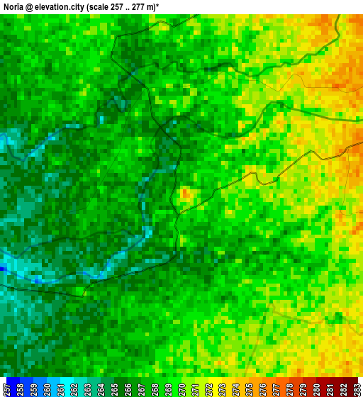
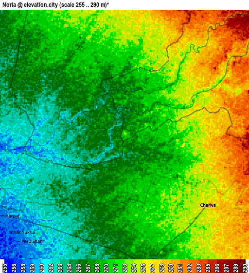
Below is the Elevation map of Norīa, which displays elevation range with different colors. Scale of the first map is from 257 to 277 m (843 to 909 ft) with average elevation of 268 meters (=879 ft) [note 1]
These maps also provides idea of topography and contour of this city, they are displayed at different zoom levels. More info about maps, scale and edge coordinates you can find below images.
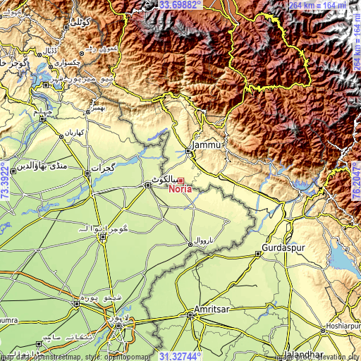
| \ | Map #1 | Map #2 | Topo.Map |
| Scale [m] | 257..277 m | 255..290 m | × |
| Scale [ft] | 843..909 ft | 837..951 ft | × |
| Average | 268 m = 879 ft | 270.2 m = 886 ft | × |
| Width | 8.24 km = 5.1 mi | 16.48 km = 10.2 mi | 263.7 km = 163.9 mi |
| Height | 8.24 km = 5.1 mi | 16.48 km = 10.2 mi | 263.7 km = 163.9 mi |
| ↑Max Latitude | 32.557997° | 32.595028° | 33.69882° |
| Latitude at center | 32.52095° | 32.52095° | 32.52095° |
| ↓Min Latitude | 32.483888° | 32.446811° | 31.32744° |
| ← Min Longitude | 74.754505° | 74.710559° | 73.3922° |
| Longitude center | 74.79845° | 74.79845° | 74.79845° |
| →Max Longitude | 74.842395° | 74.886341° | 76.2047° |
Nearby cities:
Cities around Norīa sort by population:
• Jammu elevation 379 m
24.8 km,  15°
15°
• Udhampur 759 m
54.8 km,  35°
35°
• Sāmba 392 m
30.5 km,  81°
81°
• Nawānshahr 247 m
37.1 km,  316°
316°
• Akhnūr 312 m
38.9 km,  350°
350°
• Bishnāh 294 m
11.3 km,  28°
28°
• Hirānagar 321 m
45 km,  99°
99°
• Katra 868 m
53.8 km,  13°
13°
• Rāmnagar 829 m
57.6 km,  56°
56°
• Khaur 280 m
9.1 km, 6°
• Gho Brāhmanān de 320 m
15.1 km, 75°
• Jauriān 281 m
40.4 km,  329°
329°
Multilingual:
 En español:
Norīa elevación 275 m.
 En France:
Norīa élévation 275 m.


Sources and notes:
- [note 1] Map square and city borders are not equal. Map elevation data is calculated only from area inside that square.
- [src 1] Elevation data from geonames database provided with same terms of usage.
- [src 2] The elevation map of Norīa is generated using elevation data from NASA's 3 arcsec (90m) resolution SRTM data.
- [src 3] Base (background) map © OpenStreetMap contributors tiles are generated by Geofabrik and OpenTopoMap.
Copyright & License:
This Norīa Elevation Map is licensed under CC BY-SA. You may reuse any part from this page, if you give a proper credit by linking to this URL:
 More info on terms of use page.