Attur elevation
Attur (Tamil Nadu, Salem), India elevation is 219 meters and Attur elevation in feet is 719 ft above sea level [src 1]. Attur is a populated place (feature code) with elevation that is 74 meters (243 ft) smaller than average city elevation in India.
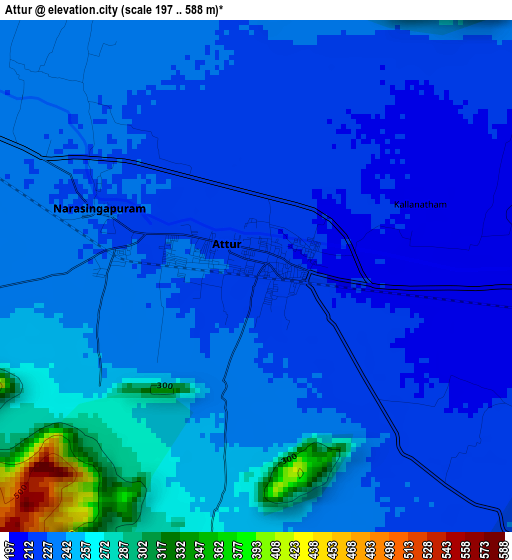
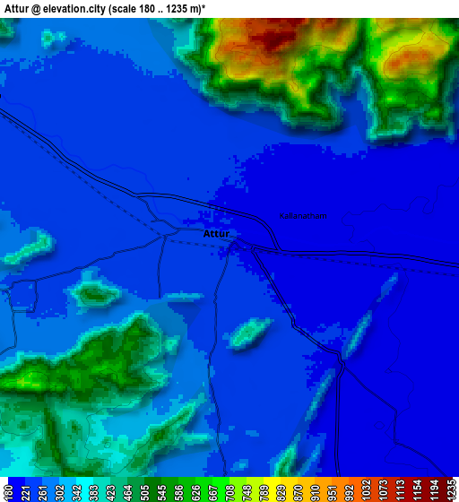
Below is the Elevation map of Attur, which displays elevation range with different colors. Scale of the first map is from 197 to 588 m (646 to 1929 ft) with average elevation of 237.9 meters (=781 ft) [note 1]
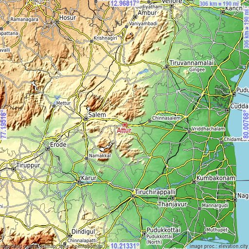
These maps also provides idea of topography and contour of this city, they are displayed at different zoom levels. More info about maps, scale and edge coordinates you can find below images.
| \ | Map #1 | Map #2 | Topo.Map |
| Scale [m] | 197..588 m | 180..1235 m | × |
| Scale [ft] | 646..1929 ft | 591..4052 ft | × |
| Average | 237.9 m = 781 ft | 314.6 m = 1032 ft | × |
| Width | 9.57 km = 5.9 mi | 19.15 km = 11.9 mi | 306.3 km = 190.3 mi |
| Height | 9.57 km = 5.9 mi | 19.15 km = 11.9 mi | 306.3 km = 190.3 mi |
| ↑Max Latitude | 11.637185° | 11.680224° | 12.96817° |
| Latitude at center | 11.59414° | 11.59414° | 11.59414° |
| ↓Min Latitude | 11.551088° | 11.508029° | 10.21331° |
| ← Min Longitude | 78.557485° | 78.513539° | 77.19518° |
| Longitude center | 78.60143° | 78.60143° | 78.60143° |
| →Max Longitude | 78.645375° | 78.689321° | 80.00768° |
Nearby cities:
Cities around Attur sort by population:
• Rasipuram elevation 234 m
47.6 km,  251°
251°
• Kallakkurichchi 131 m
42.2 km,  67°
67°
• Pallippatti 411 m
44.2 km,  330°
330°
• Nāmagiripettai 262 m
39.5 km, 246°
• Chinna Salem 140 m
30 km,  81°
81°
• Arumbāvūr 157 m
27.5 km,  149°
149°
• Gangavalli 209 m
11.9 km, 153°
• Vīraganūr 171 m
19.6 km,  131°
131°
• Belūr 336 m
24 km,  301°
301°
• Pāpireddippatti 433 m
44 km,  324°
324°
• Alagāpuram 159 m
47.4 km,  46°
46°
• Uppiliyapuram 180 m
38 km,  194°
194°
Multilingual:
 En español:
Attur elevación 219 m.
 En France:
Attur élévation 219 m.


Sources and notes:
- [note 1] Map square and city borders are not equal. Map elevation data is calculated only from area inside that square.
- [src 1] Elevation data from geonames database provided with same terms of usage.
- [src 2] The elevation map of Attur is generated using elevation data from NASA's 3 arcsec (90m) resolution SRTM data.
- [src 3] Base (background) map © OpenStreetMap contributors tiles are generated by Geofabrik and OpenTopoMap.
Copyright & License:
This Attur Elevation Map is licensed under CC BY-SA. You may reuse any part from this page, if you give a proper credit by linking to this URL:
 More info on terms of use page.