Azamgarh elevation
Azamgarh (Uttar Pradesh, Āzamgarh), India elevation is 84 meters and Azamgarh elevation in feet is 276 ft above sea level [src 1]. Azamgarh is a populated place (feature code) with elevation that is 209 meters (686 ft) smaller than average city elevation in India.
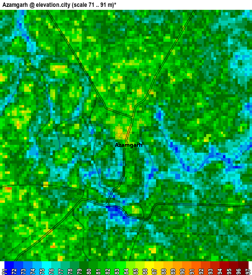
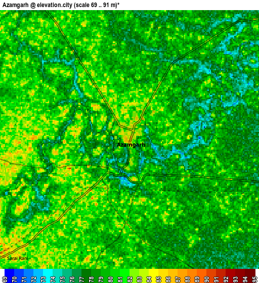
Below is the Elevation map of Azamgarh, which displays elevation range with different colors. Scale of the first map is from 71 to 91 m (233 to 299 ft) with average elevation of 79.5 meters (=261 ft) [note 1]
These maps also provides idea of topography and contour of this city, they are displayed at different zoom levels. More info about maps, scale and edge coordinates you can find below images.
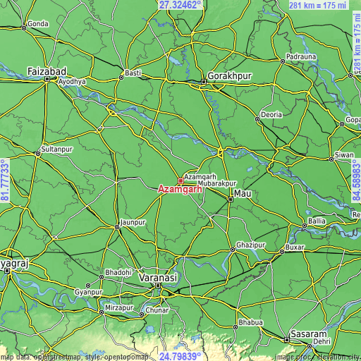
| \ | Map #1 | Map #2 | Topo.Map |
| Scale [m] | 71..91 m | 69..91 m | × |
| Scale [ft] | 233..299 ft | 226..299 ft | × |
| Average | 79.5 m = 261 ft | 79.2 m = 260 ft | × |
| Width | 8.78 km = 5.5 mi | 17.56 km = 10.9 mi | 280.9 km = 174.5 mi |
| Height | 8.78 km = 5.5 mi | 17.56 km = 10.9 mi | 280.9 km = 174.5 mi |
| ↑Max Latitude | 26.107788° | 26.147243° | 27.32462° |
| Latitude at center | 26.06832° | 26.06832° | 26.06832° |
| ↓Min Latitude | 26.028839° | 25.989344° | 24.79839° |
| ← Min Longitude | 83.139635° | 83.095689° | 81.77733° |
| Longitude center | 83.18358° | 83.18358° | 83.18358° |
| →Max Longitude | 83.227525° | 83.271471° | 84.58983° |
Nearby cities:
Cities around Azamgarh sort by population:
• Mubārakpur elevation 81 m
11 km,  78°
78°
• Ghosī 82 m
35.8 km, 83°
• Muhammadābād 77 m
20.1 km,  100°
100°
• Sarāi Mīr 90 m
26.9 km,  260°
260°
• Mehnagar 84 m
22.1 km,  197°
197°
• Nizāmābād 86 m
12.7 km, 262°
• Bilariāganj 83 m
14.8 km,  16°
16°
• Atraulia 91 m
37.7 km,  321°
321°
• Jainpur 78 m
17.9 km,  57°
57°
• Gola Bāzār 82 m
35.1 km,  28°
28°
• Phūlpur 89 m
30.7 km,  271°
271°
• Bishunpur Urf Mahārājganj 87 m
22.3 km,  342°
342°
Multilingual:
 En español:
Azamgarh elevación 84 m.
 En France:
Azamgarh élévation 84 m.


Sources and notes:
- [note 1] Map square and city borders are not equal. Map elevation data is calculated only from area inside that square.
- [src 1] Elevation data from geonames database provided with same terms of usage.
- [src 2] The elevation map of Azamgarh is generated using elevation data from NASA's 3 arcsec (90m) resolution SRTM data.
- [src 3] Base (background) map © OpenStreetMap contributors tiles are generated by Geofabrik and OpenTopoMap.
Copyright & License:
This Azamgarh Elevation Map is licensed under CC BY-SA. You may reuse any part from this page, if you give a proper credit by linking to this URL:
 More info on terms of use page.