Bahādurgarh elevation
Bahādurgarh (Haryana, Jhajjar), India elevation is 215 meters and Bahādurgarh elevation in feet is 705 ft above sea level [src 1]. Bahādurgarh is a populated place (feature code) with elevation that is 78 meters (256 ft) smaller than average city elevation in India.
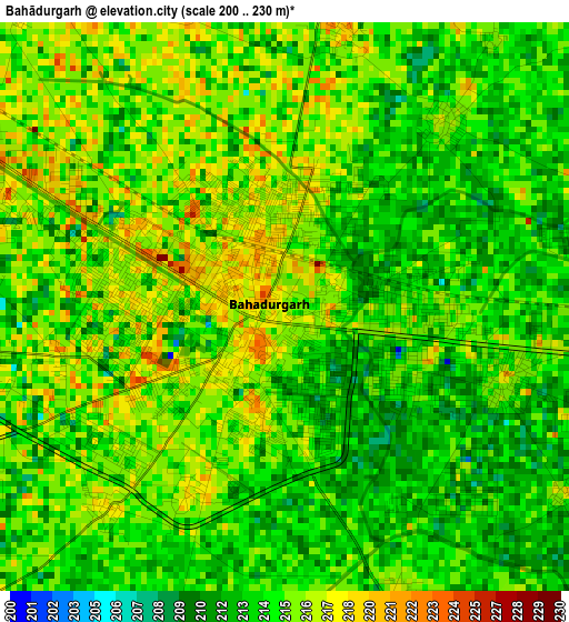
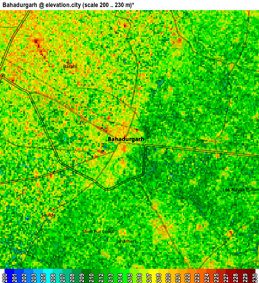
Below is the Elevation map of Bahādurgarh, which displays elevation range with different colors. Scale of the first map is from 200 to 230 m (656 to 755 ft) with average elevation of 214.5 meters (=704 ft) [note 1]
These maps also provides idea of topography and contour of this city, they are displayed at different zoom levels. More info about maps, scale and edge coordinates you can find below images.
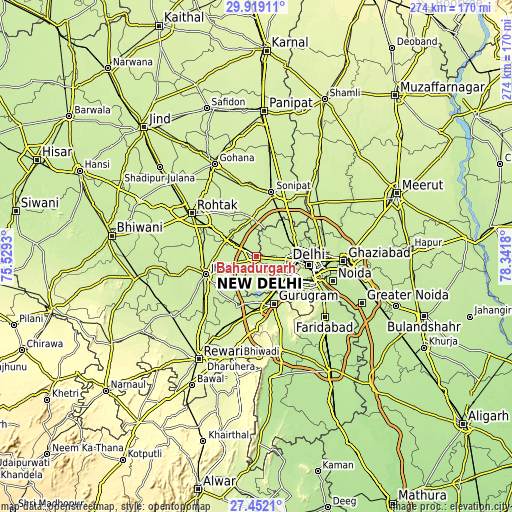
| \ | Map #1 | Map #2 | Topo.Map |
| Scale [m] | 200..230 m | 200..230 m | × |
| Scale [ft] | 656..755 ft | 656..755 ft | × |
| Average | 214.5 m = 704 ft | 214.5 m = 704 ft | × |
| Width | 8.57 km = 5.3 mi | 17.15 km = 10.7 mi | 274.3 km = 170.4 mi |
| Height | 8.57 km = 5.3 mi | 17.15 km = 10.7 mi | 274.3 km = 170.4 mi |
| ↑Max Latitude | 28.731412° | 28.76994° | 29.91911° |
| Latitude at center | 28.69287° | 28.69287° | 28.69287° |
| ↓Min Latitude | 28.654314° | 28.615743° | 27.4521° |
| ← Min Longitude | 76.891605° | 76.847659° | 75.5293° |
| Longitude center | 76.93555° | 76.93555° | 76.93555° |
| →Max Longitude | 76.979495° | 77.023441° | 78.3418° |
Nearby cities:
Cities around Bahādurgarh sort by population:
• Najafgarh elevation 215 m
10.3 km,  155°
155°
• Rohini 212 m
14.1 km,  66°
66°
• Narela 219 m
23.5 km,  40°
40°
• Karol Bāgh 231 m
25.3 km,  100°
100°
• Gurgaon 228 m
27.4 km, 161°
• Nāngloi Jāt 218 m
13 km, 96°
• Bawāna 223 m
15.2 km, 39°
• Kharkhauda 227 m
20.8 km,  353°
353°
• Alīpur 213 m
22.6 km,  58°
58°
• Kheri Sāmpla 223 m
18.2 km,  301°
301°
• Pitampura 217 m
19.1 km,  91°
91°
• Shahdara 223 m
22.3 km,  116°
116°
Multilingual:
 En español:
Bahādurgarh elevación 215 m.
 En France:
Bahādurgarh élévation 215 m.
 Auf Deutsch:
Bahādurgarh höhe über dem Meeresspiegel ist 215 m.

Sources and notes:
- [note 1] Map square and city borders are not equal. Map elevation data is calculated only from area inside that square.
- [src 1] Elevation data from geonames database provided with same terms of usage.
- [src 2] The elevation map of Bahādurgarh is generated using elevation data from NASA's 3 arcsec (90m) resolution SRTM data.
- [src 3] Base (background) map © OpenStreetMap contributors tiles are generated by Geofabrik and OpenTopoMap.
Copyright & License:
This Bahādurgarh Elevation Map is licensed under CC BY-SA. You may reuse any part from this page, if you give a proper credit by linking to this URL:
 More info on terms of use page.