Barhiya elevation
Barhiya (Bihar, Lakhisarai), India elevation is 49 meters and Barhiya elevation in feet is 161 ft above sea level [src 1]. Barhiya is a populated place (feature code) with elevation that is 244 meters (801 ft) smaller than average city elevation in India.
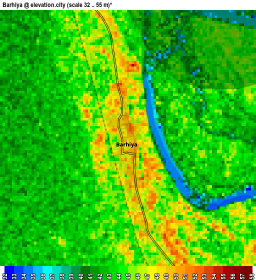
Below is the Elevation map of Barhiya, which displays elevation range with different colors. Scale of the first map is from 32 to 55 m (105 to 180 ft) with average elevation of 43.5 meters (=143 ft) [note 1]
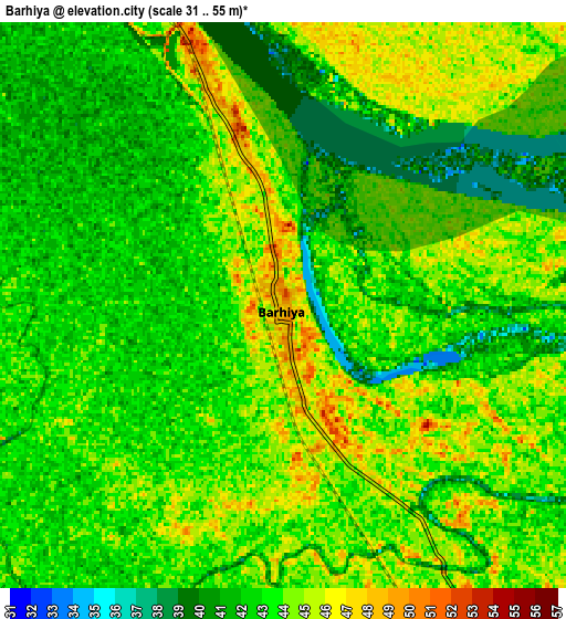
These maps also provides idea of topography and contour of this city, they are displayed at different zoom levels. More info about maps, scale and edge coordinates you can find below images.
| \ | Map #1 | Map #2 | Topo.Map |
| Scale [m] | 32..55 m | 31..55 m | × |
| Scale [ft] | 105..180 ft | 102..180 ft | × |
| Average | 43.5 m = 143 ft | 43 m = 141 ft | × |
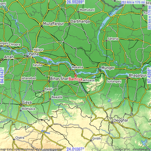
| Width | 8.84 km = 5.5 mi | 17.67 km = 11 mi | 282.7 km = 175.7 mi |
| Height | 8.84 km = 5.5 mi | 17.67 km = 11 mi | 282.7 km = 175.7 mi |
| ↑Max Latitude | 25.327868° | 25.367582° | 26.55289° |
| Latitude at center | 25.28814° | 25.28814° | 25.28814° |
| ↓Min Latitude | 25.248399° | 25.208646° | 24.01007° |
| ← Min Longitude | 85.976605° | 85.932659° | 84.6143° |
| Longitude center | 86.02055° | 86.02055° | 86.02055° |
| →Max Longitude | 86.064495° | 86.108441° | 87.4268° |
Nearby cities:
Cities around Barhiya sort by population:
• Monghyr elevation 49 m
46.6 km,  78°
78°
• Begusarai 47 m
18.4 km,  38°
38°
• Jamālpur 52 m
47.2 km,  86°
86°
• Luckeesarai 50 m
14.5 km,  149°
149°
• Bāruni 50 m
21.4 km,  345°
345°
• Jamūī 88 m
45.2 km, 152°
• Mokameh 50 m
15.6 km,  320°
320°
• Bārh 52 m
38.1 km,  304°
304°
• Sheikhpura 54 m
24.5 km,  227°
227°
• Teghra 52 m
23.9 km,  340°
340°
• Bar Bigha 55 m
29.9 km,  255°
255°
• Dalsingh Sarai 52 m
46.1 km, 336°
Multilingual:
 En español:
Barhiya elevación 49 m.
 En France:
Barhiya élévation 49 m.


Sources and notes:
- [note 1] Map square and city borders are not equal. Map elevation data is calculated only from area inside that square.
- [src 1] Elevation data from geonames database provided with same terms of usage.
- [src 2] The elevation map of Barhiya is generated using elevation data from NASA's 3 arcsec (90m) resolution SRTM data.
- [src 3] Base (background) map © OpenStreetMap contributors tiles are generated by Geofabrik and OpenTopoMap.
Copyright & License:
This Barhiya Elevation Map is licensed under CC BY-SA. You may reuse any part from this page, if you give a proper credit by linking to this URL:
 More info on terms of use page.