Benīganj elevation
Benīganj (Uttar Pradesh, Hardoi), India elevation is 139 meters and Benīganj elevation in feet is 456 ft above sea level [src 1]. Benīganj is a populated place (feature code) with elevation that is 154 meters (505 ft) smaller than average city elevation in India.
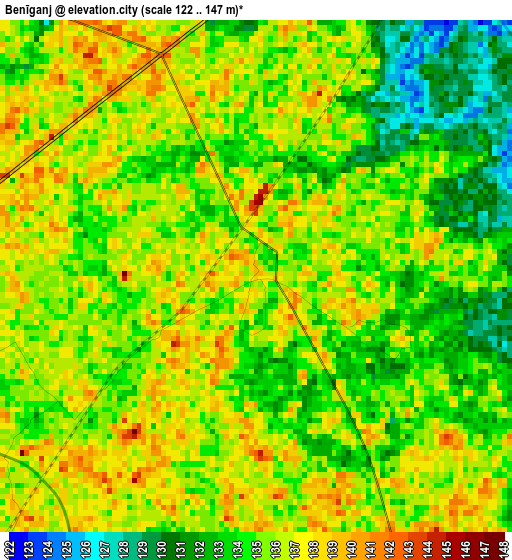
Below is the Elevation map of Benīganj, which displays elevation range with different colors. Scale of the first map is from 122 to 147 m (400 to 482 ft) with average elevation of 135 meters (=443 ft) [note 1]
These maps also provides idea of topography and contour of this city, they are displayed at different zoom levels. More info about maps, scale and edge coordinates you can find below images.
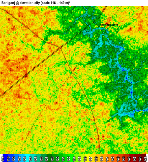
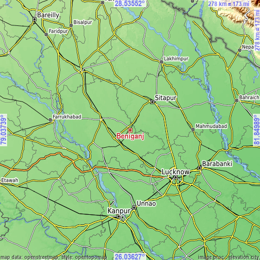
| \ | Map #1 | Map #2 | Topo.Map |
| Scale [m] | 122..147 m | 118..149 m | × |
| Scale [ft] | 400..482 ft | 387..489 ft | × |
| Average | 135 m = 443 ft | 134.7 m = 442 ft | × |
| Width | 8.68 km = 5.4 mi | 17.37 km = 10.8 mi | 277.9 km = 172.7 mi |
| Height | 8.68 km = 5.4 mi | 17.37 km = 10.8 mi | 277.9 km = 172.7 mi |
| ↑Max Latitude | 27.331976° | 27.371009° | 28.53552° |
| Latitude at center | 27.29293° | 27.29293° | 27.29293° |
| ↓Min Latitude | 27.25387° | 27.214796° | 26.03627° |
| ← Min Longitude | 80.399695° | 80.355749° | 79.03739° |
| Longitude center | 80.44364° | 80.44364° | 80.44364° |
| →Max Longitude | 80.487585° | 80.531531° | 81.84989° |
Nearby cities:
Cities around Benīganj sort by population:
• Sītāpur elevation 143 m
38.1 km,  38°
38°
• Hardoī 146 m
32.8 km,  290°
290°
• Sandīla 139 m
25.8 km,  164°
164°
• Khairābād 140 m
40.2 km,  49°
49°
• Pihānī 149 m
43.4 km,  326°
326°
• Bilgrām 146 m
42.8 km,  252°
252°
• Sidhaulī 134 m
38.6 km,  91°
91°
• Maholi 151 m
41.3 km,  4°
4°
• Misrikh 142 m
17.7 km,  29°
29°
• Gopāmau 147 m
31.1 km, 329°
• Mādhoganj 142 m
35.7 km,  237°
237°
• Aurās 131 m
42.6 km,  171°
171°
Multilingual:
 En español:
Benīganj elevación 139 m.
 En France:
Benīganj élévation 139 m.
 Auf Deutsch:
Benīganj höhe über dem Meeresspiegel ist 139 m.

Sources and notes:
- [note 1] Map square and city borders are not equal. Map elevation data is calculated only from area inside that square.
- [src 1] Elevation data from geonames database provided with same terms of usage.
- [src 2] The elevation map of Benīganj is generated using elevation data from NASA's 3 arcsec (90m) resolution SRTM data.
- [src 3] Base (background) map © OpenStreetMap contributors tiles are generated by Geofabrik and OpenTopoMap.
Copyright & License:
This Benīganj Elevation Map is licensed under CC BY-SA. You may reuse any part from this page, if you give a proper credit by linking to this URL:
 More info on terms of use page.