Chhaprauli elevation
Chhaprauli (Uttar Pradesh, Baghpat), India elevation is 234 meters and Chhaprauli elevation in feet is 768 ft above sea level [src 1]. Chhaprauli is a populated place (feature code) with elevation that is 59 meters (194 ft) smaller than average city elevation in India.
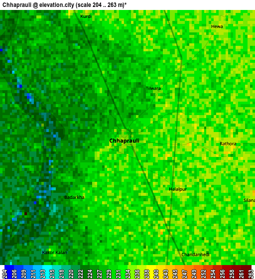
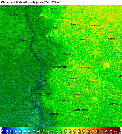
Below is the Elevation map of Chhaprauli, which displays elevation range with different colors. Scale of the first map is from 204 to 263 m (669 to 863 ft) with average elevation of 229.7 meters (=754 ft) [note 1]
These maps also provides idea of topography and contour of this city, they are displayed at different zoom levels. More info about maps, scale and edge coordinates you can find below images.
| \ | Map #1 | Map #2 | Topo.Map |
| Scale [m] | 204..263 m | 204..263 m | × |
| Scale [ft] | 669..863 ft | 669..863 ft | × |
| Average | 229.7 m = 754 ft | 229.4 m = 753 ft | × |
| Width | 8.53 km = 5.3 mi | 17.06 km = 10.6 mi | 272.9 km = 169.6 mi |
| Height | 8.53 km = 5.3 mi | 17.06 km = 10.6 mi | 272.9 km = 169.6 mi |
| ↑Max Latitude | 29.24824° | 29.286576° | 30.4299° |
| Latitude at center | 29.20989° | 29.20989° | 29.20989° |
| ↓Min Latitude | 29.171526° | 29.133147° | 27.97518° |
| ← Min Longitude | 77.130595° | 77.086649° | 75.76829° |
| Longitude center | 77.17454° | 77.17454° | 77.17454° |
| →Max Longitude | 77.218485° | 77.262431° | 78.58079° |
Nearby cities:
Cities around Chhaprauli sort by population:
• Pānīpat elevation 232 m
28.1 km,  314°
314°
• Sonīpat 229 m
28.3 km,  212°
212°
• Shāmli 248 m
29.7 km,  26°
26°
• Baraut 233 m
14.8 km,  144°
144°
• Kairāna 243 m
20.8 km,  8°
8°
• Kāndhla 250 m
15.5 km,  37°
37°
• Bāghpat 227 m
29.8 km,  171°
171°
• Samālkha 226 m
16 km,  280°
280°
• Budhāna 240 m
30.4 km,  73°
73°
• Banat 246 m
33.2 km, 31°
• Jhinjhāna 255 m
35 km, 7°
• Tīkri 239 m
17.6 km,  83°
83°
Multilingual:
 En español:
Chhaprauli elevación 234 m.
 En France:
Chhaprauli élévation 234 m.
 Auf Deutsch:
Chhaprauli höhe über dem Meeresspiegel ist 234 m.

Sources and notes:
- [note 1] Map square and city borders are not equal. Map elevation data is calculated only from area inside that square.
- [src 1] Elevation data from geonames database provided with same terms of usage.
- [src 2] The elevation map of Chhaprauli is generated using elevation data from NASA's 3 arcsec (90m) resolution SRTM data.
- [src 3] Base (background) map © OpenStreetMap contributors tiles are generated by Geofabrik and OpenTopoMap.
Copyright & License:
This Chhaprauli Elevation Map is licensed under CC BY-SA. You may reuse any part from this page, if you give a proper credit by linking to this URL:
 More info on terms of use page.