Chhatarpur elevation
Chhatarpur (Madhya Pradesh), India elevation is 311 meters and Chhatarpur elevation in feet is 1020 ft above sea level [src 1]. Chhatarpur is a populated place (feature code) with elevation that is 18 meters (59 ft) bigger than average city elevation in India.
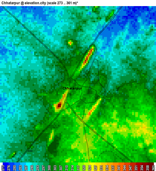
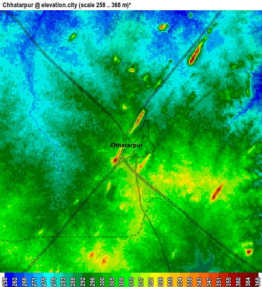
Below is the Elevation map of Chhatarpur, which displays elevation range with different colors. Scale of the first map is from 273 to 361 m (896 to 1184 ft) with average elevation of 299.5 meters (=983 ft) [note 1]
These maps also provides idea of topography and contour of this city, they are displayed at different zoom levels. More info about maps, scale and edge coordinates you can find below images.
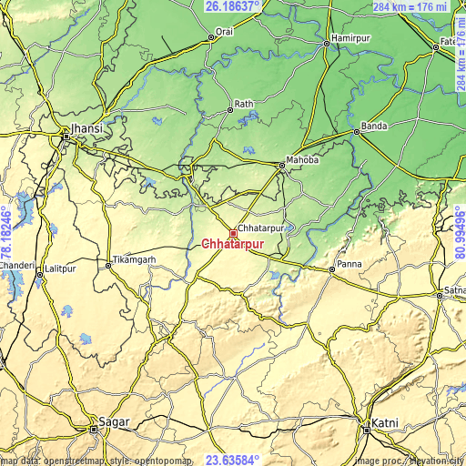
| \ | Map #1 | Map #2 | Topo.Map |
| Scale [m] | 273..361 m | 258..368 m | × |
| Scale [ft] | 896..1184 ft | 846..1207 ft | × |
| Average | 299.5 m = 983 ft | 293 m = 961 ft | × |
| Width | 8.86 km = 5.5 mi | 17.73 km = 11 mi | 283.6 km = 176.2 mi |
| Height | 8.86 km = 5.5 mi | 17.73 km = 11 mi | 283.6 km = 176.2 mi |
| ↑Max Latitude | 24.957548° | 24.997383° | 26.18637° |
| Latitude at center | 24.9177° | 24.9177° | 24.9177° |
| ↓Min Latitude | 24.877839° | 24.837965° | 23.63584° |
| ← Min Longitude | 79.544765° | 79.500819° | 78.18246° |
| Longitude center | 79.58871° | 79.58871° | 79.58871° |
| →Max Longitude | 79.632655° | 79.676601° | 80.99496° |
Nearby cities:
Cities around Chhatarpur sort by population:
• Mahobā elevation 208 m
50.5 km,  34°
34°
• Khajuraho Group of Monuments 218 m
35.6 km,  102°
102°
• Charkhāri 198 m
56.3 km,  16°
16°
• Bijāwar 360 m
34.2 km,  196°
196°
• Kulpahār 198 m
45 km,  6°
6°
• Harpālpur 214 m
48.5 km,  327°
327°
• Jatāra 262 m
55.4 km,  280°
280°
• Palera 237 m
38.1 km,  287°
287°
• Khargāpur 304 m
46.1 km,  256°
256°
• Rājnagar 228 m
32.7 km, 95°
• Chandla 181 m
63.2 km,  74°
74°
• Baldeogarh 341 m
55.6 km,  251°
251°
Multilingual:
 En español:
Chhatarpur elevación 311 m.
 En France:
Chhatarpur élévation 311 m.
 Auf Deutsch:
Chhatarpur höhe über dem Meeresspiegel ist 311 m.

Sources and notes:
- [note 1] Map square and city borders are not equal. Map elevation data is calculated only from area inside that square.
- [src 1] Elevation data from geonames database provided with same terms of usage.
- [src 2] The elevation map of Chhatarpur is generated using elevation data from NASA's 3 arcsec (90m) resolution SRTM data.
- [src 3] Base (background) map © OpenStreetMap contributors tiles are generated by Geofabrik and OpenTopoMap.
Copyright & License:
This Chhatarpur Elevation Map is licensed under CC BY-SA. You may reuse any part from this page, if you give a proper credit by linking to this URL:
 More info on terms of use page.