Dehu elevation
Dehu (Maharashtra, Pune Division), India elevation is 585 meters and Dehu elevation in feet is 1919 ft above sea level [src 1]. Dehu is a populated place (feature code) with elevation that is 292 meters (958 ft) bigger than average city elevation in India.
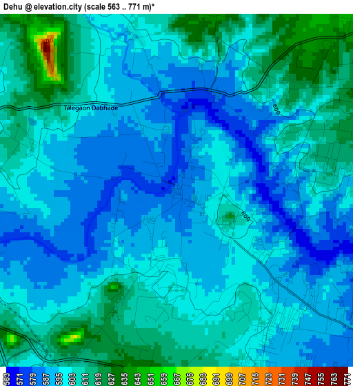
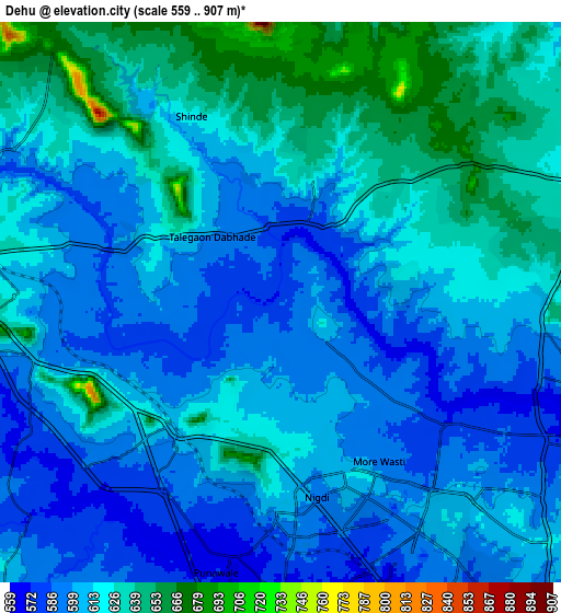
Below is the Elevation map of Dehu, which displays elevation range with different colors. Scale of the first map is from 563 to 771 m (1847 to 2530 ft) with average elevation of 599.2 meters (=1966 ft) [note 1]
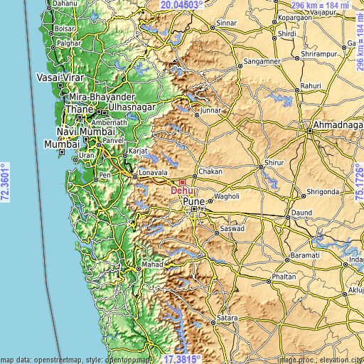
These maps also provides idea of topography and contour of this city, they are displayed at different zoom levels. More info about maps, scale and edge coordinates you can find below images.
| \ | Map #1 | Map #2 | Topo.Map |
| Scale [m] | 563..771 m | 559..907 m | × |
| Scale [ft] | 1847..2530 ft | 1834..2976 ft | × |
| Average | 599.2 m = 1966 ft | 612.4 m = 2009 ft | × |
| Width | 9.26 km = 5.8 mi | 18.51 km = 11.5 mi | 296.2 km = 184 mi |
| Height | 9.26 km = 5.8 mi | 18.51 km = 11.5 mi | 296.2 km = 184 mi |
| ↑Max Latitude | 18.760126° | 18.801731° | 20.04503° |
| Latitude at center | 18.71851° | 18.71851° | 18.71851° |
| ↓Min Latitude | 18.676884° | 18.635248° | 17.3815° |
| ← Min Longitude | 73.722405° | 73.678459° | 72.3601° |
| Longitude center | 73.76635° | 73.76635° | 73.76635° |
| →Max Longitude | 73.810295° | 73.854241° | 75.1726° |
Nearby cities:
Cities around Dehu sort by population:
• Pune elevation 554 m
24 km,  157°
157°
• Pimpri 571 m
11.5 km, 158°
• Shivaji Nagar 559 m
22.8 km, 156°
• Khadki 565 m
19.5 km,  152°
152°
• Talegaon Dābhāde 632 m
9.7 km,  280°
280°
• Koregaon 552 m
31.9 km,  104°
104°
• Kharakvasla 583 m
31 km,  178°
178°
• Chākan 619 m
11.2 km,  65°
65°
• Alandi 572 m
14.7 km,  108°
108°
• Rājgurunagar 626 m
21.7 km,  40°
40°
• Lohogaon 597 m
21.5 km,  128°
128°
• Wadgaon 631 m
13.6 km, 279°
Multilingual:
 En español:
Dehu elevación 585 m.
 En France:
Dehu élévation 585 m.


Sources and notes:
- [note 1] Map square and city borders are not equal. Map elevation data is calculated only from area inside that square.
- [src 1] Elevation data from geonames database provided with same terms of usage.
- [src 2] The elevation map of Dehu is generated using elevation data from NASA's 3 arcsec (90m) resolution SRTM data.
- [src 3] Base (background) map © OpenStreetMap contributors tiles are generated by Geofabrik and OpenTopoMap.
Copyright & License:
This Dehu Elevation Map is licensed under CC BY-SA. You may reuse any part from this page, if you give a proper credit by linking to this URL:
 More info on terms of use page.