Dhanaula elevation
Dhanaula (Punjab, Barnala), India elevation is 228 meters and Dhanaula elevation in feet is 748 ft above sea level [src 1]. Dhanaula is a populated place (feature code) with elevation that is 65 meters (213 ft) smaller than average city elevation in India.
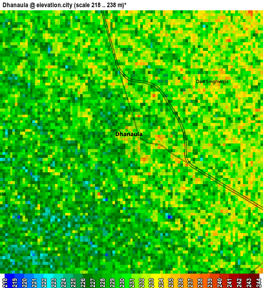
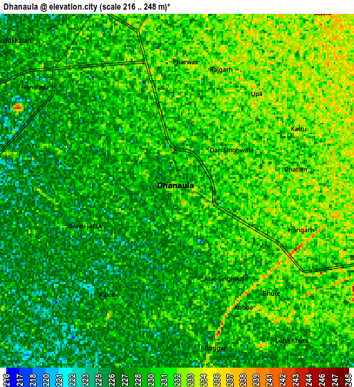
Below is the Elevation map of Dhanaula, which displays elevation range with different colors. Scale of the first map is from 218 to 238 m (715 to 781 ft) with average elevation of 229.3 meters (=752 ft) [note 1]
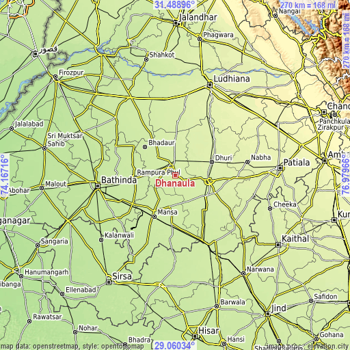
These maps also provides idea of topography and contour of this city, they are displayed at different zoom levels. More info about maps, scale and edge coordinates you can find below images.
| \ | Map #1 | Map #2 | Topo.Map |
| Scale [m] | 218..238 m | 216..248 m | × |
| Scale [ft] | 715..781 ft | 709..814 ft | × |
| Average | 229.3 m = 752 ft | 229.5 m = 753 ft | × |
| Width | 8.44 km = 5.2 mi | 16.88 km = 10.5 mi | 270 km = 167.8 mi |
| Height | 8.44 km = 5.2 mi | 16.88 km = 10.5 mi | 270 km = 167.8 mi |
| ↑Max Latitude | 30.320102° | 30.358029° | 31.48896° |
| Latitude at center | 30.28216° | 30.28216° | 30.28216° |
| ↓Min Latitude | 30.244204° | 30.206232° | 29.06034° |
| ← Min Longitude | 75.529465° | 75.485519° | 74.16716° |
| Longitude center | 75.57341° | 75.57341° | 75.57341° |
| →Max Longitude | 75.617355° | 75.661301° | 76.97966° |
Nearby cities:
Cities around Dhanaula sort by population:
• Māler Kotla elevation 251 m
40.3 km,  46°
46°
• Barnāla 237 m
10.5 km,  346°
346°
• Sangrūr 241 m
26.4 km,  98°
98°
• Mānsa 223 m
36.6 km,  206°
206°
• Dhūri 246 m
29.8 km,  71°
71°
• Sunām 245 m
27.6 km,  128°
128°
• Rāmpura 218 m
32 km,  264°
264°
• Maur 220 m
38.1 km,  234°
234°
• Budhlāda 227 m
39.4 km,  181°
181°
• Laungowāl 235 m
14.2 km, 133°
• Bhadaur 230 m
31.8 km,  312°
312°
• Bhīkhi 227 m
25.1 km,  188°
188°
Multilingual:
 En español:
Dhanaula elevación 228 m.
 En France:
Dhanaula élévation 228 m.
 Auf Deutsch:
Dhanaula höhe über dem Meeresspiegel ist 228 m.

Sources and notes:
- [note 1] Map square and city borders are not equal. Map elevation data is calculated only from area inside that square.
- [src 1] Elevation data from geonames database provided with same terms of usage.
- [src 2] The elevation map of Dhanaula is generated using elevation data from NASA's 3 arcsec (90m) resolution SRTM data.
- [src 3] Base (background) map © OpenStreetMap contributors tiles are generated by Geofabrik and OpenTopoMap.
Copyright & License:
This Dhanaula Elevation Map is licensed under CC BY-SA. You may reuse any part from this page, if you give a proper credit by linking to this URL:
 More info on terms of use page.