Dharampur elevation
Dharampur (Gujarat, Valsād), India elevation is 76 meters and Dharampur elevation in feet is 249 ft above sea level [src 1]. Dharampur is a populated place (feature code) with elevation that is 217 meters (712 ft) smaller than average city elevation in India.
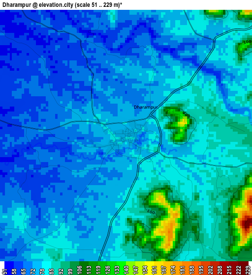
Below is the Elevation map of Dharampur, which displays elevation range with different colors. Scale of the first map is from 51 to 229 m (167 to 751 ft) with average elevation of 78.9 meters (=259 ft) [note 1]
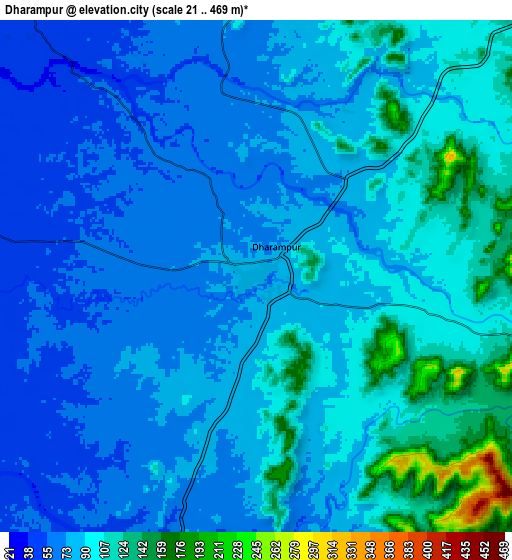
These maps also provides idea of topography and contour of this city, they are displayed at different zoom levels. More info about maps, scale and edge coordinates you can find below images.
| \ | Map #1 | Map #2 | Topo.Map |
| Scale [m] | 51..229 m | 21..469 m | × |
| Scale [ft] | 167..751 ft | 69..1539 ft | × |
| Average | 78.9 m = 259 ft | 87.6 m = 287 ft | × |
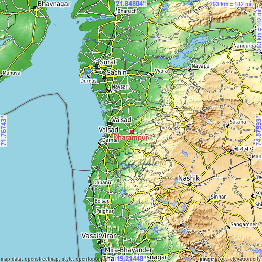
| Width | 9.15 km = 5.7 mi | 18.3 km = 11.4 mi | 292.8 km = 181.9 mi |
| Height | 9.15 km = 5.7 mi | 18.3 km = 11.4 mi | 292.8 km = 181.9 mi |
| ↑Max Latitude | 20.578077° | 20.619213° | 21.84804° |
| Latitude at center | 20.53693° | 20.53693° | 20.53693° |
| ↓Min Latitude | 20.495772° | 20.454603° | 19.21448° |
| ← Min Longitude | 73.129735° | 73.085789° | 71.76743° |
| Longitude center | 73.17368° | 73.17368° | 73.17368° |
| →Max Longitude | 73.217625° | 73.261571° | 74.57993° |
Nearby cities:
Cities around Dharampur sort by population:
• Bilimora elevation 15 m
34 km,  319°
319°
• Valsād 12 m
26.2 km,  288°
288°
• Vapi 30 m
33.5 km,  236°
236°
• Daman 11 m
38.1 km,  249°
249°
• Āmli 39 m
32.6 km,  210°
210°
• Pārdi 27 m
23.9 km,  262°
262°
• Silvassa 37 m
34.6 km, 212°
• Gandevi 19 m
35.6 km,  329°
329°
• Vānsada 116 m
31.6 km,  38°
38°
• Parnera 29 m
23.6 km,  276°
276°
• Chikhli 29 m
27.1 km, 334°
• Dadra 37 m
32 km,  222°
222°
Multilingual:
 En español:
Dharampur elevación 76 m.
 En France:
Dharampur élévation 76 m.
 Auf Deutsch:
Dharampur höhe über dem Meeresspiegel ist 76 m.

Sources and notes:
- [note 1] Map square and city borders are not equal. Map elevation data is calculated only from area inside that square.
- [src 1] Elevation data from geonames database provided with same terms of usage.
- [src 2] The elevation map of Dharampur is generated using elevation data from NASA's 3 arcsec (90m) resolution SRTM data.
- [src 3] Base (background) map © OpenStreetMap contributors tiles are generated by Geofabrik and OpenTopoMap.
Copyright & License:
This Dharampur Elevation Map is licensed under CC BY-SA. You may reuse any part from this page, if you give a proper credit by linking to this URL:
 More info on terms of use page.