Digras elevation
Digras (Maharashtra, Yavatmal), India elevation is 341 meters and Digras elevation in feet is 1119 ft above sea level [src 1]. Digras is a populated place (feature code) with elevation that is 48 meters (157 ft) bigger than average city elevation in India.
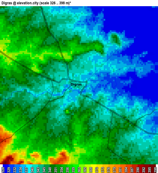
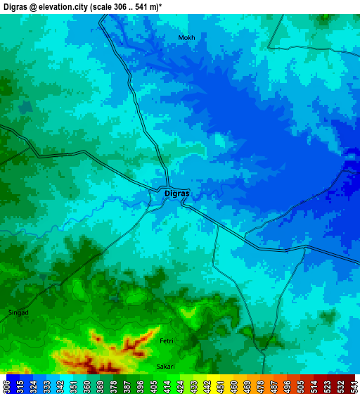
Below is the Elevation map of Digras, which displays elevation range with different colors. Scale of the first map is from 326 to 398 m (1070 to 1306 ft) with average elevation of 345.2 meters (=1133 ft) [note 1]
These maps also provides idea of topography and contour of this city, they are displayed at different zoom levels. More info about maps, scale and edge coordinates you can find below images.
| \ | Map #1 | Map #2 | Topo.Map |
| Scale [m] | 326..398 m | 306..541 m | × |
| Scale [ft] | 1070..1306 ft | 1004..1775 ft | × |
| Average | 345.2 m = 1133 ft | 355.9 m = 1168 ft | × |
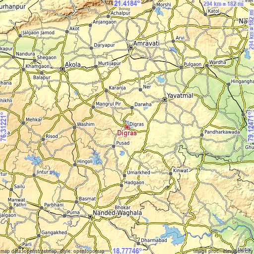
| Width | 9.18 km = 5.7 mi | 18.35 km = 11.4 mi | 293.6 km = 182.4 mi |
| Height | 9.18 km = 5.7 mi | 18.35 km = 11.4 mi | 293.7 km = 182.5 mi |
| ↑Max Latitude | 20.144762° | 20.186014° | 21.4184° |
| Latitude at center | 20.1035° | 20.1035° | 20.1035° |
| ↓Min Latitude | 20.062227° | 20.020943° | 18.77746° |
| ← Min Longitude | 77.674515° | 77.630569° | 76.31221° |
| Longitude center | 77.71846° | 77.71846° | 77.71846° |
| →Max Longitude | 77.762405° | 77.806351° | 79.12471° |
Nearby cities:
Cities around Digras sort by population:
• Yavatmāl elevation 446 m
53.8 km,  53°
53°
• Pusad 336 m
25.8 km,  214°
214°
• Wāshīm 550 m
61.1 km,  270°
270°
• Kāranja 414 m
48.5 km,  330°
330°
• Umarkhed 424 m
55.9 km,  183°
183°
• Mangrūl Pīr 450 m
45.7 km,  300°
300°
• Hadgāon 417 m
67.9 km,  185°
185°
• Kinwat 317 m
73.1 km,  136°
136°
• Dārwha 337 m
23.7 km,  13°
13°
• Kalamnūri 462 m
64 km,  221°
221°
• Ghātanji 282 m
62.3 km,  86°
86°
• Anshing 549 m
42.7 km,  260°
260°
Multilingual:
 En español:
Digras elevación 341 m.
 En France:
Digras élévation 341 m.


Sources and notes:
- [note 1] Map square and city borders are not equal. Map elevation data is calculated only from area inside that square.
- [src 1] Elevation data from geonames database provided with same terms of usage.
- [src 2] The elevation map of Digras is generated using elevation data from NASA's 3 arcsec (90m) resolution SRTM data.
- [src 3] Base (background) map © OpenStreetMap contributors tiles are generated by Geofabrik and OpenTopoMap.
Copyright & License:
This Digras Elevation Map is licensed under CC BY-SA. You may reuse any part from this page, if you give a proper credit by linking to this URL:
 More info on terms of use page.