Ganj Dundwāra elevation
Ganj Dundwāra (Uttar Pradesh, Kasganj), India elevation is 173 meters and Ganj Dundwāra elevation in feet is 568 ft above sea level [src 1]. Ganj Dundwāra is a populated place (feature code) with elevation that is 120 meters (394 ft) smaller than average city elevation in India.
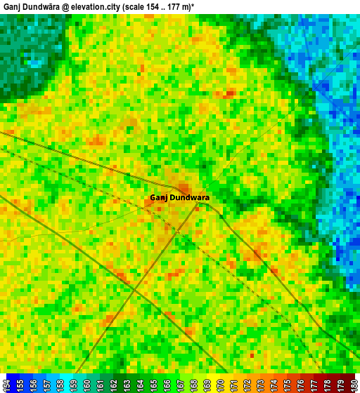
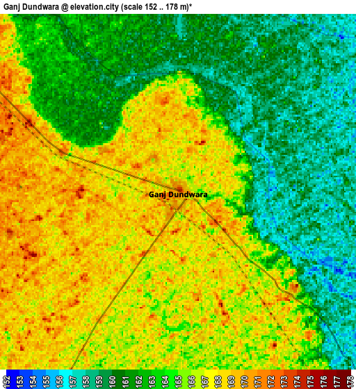
Below is the Elevation map of Ganj Dundwāra, which displays elevation range with different colors. Scale of the first map is from 154 to 177 m (505 to 581 ft) with average elevation of 166.3 meters (=546 ft) [note 1]
These maps also provides idea of topography and contour of this city, they are displayed at different zoom levels. More info about maps, scale and edge coordinates you can find below images.
| \ | Map #1 | Map #2 | Topo.Map |
| Scale [m] | 154..177 m | 152..178 m | × |
| Scale [ft] | 505..581 ft | 499..584 ft | × |
| Average | 166.3 m = 546 ft | 164 m = 538 ft | × |
| Width | 8.65 km = 5.4 mi | 17.3 km = 10.7 mi | 276.8 km = 172 mi |
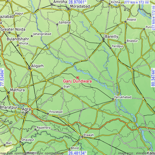
| Height | 8.65 km = 5.4 mi | 17.3 km = 10.7 mi | 276.8 km = 172 mi |
| ↑Max Latitude | 27.77197° | 27.810846° | 28.97061° |
| Latitude at center | 27.73308° | 27.73308° | 27.73308° |
| ↓Min Latitude | 27.694176° | 27.655258° | 26.48134° |
| ← Min Longitude | 78.897245° | 78.853299° | 77.53494° |
| Longitude center | 78.94119° | 78.94119° | 78.94119° |
| →Max Longitude | 78.985135° | 79.029081° | 80.34744° |
Nearby cities:
Cities around Ganj Dundwāra sort by population:
• Kāsganj elevation 181 m
30.3 km,  286°
286°
• Ujhāni 173 m
30.7 km,  12°
12°
• Kakrāla 167 m
30.6 km,  54°
54°
• Soron 177 m
26 km,  312°
312°
• Alīganj 163 m
35 km,  139°
139°
• Sahāwar 178 m
12.7 km,  303°
303°
• Mārahra 181 m
36.6 km,  270°
270°
• Usehat 162 m
30 km,  76°
76°
• Sidhpura 169 m
13.2 km,  212°
212°
• Patiāli 172 m
7.3 km,  129°
129°
• Amānpur 171 m
20.1 km,  263°
263°
• Kampil 161 m
35.7 km,  112°
112°
Multilingual:
 En español:
Ganj Dundwāra elevación 173 m.
 En France:
Ganj Dundwāra élévation 173 m.
 Auf Deutsch:
Ganj Dundwāra höhe über dem Meeresspiegel ist 173 m.

Sources and notes:
- [note 1] Map square and city borders are not equal. Map elevation data is calculated only from area inside that square.
- [src 1] Elevation data from geonames database provided with same terms of usage.
- [src 2] The elevation map of Ganj Dundwāra is generated using elevation data from NASA's 3 arcsec (90m) resolution SRTM data.
- [src 3] Base (background) map © OpenStreetMap contributors tiles are generated by Geofabrik and OpenTopoMap.
Copyright & License:
This Ganj Dundwāra Elevation Map is licensed under CC BY-SA. You may reuse any part from this page, if you give a proper credit by linking to this URL:
 More info on terms of use page.