Ghoga elevation
Ghoga (Bihar, Bhāgalpur), India elevation is 40 meters and Ghoga elevation in feet is 131 ft above sea level [src 1]. Ghoga is a populated place (feature code) with elevation that is 253 meters (830 ft) smaller than average city elevation in India.
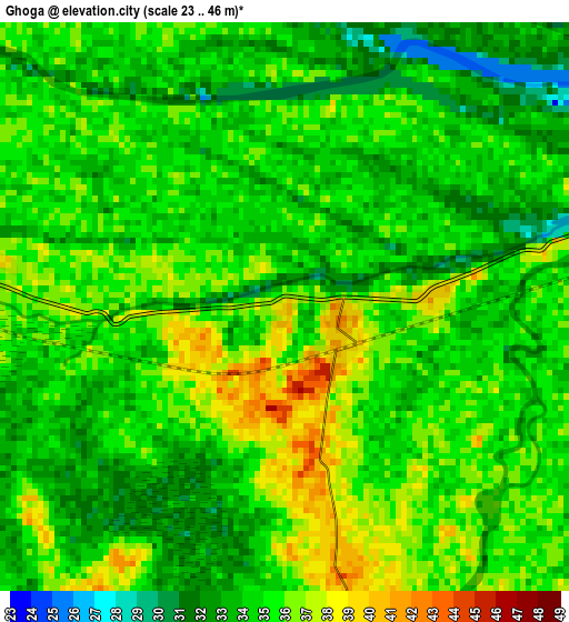
Below is the Elevation map of Ghoga, which displays elevation range with different colors. Scale of the first map is from 23 to 46 m (75 to 151 ft) with average elevation of 34.5 meters (=113 ft) [note 1]
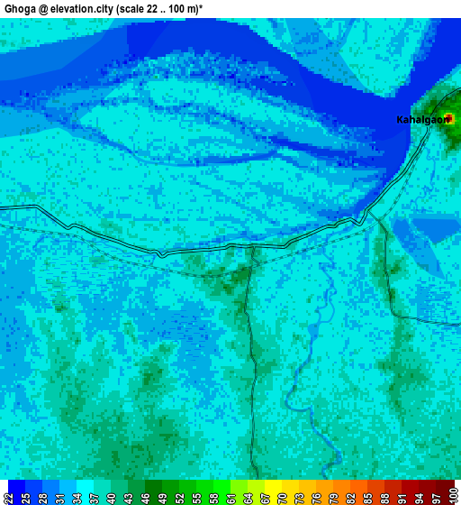
These maps also provides idea of topography and contour of this city, they are displayed at different zoom levels. More info about maps, scale and edge coordinates you can find below images.
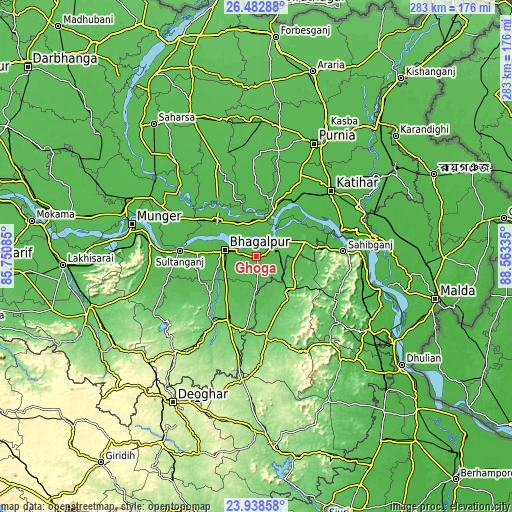
| \ | Map #1 | Map #2 | Topo.Map |
| Scale [m] | 23..46 m | 22..100 m | × |
| Scale [ft] | 75..151 ft | 72..328 ft | × |
| Average | 34.5 m = 113 ft | 34.5 m = 113 ft | × |
| Width | 8.84 km = 5.5 mi | 17.68 km = 11 mi | 282.9 km = 175.8 mi |
| Height | 8.84 km = 5.5 mi | 17.68 km = 11 mi | 282.9 km = 175.8 mi |
| ↑Max Latitude | 25.257131° | 25.296868° | 26.48288° |
| Latitude at center | 25.21738° | 25.21738° | 25.21738° |
| ↓Min Latitude | 25.177616° | 25.13784° | 23.93858° |
| ← Min Longitude | 87.113155° | 87.069209° | 85.75085° |
| Longitude center | 87.1571° | 87.1571° | 87.1571° |
| →Max Longitude | 87.201045° | 87.244991° | 88.56335° |
Nearby cities:
Cities around Ghoga sort by population:
• Bhāgalpur elevation 52 m
18.9 km,  279°
279°
• Katihar 34 m
54.8 km,  49°
49°
• Sāhibganj 44 m
48.1 km,  86°
86°
• Godda 102 m
43.8 km,  172°
172°
• Naugachhia 39 m
19.9 km,  342°
342°
• Bānka 85 m
44.2 km,  212°
212°
• Bihārīganj 46 m
59.9 km, 343°
• Colgong 49 m
9.2 km,  56°
56°
• Manihāri 37 m
48.5 km,  73°
73°
• Amarpur 64 m
32.4 km,  232°
232°
• Bariārpur 44 m
58.9 km, 277°
• Asarganj 51 m
47.9 km,  261°
261°
Multilingual:
 En español:
Ghoga elevación 40 m.
 En France:
Ghoga élévation 40 m.


Sources and notes:
- [note 1] Map square and city borders are not equal. Map elevation data is calculated only from area inside that square.
- [src 1] Elevation data from geonames database provided with same terms of usage.
- [src 2] The elevation map of Ghoga is generated using elevation data from NASA's 3 arcsec (90m) resolution SRTM data.
- [src 3] Base (background) map © OpenStreetMap contributors tiles are generated by Geofabrik and OpenTopoMap.
Copyright & License:
This Ghoga Elevation Map is licensed under CC BY-SA. You may reuse any part from this page, if you give a proper credit by linking to this URL:
 More info on terms of use page.