Gubbi elevation
Gubbi (Karnataka, Tumkur), India elevation is 786 meters and Gubbi elevation in feet is 2579 ft above sea level [src 1]. Gubbi is a populated place (feature code) with elevation that is 493 meters (1617 ft) bigger than average city elevation in India.
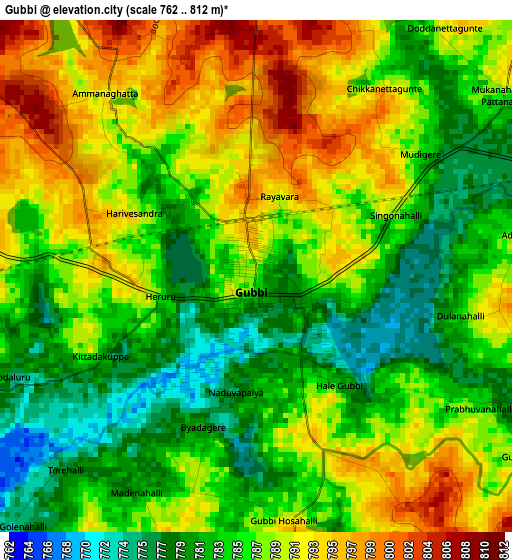
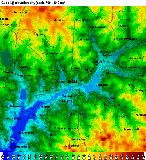
Below is the Elevation map of Gubbi, which displays elevation range with different colors. Scale of the first map is from 762 to 812 m (2500 to 2664 ft) with average elevation of 786.9 meters (=2582 ft) [note 1]
These maps also provides idea of topography and contour of this city, they are displayed at different zoom levels. More info about maps, scale and edge coordinates you can find below images.
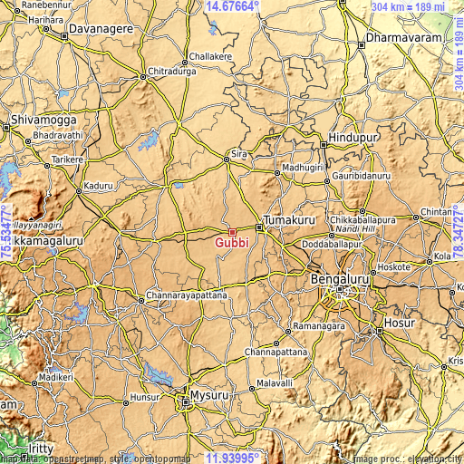
| \ | Map #1 | Map #2 | Topo.Map |
| Scale [m] | 762..812 m | 760..840 m | × |
| Scale [ft] | 2500..2664 ft | 2493..2756 ft | × |
| Average | 786.9 m = 2582 ft | 793.9 m = 2605 ft | × |
| Width | 9.51 km = 5.9 mi | 19.02 km = 11.8 mi | 304.3 km = 189.1 mi |
| Height | 9.51 km = 5.9 mi | 19.02 km = 11.8 mi | 304.3 km = 189.1 mi |
| ↑Max Latitude | 13.354921° | 13.397674° | 14.67664° |
| Latitude at center | 13.31216° | 13.31216° | 13.31216° |
| ↓Min Latitude | 13.269392° | 13.226616° | 11.93995° |
| ← Min Longitude | 76.897075° | 76.853129° | 75.53477° |
| Longitude center | 76.94102° | 76.94102° | 76.94102° |
| →Max Longitude | 76.984965° | 77.028911° | 78.34727° |
Nearby cities:
Cities around Gubbi sort by population:
• Tumkūr elevation 822 m
17.7 km,  79°
79°
• Tiptūr 862 m
50.5 km,  262°
262°
• Sīra 654 m
47.9 km,  355°
355°
• Kunigal 778 m
33.4 km,  164°
164°
• Nelamangala 898 m
54.4 km,  115°
115°
• Maddagiri 756 m
48.6 km,  37°
37°
• Māgadi 879 m
50 km,  142°
142°
• Chiknāyakanhalli 807 m
36.5 km,  288°
288°
• Nāgamangala 790 m
58.4 km,  200°
200°
• Koratagere 763 m
39.6 km,  53°
53°
• Turuvekere 808 m
34 km,  240°
240°
• Bellūru 797 m
43.1 km,  211°
211°
Multilingual:
 En español:
Gubbi elevación 786 m.
 En France:
Gubbi élévation 786 m.


Sources and notes:
- [note 1] Map square and city borders are not equal. Map elevation data is calculated only from area inside that square.
- [src 1] Elevation data from geonames database provided with same terms of usage.
- [src 2] The elevation map of Gubbi is generated using elevation data from NASA's 3 arcsec (90m) resolution SRTM data.
- [src 3] Base (background) map © OpenStreetMap contributors tiles are generated by Geofabrik and OpenTopoMap.
Copyright & License:
This Gubbi Elevation Map is licensed under CC BY-SA. You may reuse any part from this page, if you give a proper credit by linking to this URL:
 More info on terms of use page.