Gūdūr elevation
Gūdūr (Andhra Pradesh, Nellore), India elevation is 17 meters and Gūdūr elevation in feet is 56 ft above sea level [src 1]. Gūdūr is a populated place (feature code) with elevation that is 276 meters (906 ft) smaller than average city elevation in India.
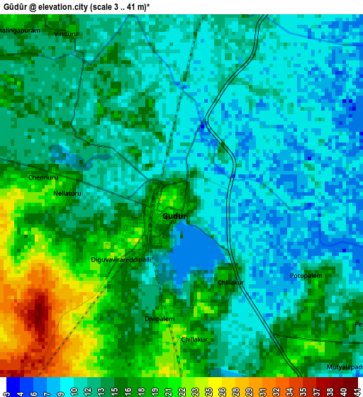
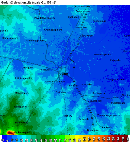
Below is the Elevation map of Gūdūr, which displays elevation range with different colors. Scale of the first map is from 3 to 41 m (10 to 135 ft) with average elevation of 14 meters (=46 ft) [note 1]
These maps also provides idea of topography and contour of this city, they are displayed at different zoom levels. More info about maps, scale and edge coordinates you can find below images.
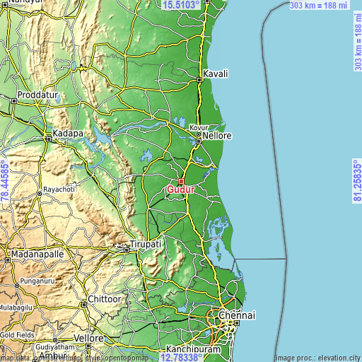
| \ | Map #1 | Map #2 | Topo.Map |
| Scale [m] | 3..41 m | -2..156 m | × |
| Scale [ft] | 10..135 ft | -7..512 ft | × |
| Average | 14 m = 46 ft | 18.6 m = 61 ft | × |
| Width | 9.48 km = 5.9 mi | 18.95 km = 11.8 mi | 303.2 km = 188.4 mi |
| Height | 9.48 km = 5.9 mi | 18.95 km = 11.8 mi | 303.2 km = 188.4 mi |
| ↑Max Latitude | 14.193538° | 14.236138° | 15.5103° |
| Latitude at center | 14.15093° | 14.15093° | 14.15093° |
| ↓Min Latitude | 14.108314° | 14.06569° | 12.78338° |
| ← Min Longitude | 79.808155° | 79.764209° | 78.44585° |
| Longitude center | 79.8521° | 79.8521° | 79.8521° |
| →Max Longitude | 79.896045° | 79.939991° | 81.25835° |
Nearby cities:
Cities around Gūdūr sort by population:
• Nellore elevation 21 m
36.3 km,  23°
23°
• Tirupati 156 m
73.9 km,  219°
219°
• Nāyudupet 34 m
27.5 km,  170°
170°
• Sūlūru 10 m
53.2 km,  160°
160°
• Kovūr 23 m
41.4 km, 20°
• Venkatagiri 68 m
36.2 km,  234°
234°
• Rāzampeta 139 m
74.9 km,  273°
273°
• Renigunta 112 m
66.5 km,  213°
213°
• Akkarampalle 167 m
72.6 km, 219°
• Tirumala 858 m
75.1 km, 226°
• Vadlapūdi 33 m
18.5 km,  343°
343°
• Nāgireddipalli 150 m
82 km,  279°
279°
Multilingual:
 En español:
Gūdūr elevación 17 m.
 En France:
Gūdūr élévation 17 m.


Sources and notes:
- [note 1] Map square and city borders are not equal. Map elevation data is calculated only from area inside that square.
- [src 1] Elevation data from geonames database provided with same terms of usage.
- [src 2] The elevation map of Gūdūr is generated using elevation data from NASA's 3 arcsec (90m) resolution SRTM data.
- [src 3] Base (background) map © OpenStreetMap contributors tiles are generated by Geofabrik and OpenTopoMap.
Copyright & License:
This Gūdūr Elevation Map is licensed under CC BY-SA. You may reuse any part from this page, if you give a proper credit by linking to this URL:
 More info on terms of use page.