Gurh elevation
Gurh (Madhya Pradesh, Rewa), India elevation is 333 meters and Gurh elevation in feet is 1093 ft above sea level [src 1]. Gurh is a populated place (feature code) with elevation that is 40 meters (131 ft) bigger than average city elevation in India.
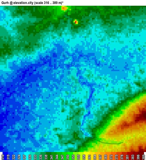
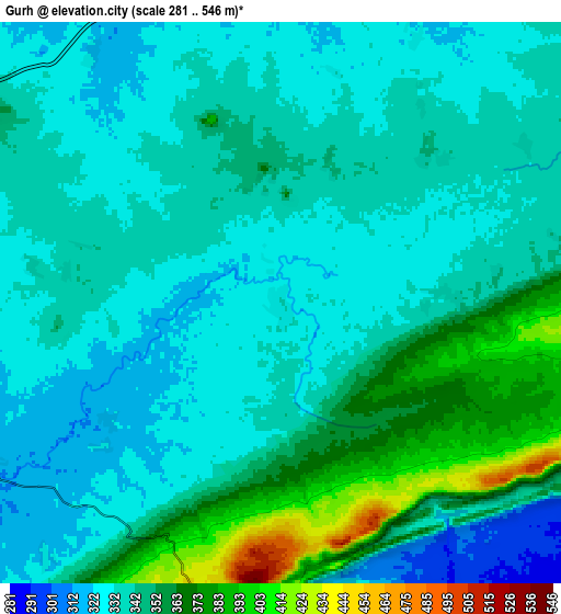
Below is the Elevation map of Gurh, which displays elevation range with different colors. Scale of the first map is from 316 to 389 m (1037 to 1276 ft) with average elevation of 333.3 meters (=1094 ft) [note 1]
These maps also provides idea of topography and contour of this city, they are displayed at different zoom levels. More info about maps, scale and edge coordinates you can find below images.
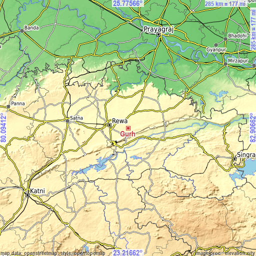
| \ | Map #1 | Map #2 | Topo.Map |
| Scale [m] | 316..389 m | 281..546 m | × |
| Scale [ft] | 1037..1276 ft | 922..1791 ft | × |
| Average | 333.3 m = 1094 ft | 343.1 m = 1126 ft | × |
| Width | 8.89 km = 5.5 mi | 17.78 km = 11 mi | 284.5 km = 176.8 mi |
| Height | 8.89 km = 5.5 mi | 17.78 km = 11 mi | 284.6 km = 176.8 mi |
| ↑Max Latitude | 24.542631° | 24.5826° | 25.77566° |
| Latitude at center | 24.50265° | 24.50265° | 24.50265° |
| ↓Min Latitude | 24.462656° | 24.422649° | 23.21662° |
| ← Min Longitude | 81.456425° | 81.412479° | 80.09412° |
| Longitude center | 81.50037° | 81.50037° | 81.50037° |
| →Max Longitude | 81.544315° | 81.588261° | 82.90662° |
Nearby cities:
Cities around Gurh sort by population:
• Rewa elevation 309 m
21.3 km,  278°
278°
• Sidhi 285 m
39.9 km,  105°
105°
• Mauganj 351 m
41.9 km,  64°
64°
• Beohāri 388 m
54.6 km,  193°
193°
• Teonthar 117 m
55.2 km,  15°
15°
• Chorhat 291 m
19 km,  116°
116°
• Simaria 298 m
47.9 km,  312°
312°
• Mangawān 310 m
18.9 km,  14°
14°
• Sirmaur 313 m
39.6 km,  339°
339°
• Govindgarh 334 m
24.8 km,  236°
236°
• Baikunthpur 305 m
26.6 km, 339°
• Naīgarhi 325 m
42.3 km,  41°
41°
Multilingual:
 En español:
Gurh elevación 333 m.
 En France:
Gurh élévation 333 m.


Sources and notes:
- [note 1] Map square and city borders are not equal. Map elevation data is calculated only from area inside that square.
- [src 1] Elevation data from geonames database provided with same terms of usage.
- [src 2] The elevation map of Gurh is generated using elevation data from NASA's 3 arcsec (90m) resolution SRTM data.
- [src 3] Base (background) map © OpenStreetMap contributors tiles are generated by Geofabrik and OpenTopoMap.
Copyright & License:
This Gurh Elevation Map is licensed under CC BY-SA. You may reuse any part from this page, if you give a proper credit by linking to this URL:
 More info on terms of use page.