Ichchāpuram elevation
Ichchāpuram (Andhra Pradesh, Srīkākulam), India elevation is 19 meters and Ichchāpuram elevation in feet is 62 ft above sea level [src 1]. Ichchāpuram is a populated place (feature code) with elevation that is 274 meters (899 ft) smaller than average city elevation in India.
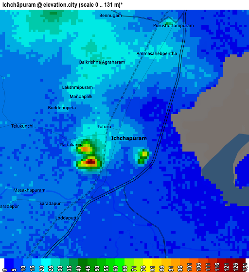
Below is the Elevation map of Ichchāpuram, which displays elevation range with different colors. Scale of the first map is from 0 to 131 m (0 to 430 ft) with average elevation of 12.9 meters (=42 ft) [note 1]
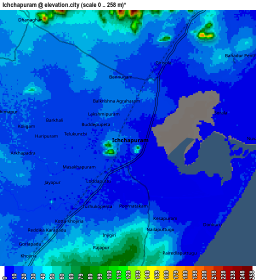
These maps also provides idea of topography and contour of this city, they are displayed at different zoom levels. More info about maps, scale and edge coordinates you can find below images.
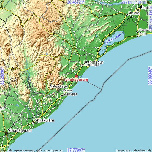
| \ | Map #1 | Map #2 | Topo.Map |
| Scale [m] | 0..131 m | 0..258 m | × |
| Scale [ft] | 0..430 ft | 0..846 ft | × |
| Average | 12.9 m = 42 ft | 21.9 m = 72 ft | × |
| Width | 9.23 km = 5.7 mi | 18.47 km = 11.5 mi | 295.5 km = 183.6 mi |
| Height | 9.23 km = 5.7 mi | 18.47 km = 11.5 mi | 295.5 km = 183.6 mi |
| ↑Max Latitude | 19.155447° | 19.196954° | 20.43721° |
| Latitude at center | 19.11393° | 19.11393° | 19.11393° |
| ↓Min Latitude | 19.072402° | 19.030864° | 17.77997° |
| ← Min Longitude | 84.643265° | 84.599319° | 83.28096° |
| Longitude center | 84.68721° | 84.68721° | 84.68721° |
| →Max Longitude | 84.731155° | 84.775101° | 86.09346° |
Nearby cities:
Cities around Ichchāpuram sort by population:
• Brahmapur elevation 37 m
24.6 km,  26°
26°
• Palāsa 36 m
47.9 km,  217°
217°
• Hinjilikatu 49 m
41.3 km,  8°
8°
• Āsika 45 m
55.4 km,  357°
357°
• Chatrapur 37 m
41.1 km,  49°
49°
• Sompeta 26 m
21.7 km,  209°
209°
• Purushottampur 23 m
49.7 km,  24°
24°
• Ganjām 11 m
48.8 km, 51°
• Digapahandi 73 m
31.2 km,  337°
337°
• Chikitigarh 52 m
12.4 km,  322°
322°
• Mandasa 44 m
36.1 km, 220°
• Gopālpur 23 m
28 km, 54°
Multilingual:
 En español:
Ichchāpuram elevación 19 m.
 En France:
Ichchāpuram élévation 19 m.
 Auf Deutsch:
Ichchāpuram höhe über dem Meeresspiegel ist 19 m.

Sources and notes:
- [note 1] Map square and city borders are not equal. Map elevation data is calculated only from area inside that square.
- [src 1] Elevation data from geonames database provided with same terms of usage.
- [src 2] The elevation map of Ichchāpuram is generated using elevation data from NASA's 3 arcsec (90m) resolution SRTM data.
- [src 3] Base (background) map © OpenStreetMap contributors tiles are generated by Geofabrik and OpenTopoMap.
Copyright & License:
This Ichchāpuram Elevation Map is licensed under CC BY-SA. You may reuse any part from this page, if you give a proper credit by linking to this URL:
 More info on terms of use page.