Jagannāthpur elevation
Jagannāthpur (Jharkhand, Pashchim Singhbhūm), India elevation is 433 meters and Jagannāthpur elevation in feet is 1421 ft above sea level [src 1]. Jagannāthpur is a populated place (feature code) with elevation that is 140 meters (459 ft) bigger than average city elevation in India.
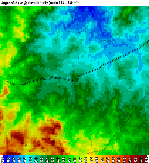
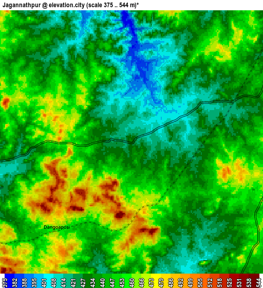
Below is the Elevation map of Jagannāthpur, which displays elevation range with different colors. Scale of the first map is from 383 to 539 m (1257 to 1768 ft) with average elevation of 437.6 meters (=1436 ft) [note 1]
These maps also provides idea of topography and contour of this city, they are displayed at different zoom levels. More info about maps, scale and edge coordinates you can find below images.
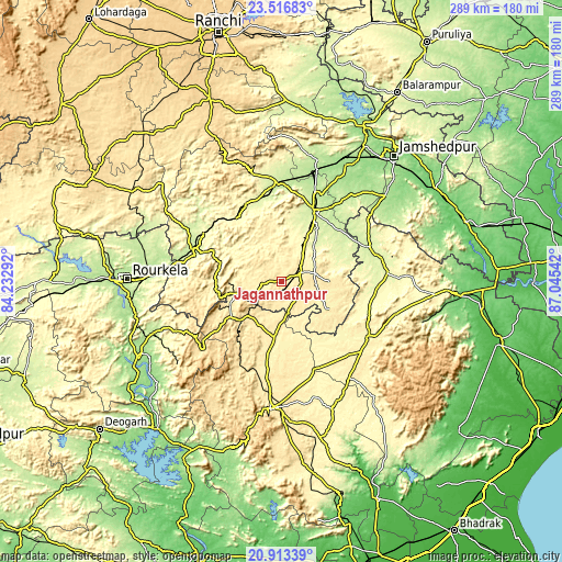
| \ | Map #1 | Map #2 | Topo.Map |
| Scale [m] | 383..539 m | 375..544 m | × |
| Scale [ft] | 1257..1768 ft | 1230..1785 ft | × |
| Average | 437.6 m = 1436 ft | 441.8 m = 1449 ft | × |
| Width | 9.05 km = 5.6 mi | 18.09 km = 11.2 mi | 289.5 km = 179.9 mi |
| Height | 9.05 km = 5.6 mi | 18.09 km = 11.2 mi | 289.5 km = 179.9 mi |
| ↑Max Latitude | 22.261826° | 22.302489° | 23.51683° |
| Latitude at center | 22.22115° | 22.22115° | 22.22115° |
| ↓Min Latitude | 22.180463° | 22.139763° | 20.91339° |
| ← Min Longitude | 85.595225° | 85.551279° | 84.23292° |
| Longitude center | 85.63917° | 85.63917° | 85.63917° |
| →Max Longitude | 85.683115° | 85.727061° | 87.04542° |
Nearby cities:
Cities around Jagannāthpur sort by population:
• Chāībāsa elevation 232 m
40.3 km,  24°
24°
• Bada Barabīl 470 m
28.7 km,  244°
244°
• Barbil 457 m
30 km, 243°
• Chakradharpur 232 m
50.6 km,  358°
358°
• Kuchaiburi 268 m
55.3 km,  84°
84°
• Noāmundi 475 m
15.4 km, 244°
• Manoharpur 228 m
49 km,  290°
290°
• Bolānīkhodān 501 m
33.4 km,  248°
248°
• Gua 392 m
25.9 km,  268°
268°
• Kiri Buru 466 m
33.5 km, 242°
• Chāmpua 396 m
17.3 km,  171°
171°
• Chiria 326 m
38.7 km,  284°
284°
Multilingual:
 En español:
Jagannāthpur elevación 433 m.
 En France:
Jagannāthpur élévation 433 m.
 Auf Deutsch:
Jagannāthpur höhe über dem Meeresspiegel ist 433 m.

Sources and notes:
- [note 1] Map square and city borders are not equal. Map elevation data is calculated only from area inside that square.
- [src 1] Elevation data from geonames database provided with same terms of usage.
- [src 2] The elevation map of Jagannāthpur is generated using elevation data from NASA's 3 arcsec (90m) resolution SRTM data.
- [src 3] Base (background) map © OpenStreetMap contributors tiles are generated by Geofabrik and OpenTopoMap.
Copyright & License:
This Jagannāthpur Elevation Map is licensed under CC BY-SA. You may reuse any part from this page, if you give a proper credit by linking to this URL:
 More info on terms of use page.