Jākhal elevation
Jākhal (Haryana, Fatehabad District), India elevation is 226 meters and Jākhal elevation in feet is 741 ft above sea level [src 1]. Jākhal is a populated place (feature code) with elevation that is 67 meters (220 ft) smaller than average city elevation in India.
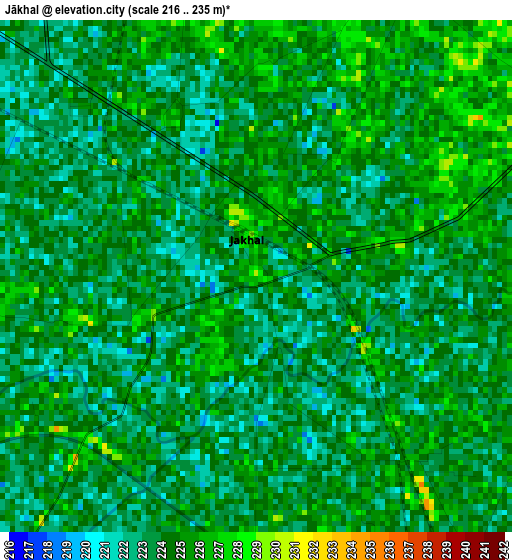
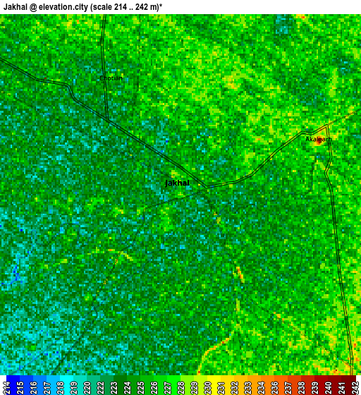
Below is the Elevation map of Jākhal, which displays elevation range with different colors. Scale of the first map is from 216 to 235 m (709 to 771 ft) with average elevation of 223.8 meters (=734 ft) [note 1]
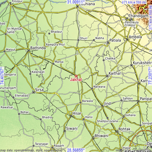
These maps also provides idea of topography and contour of this city, they are displayed at different zoom levels. More info about maps, scale and edge coordinates you can find below images.
| \ | Map #1 | Map #2 | Topo.Map |
| Scale [m] | 216..235 m | 214..242 m | × |
| Scale [ft] | 709..771 ft | 702..794 ft | × |
| Average | 223.8 m = 734 ft | 224.3 m = 736 ft | × |
| Width | 8.48 km = 5.3 mi | 16.96 km = 10.5 mi | 271.4 km = 168.6 mi |
| Height | 8.48 km = 5.3 mi | 16.96 km = 10.5 mi | 271.4 km = 168.6 mi |
| ↑Max Latitude | 29.834398° | 29.872512° | 31.00911° |
| Latitude at center | 29.79627° | 29.79627° | 29.79627° |
| ↓Min Latitude | 29.758127° | 29.71997° | 28.56855° |
| ← Min Longitude | 75.779975° | 75.736029° | 74.41767° |
| Longitude center | 75.82392° | 75.82392° | 75.82392° |
| →Max Longitude | 75.867865° | 75.911811° | 77.23017° |
Nearby cities:
Cities around Jākhal sort by population:
• Gorakhpur elevation 218 m
41.4 km,  200°
200°
• Mānsa 223 m
46 km,  297°
297°
• Tohāna 229 m
12.1 km,  139°
139°
• Narwāna 235 m
36 km,  127°
127°
• Sunām 245 m
37.1 km,  356°
356°
• Ratia 223 m
26.6 km,  243°
243°
• Budhlāda 227 m
29.2 km, 300°
• Bhīkhi 227 m
40.4 km,  316°
316°
• Dirba 238 m
34.9 km,  28°
28°
• Uklāna 222 m
32.1 km,  170°
170°
• Inda Chhoi 231 m
17.6 km,  190°
190°
• Akālgarh 230 m
7 km,  67°
67°
Multilingual:
 En español:
Jākhal elevación 226 m.
 En France:
Jākhal élévation 226 m.


Sources and notes:
- [note 1] Map square and city borders are not equal. Map elevation data is calculated only from area inside that square.
- [src 1] Elevation data from geonames database provided with same terms of usage.
- [src 2] The elevation map of Jākhal is generated using elevation data from NASA's 3 arcsec (90m) resolution SRTM data.
- [src 3] Base (background) map © OpenStreetMap contributors tiles are generated by Geofabrik and OpenTopoMap.
Copyright & License:
This Jākhal Elevation Map is licensed under CC BY-SA. You may reuse any part from this page, if you give a proper credit by linking to this URL:
 More info on terms of use page.