Madhogarh elevation
Madhogarh (Madhya Pradesh, Satna), India elevation is 302 meters and Madhogarh elevation in feet is 991 ft above sea level [src 1]. Madhogarh is a populated place (feature code) with elevation that is 9 meters (30 ft) bigger than average city elevation in India.
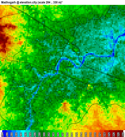
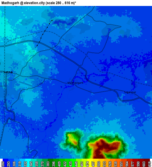
Below is the Elevation map of Madhogarh, which displays elevation range with different colors. Scale of the first map is from 284 to 330 m (932 to 1083 ft) with average elevation of 302.4 meters (=992 ft) [note 1]
These maps also provides idea of topography and contour of this city, they are displayed at different zoom levels. More info about maps, scale and edge coordinates you can find below images.
| \ | Map #1 | Map #2 | Topo.Map |
| Scale [m] | 284..330 m | 280..616 m | × |
| Scale [ft] | 932..1083 ft | 919..2021 ft | × |
| Average | 302.4 m = 992 ft | 316.9 m = 1040 ft | × |
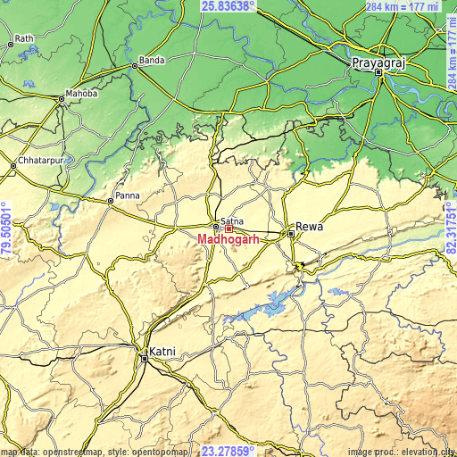
| Width | 8.89 km = 5.5 mi | 17.78 km = 11 mi | 284.4 km = 176.7 mi |
| Height | 8.89 km = 5.5 mi | 17.78 km = 11 mi | 284.4 km = 176.7 mi |
| ↑Max Latitude | 24.603972° | 24.643921° | 25.83638° |
| Latitude at center | 24.56401° | 24.56401° | 24.56401° |
| ↓Min Latitude | 24.524035° | 24.484048° | 23.27859° |
| ← Min Longitude | 80.867315° | 80.823369° | 79.50501° |
| Longitude center | 80.91126° | 80.91126° | 80.91126° |
| →Max Longitude | 80.955205° | 80.999151° | 82.31751° |
Nearby cities:
Cities around Madhogarh sort by population:
• Satna elevation 324 m
8.6 km,  279°
279°
• Rewa 309 m
38.7 km,  95°
95°
• Maihar 358 m
36.5 km,  204°
204°
• Nāgod 335 m
32.7 km,  271°
271°
• Amarpātan 362 m
28.6 km,  166°
166°
• Mānikpur 243 m
58.4 km,  18°
18°
• Simaria 298 m
35.4 km,  43°
43°
• Sirmaur 313 m
54.9 km,  56°
56°
• Govindgarh 334 m
44.1 km,  117°
117°
• Baikunthpur 305 m
53.6 km,  70°
70°
• Kothi 327 m
24.9 km,  327°
327°
• Kotār 303 m
16.5 km,  25°
25°
Multilingual:
 En español:
Madhogarh elevación 302 m.
 En France:
Madhogarh élévation 302 m.
 Auf Deutsch:
Madhogarh höhe über dem Meeresspiegel ist 302 m.

Sources and notes:
- [note 1] Map square and city borders are not equal. Map elevation data is calculated only from area inside that square.
- [src 1] Elevation data from geonames database provided with same terms of usage.
- [src 2] The elevation map of Madhogarh is generated using elevation data from NASA's 3 arcsec (90m) resolution SRTM data.
- [src 3] Base (background) map © OpenStreetMap contributors tiles are generated by Geofabrik and OpenTopoMap.
Copyright & License:
This Madhogarh Elevation Map is licensed under CC BY-SA. You may reuse any part from this page, if you give a proper credit by linking to this URL:
 More info on terms of use page.