Mairwa elevation
Mairwa (Bihar, Siwān), India elevation is 72 meters and Mairwa elevation in feet is 236 ft above sea level [src 1]. Mairwa is a populated place (feature code) with elevation that is 221 meters (725 ft) smaller than average city elevation in India.
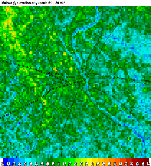
Below is the Elevation map of Mairwa, which displays elevation range with different colors. Scale of the first map is from 61 to 80 m (200 to 262 ft) with average elevation of 68.3 meters (=224 ft) [note 1]
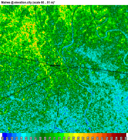
These maps also provides idea of topography and contour of this city, they are displayed at different zoom levels. More info about maps, scale and edge coordinates you can find below images.
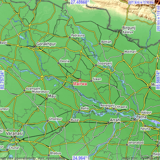
| \ | Map #1 | Map #2 | Topo.Map |
| Scale [m] | 61..80 m | 60..81 m | × |
| Scale [ft] | 200..262 ft | 197..266 ft | × |
| Average | 68.3 m = 224 ft | 68.1 m = 223 ft | × |
| Width | 8.77 km = 5.4 mi | 17.53 km = 10.9 mi | 280.5 km = 174.3 mi |
| Height | 8.77 km = 5.4 mi | 17.53 km = 10.9 mi | 280.5 km = 174.3 mi |
| ↑Max Latitude | 26.271593° | 26.310992° | 27.48668° |
| Latitude at center | 26.23218° | 26.23218° | 26.23218° |
| ↓Min Latitude | 26.192754° | 26.153314° | 24.964° |
| ← Min Longitude | 84.119545° | 84.075599° | 82.75724° |
| Longitude center | 84.16349° | 84.16349° | 84.16349° |
| →Max Longitude | 84.207435° | 84.251381° | 85.56974° |
Nearby cities:
Cities around Mairwa sort by population:
• Deoria elevation 82 m
48.6 km,  308°
308°
• Siwān 71 m
19.3 km,  93°
93°
• Gopālganj 74 m
38 km,  46°
46°
• Barauli 73 m
45.3 km,  68°
68°
• Rasrā 72 m
51.8 km,  216°
216°
• Lar 72 m
19.6 km,  260°
260°
• Sikandarpur 69 m
23.7 km,  207°
207°
• Reoti 64 m
47.5 km,  153°
153°
• Mahārājgani 67 m
36.6 km,  111°
111°
• Bānsdīh 68 m
39.1 km,  171°
171°
• Maniar 68 m
27.4 km,  178°
178°
• Bilthra 71 m
29.6 km,  246°
246°
Multilingual:
 En español:
Mairwa elevación 72 m.
 En France:
Mairwa élévation 72 m.


Sources and notes:
- [note 1] Map square and city borders are not equal. Map elevation data is calculated only from area inside that square.
- [src 1] Elevation data from geonames database provided with same terms of usage.
- [src 2] The elevation map of Mairwa is generated using elevation data from NASA's 3 arcsec (90m) resolution SRTM data.
- [src 3] Base (background) map © OpenStreetMap contributors tiles are generated by Geofabrik and OpenTopoMap.
Copyright & License:
This Mairwa Elevation Map is licensed under CC BY-SA. You may reuse any part from this page, if you give a proper credit by linking to this URL:
 More info on terms of use page.