Manjhanpur elevation
Manjhanpur (Uttar Pradesh, Kaushambi District), India elevation is 104 meters and Manjhanpur elevation in feet is 341 ft above sea level [src 1]. Manjhanpur is a populated place (feature code) with elevation that is 189 meters (620 ft) smaller than average city elevation in India.
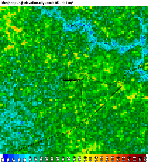
Below is the Elevation map of Manjhanpur, which displays elevation range with different colors. Scale of the first map is from 95 to 114 m (312 to 374 ft) with average elevation of 103.7 meters (=340 ft) [note 1]
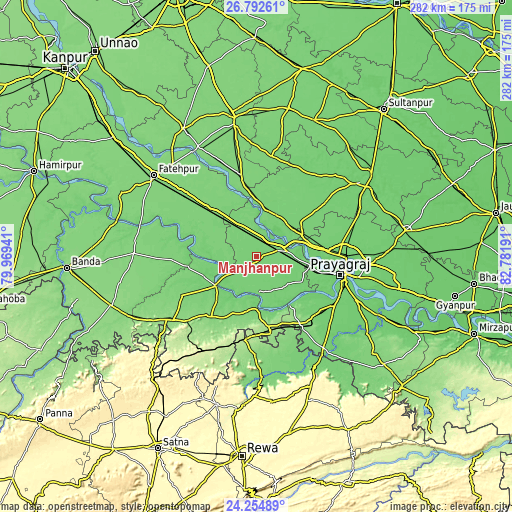
These maps also provides idea of topography and contour of this city, they are displayed at different zoom levels. More info about maps, scale and edge coordinates you can find below images.
| \ | Map #1 | Map #2 | Topo.Map |
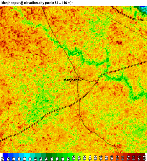
| Scale [m] | 95..114 m | 84..116 m | × |
| Scale [ft] | 312..374 ft | 276..381 ft | × |
| Average | 103.7 m = 340 ft | 104.3 m = 342 ft | × |
| Width | 8.82 km = 5.5 mi | 17.64 km = 11 mi | 282.2 km = 175.4 mi |
| Height | 8.82 km = 5.5 mi | 17.64 km = 11 mi | 282.2 km = 175.4 mi |
| ↑Max Latitude | 25.570108° | 25.609742° | 26.79261° |
| Latitude at center | 25.53046° | 25.53046° | 25.53046° |
| ↓Min Latitude | 25.490799° | 25.451125° | 24.25489° |
| ← Min Longitude | 81.331715° | 81.287769° | 79.96941° |
| Longitude center | 81.37566° | 81.37566° | 81.37566° |
| →Max Longitude | 81.419605° | 81.463551° | 82.78191° |
Nearby cities:
Cities around Manjhanpur sort by population:
• Allahābād elevation 99 m
47.9 km,  101°
101°
• Kunda 109 m
25 km,  33°
33°
• Sarāi Ākil 107 m
21.6 km,  141°
141°
• Jhūsi 95 m
54.2 km, 101°
• Bharwāri 106 m
12.1 km,  73°
73°
• Karārī 109 m
10.1 km,  149°
149°
• Shankargarh 136 m
45.7 km, 147°
• Rājāpur 111 m
27.6 km,  234°
234°
• Sirāthu 112 m
13.8 km,  335°
335°
• Khāga 115 m
38.3 km,  314°
314°
• Chail 105 m
28.2 km,  114°
114°
• Kishanpur 109 m
37.5 km,  289°
289°
Multilingual:
 En español:
Manjhanpur elevación 104 m.
 En France:
Manjhanpur élévation 104 m.
 Auf Deutsch:
Manjhanpur höhe über dem Meeresspiegel ist 104 m.

Sources and notes:
- [note 1] Map square and city borders are not equal. Map elevation data is calculated only from area inside that square.
- [src 1] Elevation data from geonames database provided with same terms of usage.
- [src 2] The elevation map of Manjhanpur is generated using elevation data from NASA's 3 arcsec (90m) resolution SRTM data.
- [src 3] Base (background) map © OpenStreetMap contributors tiles are generated by Geofabrik and OpenTopoMap.
Copyright & License:
This Manjhanpur Elevation Map is licensed under CC BY-SA. You may reuse any part from this page, if you give a proper credit by linking to this URL:
 More info on terms of use page.