Mayāng Imphāl elevation
Mayāng Imphāl (Manipur, Imphal East), India elevation is 777 meters and Mayāng Imphāl elevation in feet is 2549 ft above sea level [src 1]. Mayāng Imphāl is a populated place (feature code) with elevation that is 484 meters (1588 ft) bigger than average city elevation in India.
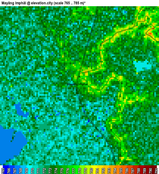
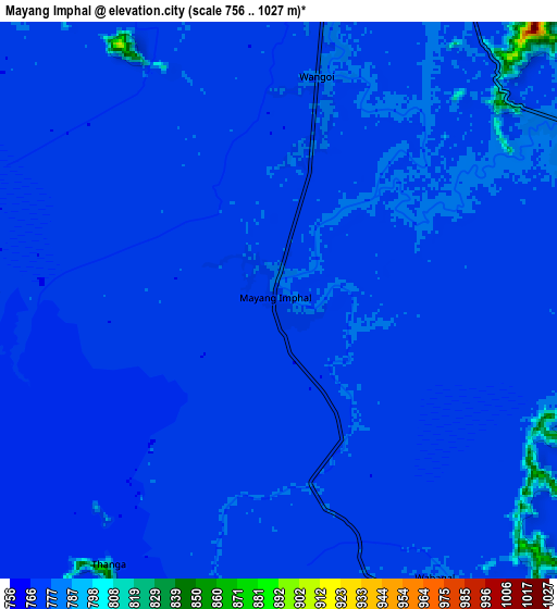
Below is the Elevation map of Mayāng Imphāl, which displays elevation range with different colors. Scale of the first map is from 765 to 785 m (2510 to 2575 ft) with average elevation of 772.4 meters (=2534 ft) [note 1]
These maps also provides idea of topography and contour of this city, they are displayed at different zoom levels. More info about maps, scale and edge coordinates you can find below images.
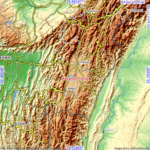
| \ | Map #1 | Map #2 | Topo.Map |
| Scale [m] | 765..785 m | 756..1027 m | × |
| Scale [ft] | 2510..2575 ft | 2480..3369 ft | × |
| Average | 772.4 m = 2534 ft | 773.9 m = 2539 ft | × |
| Width | 8.88 km = 5.5 mi | 17.77 km = 11 mi | 284.3 km = 176.7 mi |
| Height | 8.88 km = 5.5 mi | 17.77 km = 11 mi | 284.3 km = 176.7 mi |
| ↑Max Latitude | 24.649927° | 24.689861° | 25.88187° |
| Latitude at center | 24.60998° | 24.60998° | 24.60998° |
| ↓Min Latitude | 24.57002° | 24.530048° | 23.32502° |
| ← Min Longitude | 93.844785° | 93.800839° | 92.48248° |
| Longitude center | 93.88873° | 93.88873° | 93.88873° |
| →Max Longitude | 93.932675° | 93.976621° | 95.29498° |
Nearby cities:
Cities around Mayāng Imphāl sort by population:
• Imphal elevation 784 m
22.7 km,  14°
14°
• Churāchāndpur 944 m
37.9 km,  215°
215°
• Thoubāl 780 m
11.3 km,  73°
73°
• Kakching 787 m
15.6 km,  143°
143°
• Moirāng 773 m
16.8 km, 221°
• Yairipok 791 m
17.8 km,  64°
64°
• Wāngjing 793 m
17.9 km,  97°
97°
• Kamjong 1564 m
69.1 km, 66°
• Kāngpokpi 1075 m
60.9 km, 7°
• Tengnoupal 1388 m
36.2 km,  133°
133°
• Chandel 888 m
33.3 km,  159°
159°
• Bishnupur 809 m
13 km,  279°
279°
Multilingual:
 En español:
Mayāng Imphāl elevación 777 m.
 En France:
Mayāng Imphāl élévation 777 m.
 Auf Deutsch:
Mayāng Imphāl höhe über dem Meeresspiegel ist 777 m.

Sources and notes:
- [note 1] Map square and city borders are not equal. Map elevation data is calculated only from area inside that square.
- [src 1] Elevation data from geonames database provided with same terms of usage.
- [src 2] The elevation map of Mayāng Imphāl is generated using elevation data from NASA's 3 arcsec (90m) resolution SRTM data.
- [src 3] Base (background) map © OpenStreetMap contributors tiles are generated by Geofabrik and OpenTopoMap.
Copyright & License:
This Mayāng Imphāl Elevation Map is licensed under CC BY-SA. You may reuse any part from this page, if you give a proper credit by linking to this URL:
 More info on terms of use page.