Nabīnagar elevation
Nabīnagar (Bihar, Aurangābād), India elevation is 144 meters and Nabīnagar elevation in feet is 472 ft above sea level [src 1]. Nabīnagar is a populated place (feature code) with elevation that is 149 meters (489 ft) smaller than average city elevation in India.
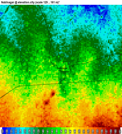
Below is the Elevation map of Nabīnagar, which displays elevation range with different colors. Scale of the first map is from 129 to 161 m (423 to 528 ft) with average elevation of 142.9 meters (=469 ft) [note 1]
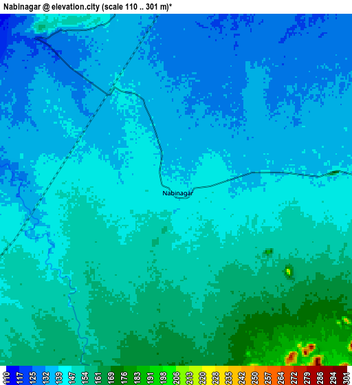
These maps also provides idea of topography and contour of this city, they are displayed at different zoom levels. More info about maps, scale and edge coordinates you can find below images.
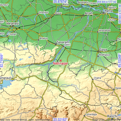
| \ | Map #1 | Map #2 | Topo.Map |
| Scale [m] | 129..161 m | 110..301 m | × |
| Scale [ft] | 423..528 ft | 361..988 ft | × |
| Average | 142.9 m = 469 ft | 145 m = 476 ft | × |
| Width | 8.88 km = 5.5 mi | 17.77 km = 11 mi | 284.3 km = 176.7 mi |
| Height | 8.89 km = 5.5 mi | 17.77 km = 11 mi | 284.3 km = 176.7 mi |
| ↑Max Latitude | 24.646758° | 24.686693° | 25.87874° |
| Latitude at center | 24.60681° | 24.60681° | 24.60681° |
| ↓Min Latitude | 24.566849° | 24.526876° | 23.32182° |
| ← Min Longitude | 84.082295° | 84.038349° | 82.71999° |
| Longitude center | 84.12624° | 84.12624° | 84.12624° |
| →Max Longitude | 84.170185° | 84.214131° | 85.53249° |
Nearby cities:
Cities around Nabīnagar sort by population:
• Dehri elevation 114 m
33.4 km,  9°
9°
• Aurangābād 116 m
29.8 km,  57°
57°
• Daltonganj 227 m
63.4 km,  185°
185°
• Bhabhua 88 m
71.2 km,  312°
312°
• Bikramganj 93 m
68.4 km, 10°
• Daudnagar 97 m
55.1 km,  30°
30°
• Garhwa 203 m
59.2 km,  213°
213°
• Sherghāti 151 m
67.5 km,  94°
94°
• Rafiganj 106 m
56.4 km,  65°
65°
• Husainābād 153 m
15.5 km,  235°
235°
• Nāsriganj 102 m
53.5 km,  22°
22°
• Koāth 88 m
81.1 km, 9°
Multilingual:
 En español:
Nabīnagar elevación 144 m.
 En France:
Nabīnagar élévation 144 m.
 Auf Deutsch:
Nabīnagar höhe über dem Meeresspiegel ist 144 m.

Sources and notes:
- [note 1] Map square and city borders are not equal. Map elevation data is calculated only from area inside that square.
- [src 1] Elevation data from geonames database provided with same terms of usage.
- [src 2] The elevation map of Nabīnagar is generated using elevation data from NASA's 3 arcsec (90m) resolution SRTM data.
- [src 3] Base (background) map © OpenStreetMap contributors tiles are generated by Geofabrik and OpenTopoMap.
Copyright & License:
This Nabīnagar Elevation Map is licensed under CC BY-SA. You may reuse any part from this page, if you give a proper credit by linking to this URL:
 More info on terms of use page.