Nagīna elevation
Nagīna (Uttar Pradesh, Bijnor), India elevation is 250 meters and Nagīna elevation in feet is 820 ft above sea level [src 1]. Nagīna is a populated place (feature code) with elevation that is 43 meters (141 ft) smaller than average city elevation in India.
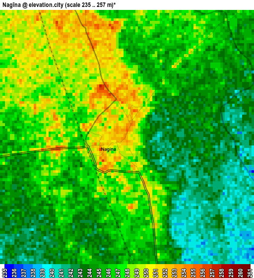
Below is the Elevation map of Nagīna, which displays elevation range with different colors. Scale of the first map is from 235 to 257 m (771 to 843 ft) with average elevation of 245.5 meters (=805 ft) [note 1]
These maps also provides idea of topography and contour of this city, they are displayed at different zoom levels. More info about maps, scale and edge coordinates you can find below images.
| \ | Map #1 | Map #2 | Topo.Map |
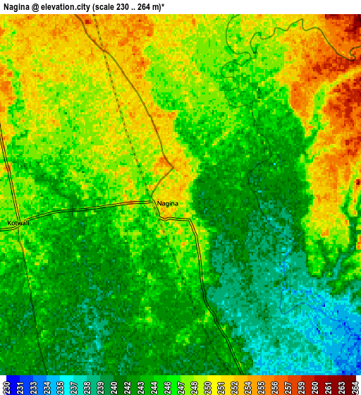
| Scale [m] | 235..257 m | 230..264 m | × |
| Scale [ft] | 771..843 ft | 755..866 ft | × |
| Average | 245.5 m = 805 ft | 245.7 m = 806 ft | × |
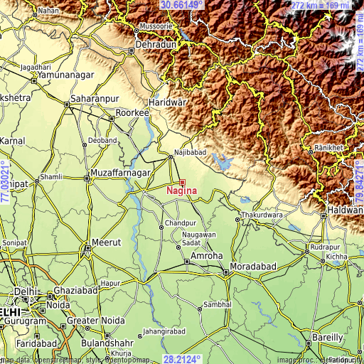
| Width | 8.51 km = 5.3 mi | 17.02 km = 10.6 mi | 272.3 km = 169.2 mi |
| Height | 8.51 km = 5.3 mi | 17.02 km = 10.6 mi | 272.3 km = 169.2 mi |
| ↑Max Latitude | 29.482592° | 29.520839° | 30.66149° |
| Latitude at center | 29.44433° | 29.44433° | 29.44433° |
| ↓Min Latitude | 29.406054° | 29.367763° | 28.2124° |
| ← Min Longitude | 78.392515° | 78.348569° | 77.03021° |
| Longitude center | 78.43646° | 78.43646° | 78.43646° |
| →Max Longitude | 78.480405° | 78.524351° | 79.84271° |
Nearby cities:
Cities around Nagīna sort by population:
• Bijnor elevation 237 m
30.1 km,  254°
254°
• Najībābād 273 m
20.7 km,  334°
334°
• Kīratpur 256 m
23.3 km,  287°
287°
• Sherkot 236 m
18.7 km,  134°
134°
• Dhāmpur 241 m
16.7 km,  154°
154°
• Nihtaur 243 m
14.2 km,  199°
199°
• Seohāra 232 m
30 km, 150°
• Afzalgarh 234 m
23.7 km,  103°
103°
• Mandāwar 243 m
30.3 km,  278°
278°
• Jhālu 241 m
23.7 km,  239°
239°
• Haldaur 238 m
22.6 km,  220°
220°
• Tājpur 227 m
31.7 km,  171°
171°
Multilingual:
 En español:
Nagīna elevación 250 m.
 En France:
Nagīna élévation 250 m.


Sources and notes:
- [note 1] Map square and city borders are not equal. Map elevation data is calculated only from area inside that square.
- [src 1] Elevation data from geonames database provided with same terms of usage.
- [src 2] The elevation map of Nagīna is generated using elevation data from NASA's 3 arcsec (90m) resolution SRTM data.
- [src 3] Base (background) map © OpenStreetMap contributors tiles are generated by Geofabrik and OpenTopoMap.
Copyright & License:
This Nagīna Elevation Map is licensed under CC BY-SA. You may reuse any part from this page, if you give a proper credit by linking to this URL:
 More info on terms of use page.