Nanguneri elevation
Nanguneri (Tamil Nadu, Tirunelveli Kattabo), India elevation is 97 meters and Nanguneri elevation in feet is 318 ft above sea level [src 1]. Nanguneri is a populated place (feature code) with elevation that is 196 meters (643 ft) smaller than average city elevation in India.
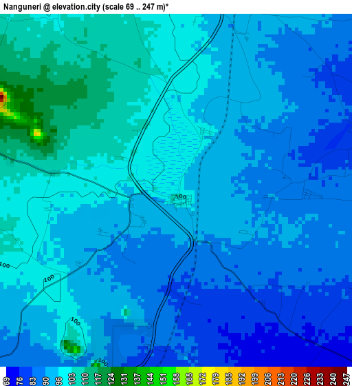
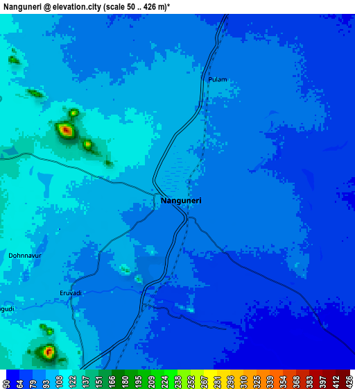
Below is the Elevation map of Nanguneri, which displays elevation range with different colors. Scale of the first map is from 69 to 247 m (226 to 810 ft) with average elevation of 93.8 meters (=308 ft) [note 1]
These maps also provides idea of topography and contour of this city, they are displayed at different zoom levels. More info about maps, scale and edge coordinates you can find below images.
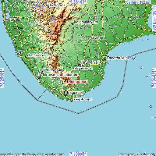
| \ | Map #1 | Map #2 | Topo.Map |
| Scale [m] | 69..247 m | 50..426 m | × |
| Scale [ft] | 226..810 ft | 164..1398 ft | × |
| Average | 93.8 m = 308 ft | 90 m = 295 ft | × |
| Width | 9.67 km = 6 mi | 19.33 km = 12 mi | 309.3 km = 192.2 mi |
| Height | 9.67 km = 6 mi | 19.33 km = 12 mi | 309.3 km = 192.2 mi |
| ↑Max Latitude | 8.536721° | 8.580177° | 9.88143° |
| Latitude at center | 8.49326° | 8.49326° | 8.49326° |
| ↓Min Latitude | 8.449794° | 8.406323° | 7.10005° |
| ← Min Longitude | 77.614115° | 77.570169° | 76.25181° |
| Longitude center | 77.65806° | 77.65806° | 77.65806° |
| →Max Longitude | 77.702005° | 77.745951° | 79.06431° |
Nearby cities:
Cities around Nanguneri sort by population:
• Tirunelveli elevation 49 m
26.2 km,  6°
6°
• Ambasamudram 68 m
33.1 km,  316°
316°
• Kalakkādu 132 m
12.2 km,  280°
280°
• Kallidaikurichi 72 m
30.1 km, 315°
• Vadakku Valliyūr 106 m
13.3 km,  202°
202°
• Tisaiyanvilai 23 m
28.9 km,  126°
126°
• Vadakku Viravanallur 66 m
27.4 km,  326°
326°
• Udangudi 12 m
41.5 km,  99°
99°
• Srivaikuntam 19 m
31.8 km,  61°
61°
• Sathankulam 25 m
28.7 km, 101°
• Gangaikondān 47 m
42.7 km,  18°
18°
• Alwa Tirunagari 20 m
33.4 km,  67°
67°
Multilingual:
 En español:
Nanguneri elevación 97 m.
 En France:
Nanguneri élévation 97 m.
 Auf Deutsch:
Nanguneri höhe über dem Meeresspiegel ist 97 m.

Sources and notes:
- [note 1] Map square and city borders are not equal. Map elevation data is calculated only from area inside that square.
- [src 1] Elevation data from geonames database provided with same terms of usage.
- [src 2] The elevation map of Nanguneri is generated using elevation data from NASA's 3 arcsec (90m) resolution SRTM data.
- [src 3] Base (background) map © OpenStreetMap contributors tiles are generated by Geofabrik and OpenTopoMap.
Copyright & License:
This Nanguneri Elevation Map is licensed under CC BY-SA. You may reuse any part from this page, if you give a proper credit by linking to this URL:
 More info on terms of use page.