Nānpāra elevation
Nānpāra (Uttar Pradesh, Bahraich), India elevation is 138 meters and Nānpāra elevation in feet is 453 ft above sea level [src 1]. Nānpāra is a populated place (feature code) with elevation that is 155 meters (509 ft) smaller than average city elevation in India.
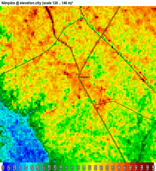
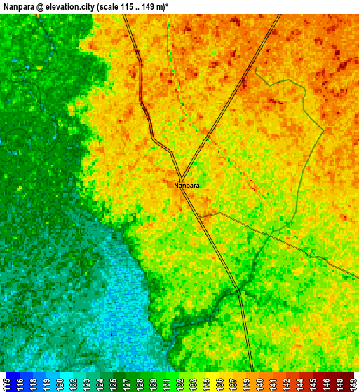
Below is the Elevation map of Nānpāra, which displays elevation range with different colors. Scale of the first map is from 120 to 146 m (394 to 479 ft) with average elevation of 134 meters (=440 ft) [note 1]
These maps also provides idea of topography and contour of this city, they are displayed at different zoom levels. More info about maps, scale and edge coordinates you can find below images.
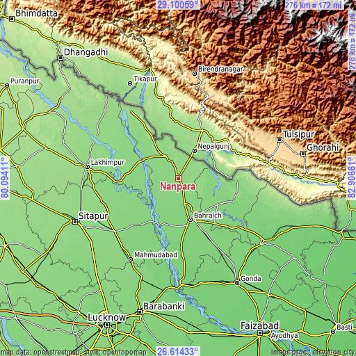
| \ | Map #1 | Map #2 | Topo.Map |
| Scale [m] | 120..146 m | 115..149 m | × |
| Scale [ft] | 394..479 ft | 377..489 ft | × |
| Average | 134 m = 440 ft | 132.4 m = 434 ft | × |
| Width | 8.64 km = 5.4 mi | 17.28 km = 10.7 mi | 276.4 km = 171.7 mi |
| Height | 8.64 km = 5.4 mi | 17.28 km = 10.7 mi | 276.5 km = 171.8 mi |
| ↑Max Latitude | 27.903433° | 27.942262° | 29.10059° |
| Latitude at center | 27.86459° | 27.86459° | 27.86459° |
| ↓Min Latitude | 27.825733° | 27.786862° | 26.61433° |
| ← Min Longitude | 81.456415° | 81.412469° | 80.09411° |
| Longitude center | 81.50036° | 81.50036° | 81.50036° |
| →Max Longitude | 81.544305° | 81.588251° | 82.90661° |
Nearby cities:
Cities around Nānpāra sort by population:
• Bahraigh elevation 127 m
33.6 km,  163°
163°
• Lakhīmpur 152 m
71.5 km,  277°
277°
• Lāharpur 142 m
61.3 km,  253°
253°
• Biswān 136 m
64.4 km,  230°
230°
• Mahmudābād 129 m
74 km,  210°
210°
• Kheri 149 m
69.2 km,  273°
273°
• Bhinga 122 m
46.3 km,  112°
112°
• Dhaurahra 135 m
43 km,  290°
290°
• Ikauna 118 m
59.2 km,  128°
128°
• Amethi 133 m
47.4 km, 290°
• Khargupur 117 m
72.5 km,  138°
138°
• Katra 115 m
65.2 km, 127°
Multilingual:
 En español:
Nānpāra elevación 138 m.
 En France:
Nānpāra élévation 138 m.


Sources and notes:
- [note 1] Map square and city borders are not equal. Map elevation data is calculated only from area inside that square.
- [src 1] Elevation data from geonames database provided with same terms of usage.
- [src 2] The elevation map of Nānpāra is generated using elevation data from NASA's 3 arcsec (90m) resolution SRTM data.
- [src 3] Base (background) map © OpenStreetMap contributors tiles are generated by Geofabrik and OpenTopoMap.
Copyright & License:
This Nānpāra Elevation Map is licensed under CC BY-SA. You may reuse any part from this page, if you give a proper credit by linking to this URL:
 More info on terms of use page.