Nasīrābād elevation
Nasīrābād (Rajasthan, Ajmer), India elevation is 435 meters and Nasīrābād elevation in feet is 1427 ft above sea level [src 1]. Nasīrābād is a populated place (feature code) with elevation that is 142 meters (466 ft) bigger than average city elevation in India.
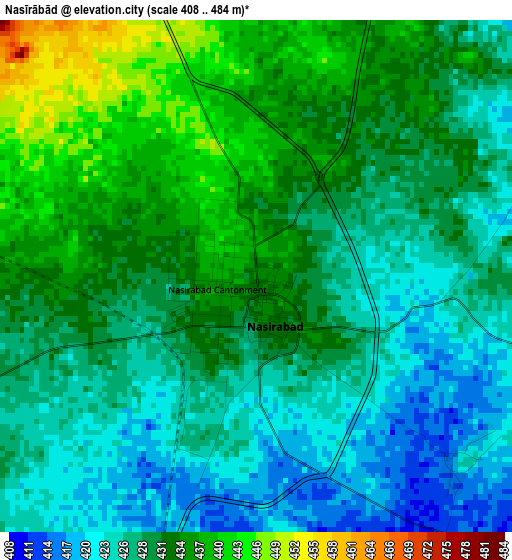
Below is the Elevation map of Nasīrābād, which displays elevation range with different colors. Scale of the first map is from 408 to 484 m (1339 to 1588 ft) with average elevation of 429.9 meters (=1410 ft) [note 1]
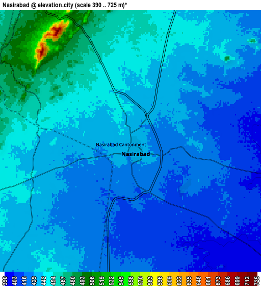
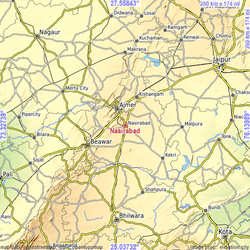
These maps also provides idea of topography and contour of this city, they are displayed at different zoom levels. More info about maps, scale and edge coordinates you can find below images.
| \ | Map #1 | Map #2 | Topo.Map |
| Scale [m] | 408..484 m | 390..725 m | × |
| Scale [ft] | 1339..1588 ft | 1280..2379 ft | × |
| Average | 429.9 m = 1410 ft | 435.8 m = 1430 ft | × |
| Width | 8.76 km = 5.4 mi | 17.52 km = 10.9 mi | 280.3 km = 174.2 mi |
| Height | 8.76 km = 5.4 mi | 17.52 km = 10.9 mi | 280.3 km = 174.2 mi |
| ↑Max Latitude | 26.344118° | 26.383493° | 27.55843° |
| Latitude at center | 26.30473° | 26.30473° | 26.30473° |
| ↓Min Latitude | 26.265329° | 26.225914° | 25.03732° |
| ← Min Longitude | 74.689695° | 74.645749° | 73.32739° |
| Longitude center | 74.73364° | 74.73364° | 74.73364° |
| →Max Longitude | 74.777585° | 74.821531° | 76.13989° |
Nearby cities:
Cities around Nasīrābād sort by population:
• Ajmer elevation 475 m
18.9 km,  330°
330°
• Kishangarh 443 m
33.9 km,  20°
20°
• Beāwar 453 m
47 km,  241°
241°
• Kekri 358 m
55.7 km,  131°
131°
• Mālpura 326 m
62.9 km,  92°
92°
• Gulābpura 400 m
45.1 km,  189°
189°
• Sarwār 363 m
38.6 km, 134°
• Naraina 381 m
71.6 km,  41°
41°
• Pushkar 495 m
27.4 km,  318°
318°
• Parvatsar 434 m
64.7 km,  2°
2°
• Āsind 478 m
75 km,  212°
212°
• Uniāra 352 m
50.9 km,  109°
109°
Multilingual:
 En español:
Nasīrābād elevación 435 m.
 En France:
Nasīrābād élévation 435 m.
 Auf Deutsch:
Nasīrābād höhe über dem Meeresspiegel ist 435 m.

Sources and notes:
- [note 1] Map square and city borders are not equal. Map elevation data is calculated only from area inside that square.
- [src 1] Elevation data from geonames database provided with same terms of usage.
- [src 2] The elevation map of Nasīrābād is generated using elevation data from NASA's 3 arcsec (90m) resolution SRTM data.
- [src 3] Base (background) map © OpenStreetMap contributors tiles are generated by Geofabrik and OpenTopoMap.
Copyright & License:
This Nasīrābād Elevation Map is licensed under CC BY-SA. You may reuse any part from this page, if you give a proper credit by linking to this URL:
 More info on terms of use page.