Nattam elevation
Nattam (Tamil Nadu, Dindigul), India elevation is 252 meters and Nattam elevation in feet is 827 ft above sea level [src 1]. Nattam is a populated place (feature code) with elevation that is 41 meters (135 ft) smaller than average city elevation in India.
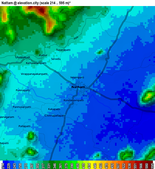
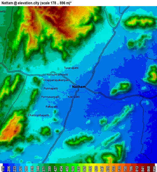
Below is the Elevation map of Nattam, which displays elevation range with different colors. Scale of the first map is from 214 to 595 m (702 to 1952 ft) with average elevation of 273 meters (=896 ft) [note 1]
These maps also provides idea of topography and contour of this city, they are displayed at different zoom levels. More info about maps, scale and edge coordinates you can find below images.
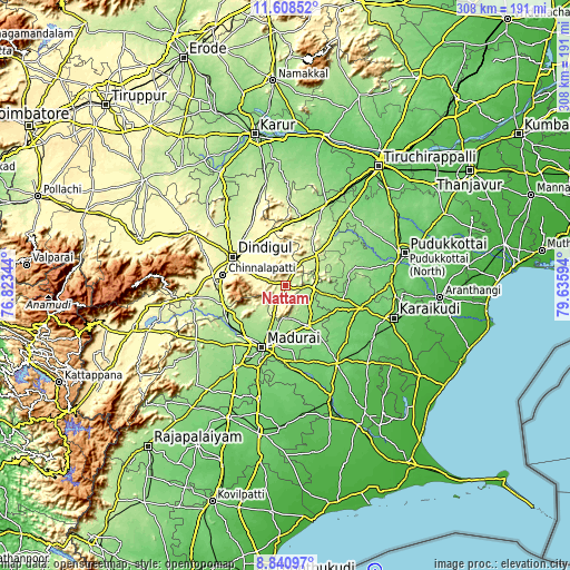
| \ | Map #1 | Map #2 | Topo.Map |
| Scale [m] | 214..595 m | 178..896 m | × |
| Scale [ft] | 702..1952 ft | 584..2940 ft | × |
| Average | 273 m = 896 ft | 345.3 m = 1133 ft | × |
| Width | 9.62 km = 6 mi | 19.23 km = 11.9 mi | 307.7 km = 191.2 mi |
| Height | 9.62 km = 6 mi | 19.23 km = 11.9 mi | 307.8 km = 191.3 mi |
| ↑Max Latitude | 10.271004° | 10.314242° | 11.60852° |
| Latitude at center | 10.22776° | 10.22776° | 10.22776° |
| ↓Min Latitude | 10.18451° | 10.141254° | 8.84097° |
| ← Min Longitude | 78.185745° | 78.141799° | 76.82344° |
| Longitude center | 78.22969° | 78.22969° | 78.22969° |
| →Max Longitude | 78.273635° | 78.317581° | 79.63594° |
Nearby cities:
Cities around Nattam sort by population:
• Madurai elevation 138 m
36.4 km,  199°
199°
• Dindigul 285 m
31.5 km,  299°
299°
• Tirupparangunram 154 m
42.1 km, 204°
• Melur 154 m
24.8 km,  151°
151°
• Tiruppuvanam 109 m
44.8 km,  176°
176°
• Vādippatti 193 m
33.4 km,  241°
241°
• Nilakottai 228 m
42.1 km,  260°
260°
• V.S.K.Valasai (Dindigul-Dist.) 372 m
13 km,  318°
318°
• Vadamadurai 293 m
27.7 km,  328°
328°
• Ponnamarāvati 151 m
34 km,  80°
80°
• Alangānallūr 183 m
25.2 km,  217°
217°
• Pālamedu 227 m
18.7 km, 223°
Multilingual:
 En español:
Nattam elevación 252 m.
 En France:
Nattam élévation 252 m.


Sources and notes:
- [note 1] Map square and city borders are not equal. Map elevation data is calculated only from area inside that square.
- [src 1] Elevation data from geonames database provided with same terms of usage.
- [src 2] The elevation map of Nattam is generated using elevation data from NASA's 3 arcsec (90m) resolution SRTM data.
- [src 3] Base (background) map © OpenStreetMap contributors tiles are generated by Geofabrik and OpenTopoMap.
Copyright & License:
This Nattam Elevation Map is licensed under CC BY-SA. You may reuse any part from this page, if you give a proper credit by linking to this URL:
 More info on terms of use page.