Navelim elevation
Navelim (Goa, North Goa), India elevation is 18 meters and Navelim elevation in feet is 59 ft above sea level [src 1]. Navelim is a populated place (feature code) with elevation that is 275 meters (902 ft) smaller than average city elevation in India.
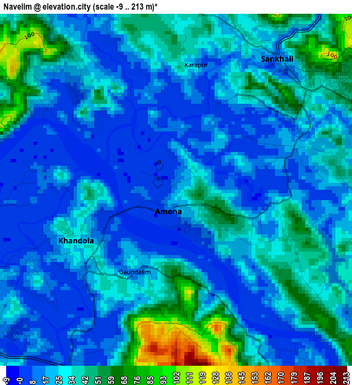
Below is the Elevation map of Navelim, which displays elevation range with different colors. Scale of the first map is from -9 to 213 m (-30 to 699 ft) with average elevation of 27.5 meters (=90 ft) [note 1]
These maps also provides idea of topography and contour of this city, they are displayed at different zoom levels. More info about maps, scale and edge coordinates you can find below images.
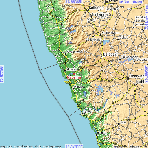
| \ | Map #1 | Map #2 | Topo.Map |
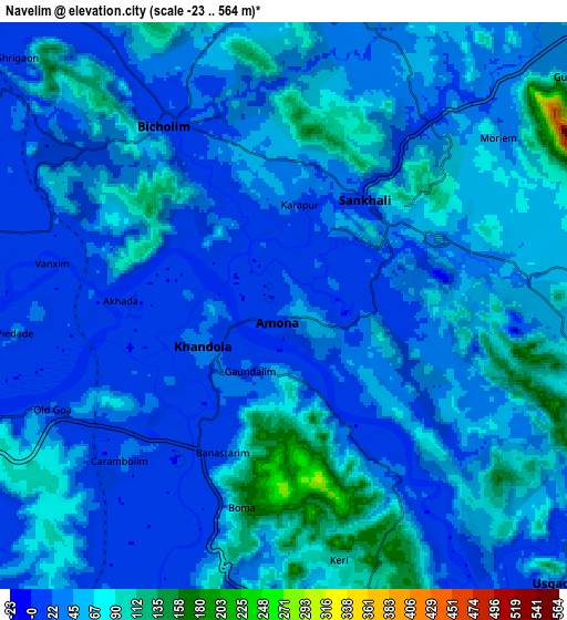
| Scale [m] | -9..213 m | -23..564 m | × |
| Scale [ft] | -30..699 ft | -75..1850 ft | × |
| Average | 27.5 m = 90 ft | 45.7 m = 150 ft | × |
| Width | 9.42 km = 5.9 mi | 18.83 km = 11.7 mi | 301.3 km = 187.2 mi |
| Height | 9.42 km = 5.9 mi | 18.83 km = 11.7 mi | 301.3 km = 187.2 mi |
| ↑Max Latitude | 15.575666° | 15.617993° | 16.88365° |
| Latitude at center | 15.53333° | 15.53333° | 15.53333° |
| ↓Min Latitude | 15.490985° | 15.448632° | 14.17411° |
| ← Min Longitude | 73.939385° | 73.895439° | 72.57708° |
| Longitude center | 73.98333° | 73.98333° | 73.98333° |
| →Max Longitude | 74.027275° | 74.071221° | 75.38958° |
Nearby cities:
Cities around Navelim sort by population:
• Ponda elevation 39 m
14.8 km,  166°
166°
• Dicholi 11 m
7.8 km,  328°
328°
• Curti 51 m
13.5 km,  164°
164°
• Bandora 32 m
13.9 km,  180°
180°
• Sanquelim 17 m
4.3 km,  37°
37°
• Serula 43 m
15.1 km,  276°
276°
• Aldona 17 m
13.4 km,  299°
299°
• Queula 37 m
15.9 km, 179°
• Goa Velha 10 m
14.4 km,  226°
226°
• Carapur 37 m
3.6 km,  6°
6°
• Jua 4 m
3.5 km,  265°
265°
• Palle 12 m
13 km,  124°
124°
Multilingual:
 En español:
Navelim elevación 18 m.
 En France:
Navelim élévation 18 m.


Sources and notes:
- [note 1] Map square and city borders are not equal. Map elevation data is calculated only from area inside that square.
- [src 1] Elevation data from geonames database provided with same terms of usage.
- [src 2] The elevation map of Navelim is generated using elevation data from NASA's 3 arcsec (90m) resolution SRTM data.
- [src 3] Base (background) map © OpenStreetMap contributors tiles are generated by Geofabrik and OpenTopoMap.
Copyright & License:
This Navelim Elevation Map is licensed under CC BY-SA. You may reuse any part from this page, if you give a proper credit by linking to this URL:
 More info on terms of use page.