Nūrmahal elevation
Nūrmahal (Punjab, Jalandhar), India elevation is 245 meters and Nūrmahal elevation in feet is 804 ft above sea level [src 1]. Nūrmahal is a populated place (feature code) with elevation that is 48 meters (157 ft) smaller than average city elevation in India.
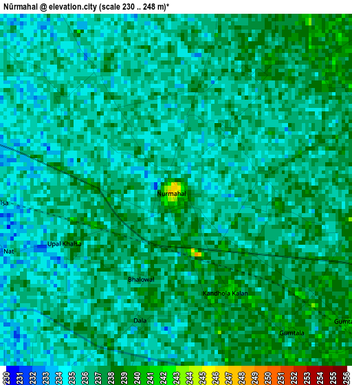
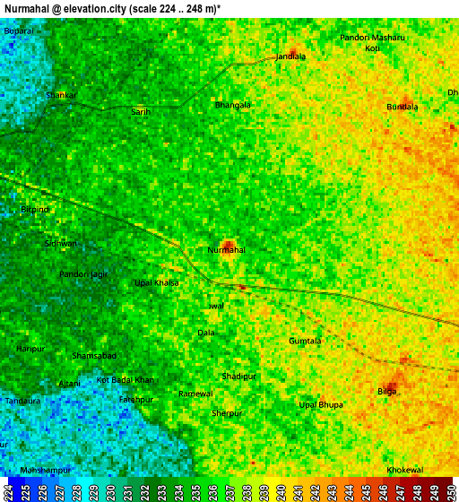
Below is the Elevation map of Nūrmahal, which displays elevation range with different colors. Scale of the first map is from 230 to 248 m (755 to 814 ft) with average elevation of 236 meters (=774 ft) [note 1]
These maps also provides idea of topography and contour of this city, they are displayed at different zoom levels. More info about maps, scale and edge coordinates you can find below images.
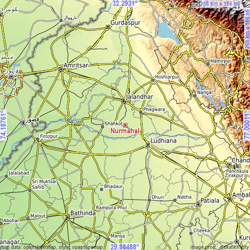
| \ | Map #1 | Map #2 | Topo.Map |
| Scale [m] | 230..248 m | 224..248 m | × |
| Scale [ft] | 755..814 ft | 735..814 ft | × |
| Average | 236 m = 774 ft | 235.7 m = 773 ft | × |
| Width | 8.37 km = 5.2 mi | 16.74 km = 10.4 mi | 267.8 km = 166.4 mi |
| Height | 8.37 km = 5.2 mi | 16.74 km = 10.4 mi | 267.8 km = 166.4 mi |
| ↑Max Latitude | 31.134243° | 31.171851° | 32.2931° |
| Latitude at center | 31.09662° | 31.09662° | 31.09662° |
| ↓Min Latitude | 31.058982° | 31.02133° | 29.88488° |
| ← Min Longitude | 75.549915° | 75.505969° | 74.18761° |
| Longitude center | 75.59386° | 75.59386° | 75.59386° |
| →Max Longitude | 75.637805° | 75.681751° | 77.00011° |
Nearby cities:
Cities around Nūrmahal sort by population:
• Ludhiāna elevation 256 m
32.2 km,  129°
129°
• Jalandhar 243 m
25.5 km,  356°
356°
• Phagwāra 248 m
22.3 km,  50°
50°
• Kapūrthala 229 m
37.5 km,  327°
327°
• Jagraon 238 m
36.2 km,  198°
198°
• Nakodar 235 m
11.8 km,  286°
286°
• Jandiāla 245 m
7.3 km,  17°
17°
• Phillaur 246 m
20.7 km,  114°
114°
• Banga 256 m
39.5 km,  74°
74°
• Adampur 248 m
39 km, 17°
• Shāhkot 227 m
24.5 km,  266°
266°
• Alāwalpur 248 m
37.7 km,  9°
9°
Multilingual:
 En español:
Nūrmahal elevación 245 m.
 En France:
Nūrmahal élévation 245 m.
 Auf Deutsch:
Nūrmahal höhe über dem Meeresspiegel ist 245 m.

Sources and notes:
- [note 1] Map square and city borders are not equal. Map elevation data is calculated only from area inside that square.
- [src 1] Elevation data from geonames database provided with same terms of usage.
- [src 2] The elevation map of Nūrmahal is generated using elevation data from NASA's 3 arcsec (90m) resolution SRTM data.
- [src 3] Base (background) map © OpenStreetMap contributors tiles are generated by Geofabrik and OpenTopoMap.
Copyright & License:
This Nūrmahal Elevation Map is licensed under CC BY-SA. You may reuse any part from this page, if you give a proper credit by linking to this URL:
 More info on terms of use page.