Rājur elevation
Rājur (Maharashtra, Yavatmal), India elevation is 221 meters and Rājur elevation in feet is 725 ft above sea level [src 1]. Rājur is a populated place (feature code) with elevation that is 72 meters (236 ft) smaller than average city elevation in India.
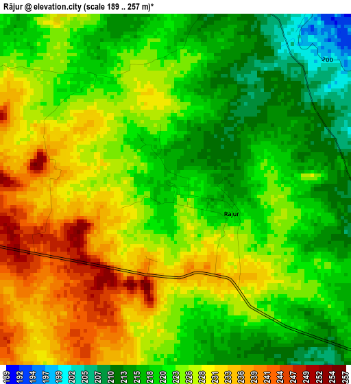
Below is the Elevation map of Rājur, which displays elevation range with different colors. Scale of the first map is from 189 to 257 m (620 to 843 ft) with average elevation of 223.8 meters (=734 ft) [note 1]
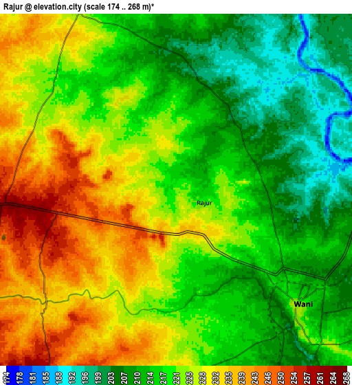
These maps also provides idea of topography and contour of this city, they are displayed at different zoom levels. More info about maps, scale and edge coordinates you can find below images.
| \ | Map #1 | Map #2 | Topo.Map |
| Scale [m] | 189..257 m | 174..268 m | × |
| Scale [ft] | 620..843 ft | 571..879 ft | × |
| Average | 223.8 m = 734 ft | 220.9 m = 725 ft | × |
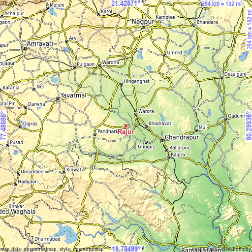
| Width | 9.18 km = 5.7 mi | 18.35 km = 11.4 mi | 293.6 km = 182.4 mi |
| Height | 9.18 km = 5.7 mi | 18.35 km = 11.4 mi | 293.7 km = 182.5 mi |
| ↑Max Latitude | 20.15213° | 20.19338° | 21.42571° |
| Latitude at center | 20.11087° | 20.11087° | 20.11087° |
| ↓Min Latitude | 20.069599° | 20.028316° | 18.78489° |
| ← Min Longitude | 78.849165° | 78.805219° | 77.48686° |
| Longitude center | 78.89311° | 78.89311° | 78.89311° |
| →Max Longitude | 78.937055° | 78.981001° | 80.29936° |
Nearby cities:
Cities around Rājur sort by population:
• Chānda elevation 186 m
45.6 km,  112°
112°
• Ādilābād 257 m
61.4 km,  217°
217°
• Hinganghāt 228 m
49 km,  353°
353°
• Ballālpur 188 m
55.7 km,  121°
121°
• Wani 224 m
8.8 km,  134°
134°
• Warora 208 m
17.4 km,  41°
41°
• Ghugus 199 m
29.9 km, 130°
• Rājūra 193 m
61.5 km, 126°
• Chāndur 248 m
51 km,  145°
145°
• Ghātanji 282 m
60.6 km,  273°
273°
• Durgāpur 205 m
44.4 km, 105°
• Sonegaon 254 m
61.3 km,  340°
340°
Multilingual:
 En español:
Rājur elevación 221 m.
 En France:
Rājur élévation 221 m.


Sources and notes:
- [note 1] Map square and city borders are not equal. Map elevation data is calculated only from area inside that square.
- [src 1] Elevation data from geonames database provided with same terms of usage.
- [src 2] The elevation map of Rājur is generated using elevation data from NASA's 3 arcsec (90m) resolution SRTM data.
- [src 3] Base (background) map © OpenStreetMap contributors tiles are generated by Geofabrik and OpenTopoMap.
Copyright & License:
This Rājur Elevation Map is licensed under CC BY-SA. You may reuse any part from this page, if you give a proper credit by linking to this URL:
 More info on terms of use page.