Rāmāpuram elevation
Rāmāpuram (Andhra Pradesh, Kurnool), India elevation is 462 meters and Rāmāpuram elevation in feet is 1516 ft above sea level [src 1]. Rāmāpuram is a populated place (feature code) with elevation that is 169 meters (554 ft) bigger than average city elevation in India.
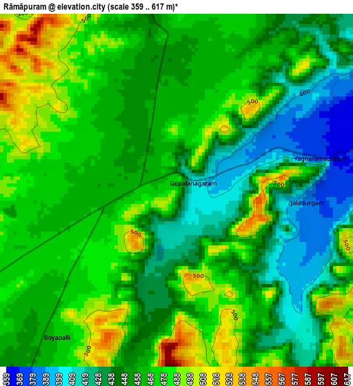
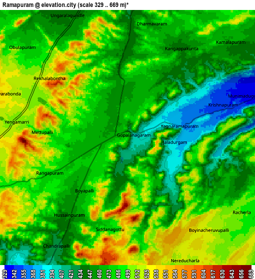
Below is the Elevation map of Rāmāpuram, which displays elevation range with different colors. Scale of the first map is from 359 to 617 m (1178 to 2024 ft) with average elevation of 460.7 meters (=1511 ft) [note 1]
These maps also provides idea of topography and contour of this city, they are displayed at different zoom levels. More info about maps, scale and edge coordinates you can find below images.
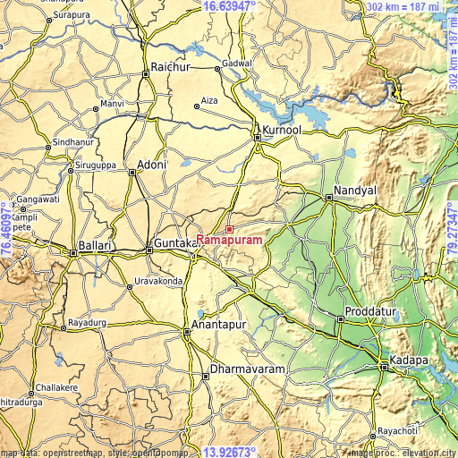
| \ | Map #1 | Map #2 | Topo.Map |
| Scale [m] | 359..617 m | 329..669 m | × |
| Scale [ft] | 1178..2024 ft | 1079..2195 ft | × |
| Average | 460.7 m = 1511 ft | 478.1 m = 1569 ft | × |
| Width | 9.43 km = 5.9 mi | 18.85 km = 11.7 mi | 301.6 km = 187.4 mi |
| Height | 9.43 km = 5.9 mi | 18.85 km = 11.7 mi | 301.7 km = 187.5 mi |
| ↑Max Latitude | 15.329876° | 15.372253° | 16.63947° |
| Latitude at center | 15.28749° | 15.28749° | 15.28749° |
| ↓Min Latitude | 15.245095° | 15.202692° | 13.92673° |
| ← Min Longitude | 77.823275° | 77.779329° | 76.46097° |
| Longitude center | 77.86722° | 77.86722° | 77.86722° |
| →Max Longitude | 77.911165° | 77.955111° | 79.27347° |
Nearby cities:
Cities around Rāmāpuram sort by population:
• Kurnool elevation 286 m
62.9 km,  16°
16°
• Anantapur 350 m
73.3 km,  202°
202°
• Nandyāl 213 m
69.4 km,  72°
72°
• Ādoni 432 m
73.9 km,  300°
300°
• Guntakal Junction 457 m
55.7 km,  256°
256°
• Tādpatri 240 m
44.9 km,  159°
159°
• Emmiganūr 378 m
67.8 km,  322°
322°
• Jammalamadugu 188 m
74 km,  131°
131°
• Dhone 425 m
12 km,  2°
2°
• Betamcherla 424 m
35.2 km,  58°
58°
• Banganapalle 231 m
38.7 km,  85°
85°
• Ālampur 274 m
71.8 km, 23°
Multilingual:
 En español:
Rāmāpuram elevación 462 m.
 En France:
Rāmāpuram élévation 462 m.
 Auf Deutsch:
Rāmāpuram höhe über dem Meeresspiegel ist 462 m.

Sources and notes:
- [note 1] Map square and city borders are not equal. Map elevation data is calculated only from area inside that square.
- [src 1] Elevation data from geonames database provided with same terms of usage.
- [src 2] The elevation map of Rāmāpuram is generated using elevation data from NASA's 3 arcsec (90m) resolution SRTM data.
- [src 3] Base (background) map © OpenStreetMap contributors tiles are generated by Geofabrik and OpenTopoMap.
Copyright & License:
This Rāmāpuram Elevation Map is licensed under CC BY-SA. You may reuse any part from this page, if you give a proper credit by linking to this URL:
 More info on terms of use page.