Rāmkola elevation
Rāmkola (Uttar Pradesh, Kushinagar), India elevation is 90 meters and Rāmkola elevation in feet is 295 ft above sea level [src 1]. Rāmkola is a populated place (feature code) with elevation that is 203 meters (666 ft) smaller than average city elevation in India.
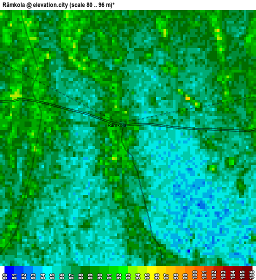
Below is the Elevation map of Rāmkola, which displays elevation range with different colors. Scale of the first map is from 80 to 96 m (262 to 315 ft) with average elevation of 86.9 meters (=285 ft) [note 1]
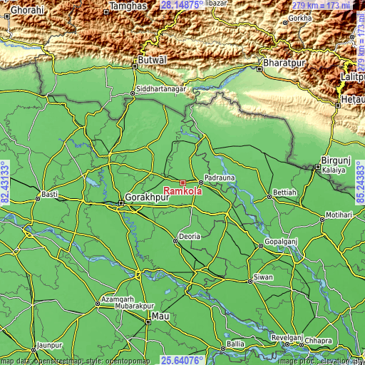
These maps also provides idea of topography and contour of this city, they are displayed at different zoom levels. More info about maps, scale and edge coordinates you can find below images.
| \ | Map #1 | Map #2 | Topo.Map |
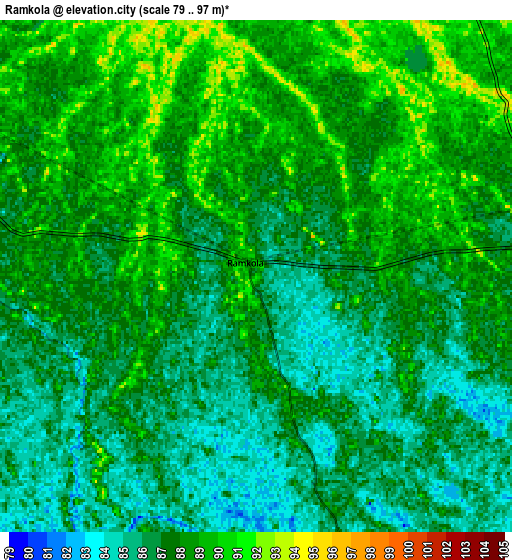
| Scale [m] | 80..96 m | 79..97 m | × |
| Scale [ft] | 262..315 ft | 259..318 ft | × |
| Average | 86.9 m = 285 ft | 87.2 m = 286 ft | × |
| Width | 8.71 km = 5.4 mi | 17.43 km = 10.8 mi | 278.9 km = 173.3 mi |
| Height | 8.72 km = 5.4 mi | 17.43 km = 10.8 mi | 278.9 km = 173.3 mi |
| ↑Max Latitude | 26.940903° | 26.980072° | 28.14875° |
| Latitude at center | 26.90172° | 26.90172° | 26.90172° |
| ↓Min Latitude | 26.862523° | 26.823313° | 25.64076° |
| ← Min Longitude | 83.793635° | 83.749689° | 82.43133° |
| Longitude center | 83.83758° | 83.83758° | 83.83758° |
| →Max Longitude | 83.881525° | 83.925471° | 85.24383° |
Nearby cities:
Cities around Rāmkola sort by population:
• Gorakhpur elevation 83 m
48.9 km,  252°
252°
• Deoria 82 m
44.9 km,  187°
187°
• Bagaha 94 m
33.3 km,  48°
48°
• Padrauna 94 m
14.2 km,  88°
88°
• Rūdarpur 79 m
55.5 km,  203°
203°
• Mahārāganj 96 m
38.4 km,  314°
314°
• Siswā Bāzār 100 m
28.3 km,  343°
343°
• Nichlaul 104 m
47 km,  346°
346°
• Khada 96 m
31.6 km,  8°
8°
• Pipraich 91 m
32 km,  255°
255°
• Captainganj 94 m
12.6 km,  282°
282°
• Hātā 83 m
20.1 km,  207°
207°
Multilingual:
 En español:
Rāmkola elevación 90 m.
 En France:
Rāmkola élévation 90 m.


Sources and notes:
- [note 1] Map square and city borders are not equal. Map elevation data is calculated only from area inside that square.
- [src 1] Elevation data from geonames database provided with same terms of usage.
- [src 2] The elevation map of Rāmkola is generated using elevation data from NASA's 3 arcsec (90m) resolution SRTM data.
- [src 3] Base (background) map © OpenStreetMap contributors tiles are generated by Geofabrik and OpenTopoMap.
Copyright & License:
This Rāmkola Elevation Map is licensed under CC BY-SA. You may reuse any part from this page, if you give a proper credit by linking to this URL:
 More info on terms of use page.