Sanguem elevation
Sanguem (Goa, South Goa), India elevation is 26 meters and Sanguem elevation in feet is 85 ft above sea level [src 1]. Sanguem is a populated place (feature code) with elevation that is 267 meters (876 ft) smaller than average city elevation in India.
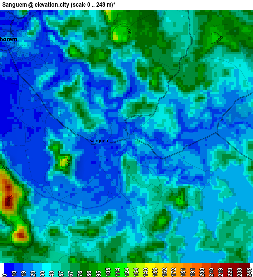
Below is the Elevation map of Sanguem, which displays elevation range with different colors. Scale of the first map is from 0 to 248 m (0 to 814 ft) with average elevation of 46.6 meters (=153 ft) [note 1]
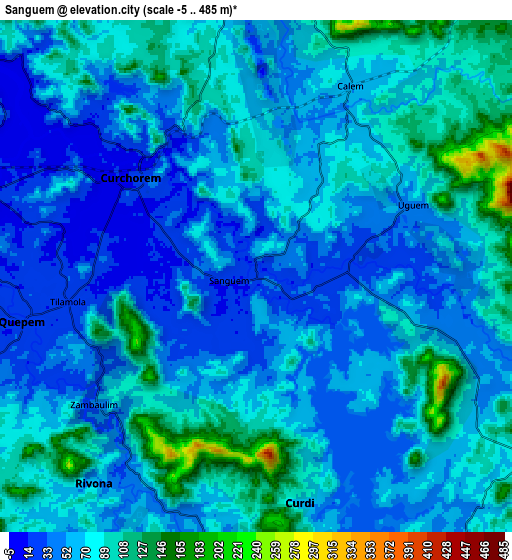
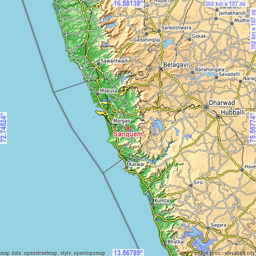
These maps also provides idea of topography and contour of this city, they are displayed at different zoom levels. More info about maps, scale and edge coordinates you can find below images.
| \ | Map #1 | Map #2 | Topo.Map |
| Scale [m] | 0..248 m | -5..485 m | × |
| Scale [ft] | 0..814 ft | -16..1591 ft | × |
| Average | 46.6 m = 153 ft | 68.3 m = 224 ft | × |
| Width | 9.43 km = 5.9 mi | 18.86 km = 11.7 mi | 301.7 km = 187.5 mi |
| Height | 9.43 km = 5.9 mi | 18.86 km = 11.7 mi | 301.7 km = 187.5 mi |
| ↑Max Latitude | 15.271408° | 15.313797° | 16.58139° |
| Latitude at center | 15.22901° | 15.22901° | 15.22901° |
| ↓Min Latitude | 15.186604° | 15.144189° | 13.86789° |
| ← Min Longitude | 74.107545° | 74.063599° | 72.74524° |
| Longitude center | 74.15149° | 74.15149° | 74.15149° |
| →Max Longitude | 74.195435° | 74.239381° | 75.55774° |
Nearby cities:
Cities around Sanguem sort by population:
• Madgaon elevation 22 m
21.4 km,  283°
283°
• Curchorem 14 m
6 km,  309°
309°
• Ponda 39 m
24.3 km,  322°
322°
• Cuncolim 13 m
17.9 km,  251°
251°
• Quepem 20 m
8.2 km,  257°
257°
• Cavelossim 7 m
23.3 km, 254°
• Davorlim 25 m
17.7 km,  285°
285°
• Benaulim 19 m
24.3 km, 279°
• Raia 18 m
21.1 km, 293°
• Chinchinim 14 m
18.9 km,  265°
265°
• Varca 15 m
22.4 km, 270°
• Sanvordem 20 m
5.1 km, 317°
Multilingual:
 En español:
Sanguem elevación 26 m.
 En France:
Sanguem élévation 26 m.


Sources and notes:
- [note 1] Map square and city borders are not equal. Map elevation data is calculated only from area inside that square.
- [src 1] Elevation data from geonames database provided with same terms of usage.
- [src 2] The elevation map of Sanguem is generated using elevation data from NASA's 3 arcsec (90m) resolution SRTM data.
- [src 3] Base (background) map © OpenStreetMap contributors tiles are generated by Geofabrik and OpenTopoMap.
Copyright & License:
This Sanguem Elevation Map is licensed under CC BY-SA. You may reuse any part from this page, if you give a proper credit by linking to this URL:
 More info on terms of use page.