Srīsailain elevation
Srīsailain (Andhra Pradesh, Kurnool), India elevation is 440 meters and Srīsailain elevation in feet is 1444 ft above sea level [src 1]. Srīsailain is a populated place (feature code) with elevation that is 147 meters (482 ft) bigger than average city elevation in India.
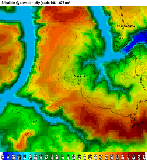
Below is the Elevation map of Srīsailain, which displays elevation range with different colors. Scale of the first map is from 166 to 673 m (545 to 2208 ft) with average elevation of 434.9 meters (=1427 ft) [note 1]
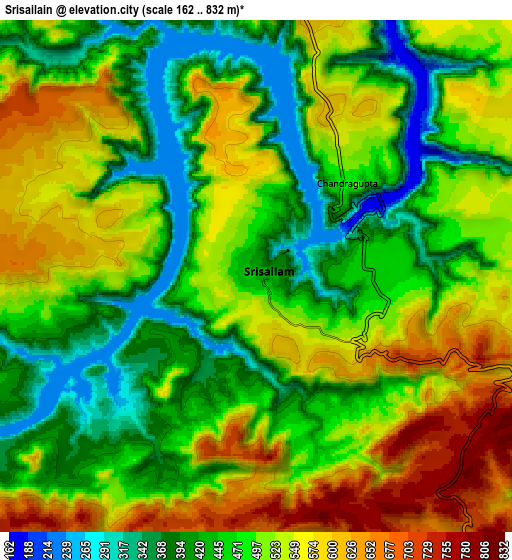
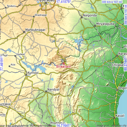
These maps also provides idea of topography and contour of this city, they are displayed at different zoom levels. More info about maps, scale and edge coordinates you can find below images.
| \ | Map #1 | Map #2 | Topo.Map |
| Scale [m] | 166..673 m | 162..832 m | × |
| Scale [ft] | 545..2208 ft | 531..2730 ft | × |
| Average | 434.9 m = 1427 ft | 493.9 m = 1620 ft | × |
| Width | 9.39 km = 5.8 mi | 18.78 km = 11.7 mi | 300.5 km = 186.7 mi |
| Height | 9.39 km = 5.8 mi | 18.78 km = 11.7 mi | 300.5 km = 186.7 mi |
| ↑Max Latitude | 16.114393° | 16.156607° | 17.41875° |
| Latitude at center | 16.07217° | 16.07217° | 16.07217° |
| ↓Min Latitude | 16.029938° | 15.987697° | 14.71641° |
| ← Min Longitude | 78.824215° | 78.780269° | 77.46191° |
| Longitude center | 78.86816° | 78.86816° | 78.86816° |
| →Max Longitude | 78.912105° | 78.956051° | 80.27441° |
Nearby cities:
Cities around Srīsailain sort by population:
• Nandyāl elevation 213 m
77.8 km,  211°
211°
• Mārkāpur 158 m
56.9 km,  131°
131°
• Mācherla 142 m
75.4 km,  53°
53°
• Nandikotkūr 303 m
68.7 km,  249°
249°
• Atmakūr 295 m
36.8 km,  234°
234°
• Chemmumiahpet 132 m
52.2 km,  111°
111°
• Devarkonda 282 m
69.1 km,  4°
4°
• Nāgar Karnūl 454 m
73.8 km,  308°
308°
• Giddalūr 265 m
77.8 km,  175°
175°
• Cumbum 193 m
60.4 km,  154°
154°
• Ālampur 274 m
81.4 km, 254°
• Diguvametta 309 m
75.4 km, 183°
Multilingual:
 En español:
Srīsailain elevación 440 m.
 En France:
Srīsailain élévation 440 m.
 Auf Deutsch:
Srīsailain höhe über dem Meeresspiegel ist 440 m.

Sources and notes:
- [note 1] Map square and city borders are not equal. Map elevation data is calculated only from area inside that square.
- [src 1] Elevation data from geonames database provided with same terms of usage.
- [src 2] The elevation map of Srīsailain is generated using elevation data from NASA's 3 arcsec (90m) resolution SRTM data.
- [src 3] Base (background) map © OpenStreetMap contributors tiles are generated by Geofabrik and OpenTopoMap.
Copyright & License:
This Srīsailain Elevation Map is licensed under CC BY-SA. You may reuse any part from this page, if you give a proper credit by linking to this URL:
 More info on terms of use page.