Tiruchengode elevation
Tiruchengode (Tamil Nadu, Namakkal), India elevation is 246 meters and Tiruchengode elevation in feet is 807 ft above sea level [src 1]. Tiruchengode is a populated place (feature code) with elevation that is 47 meters (154 ft) smaller than average city elevation in India.
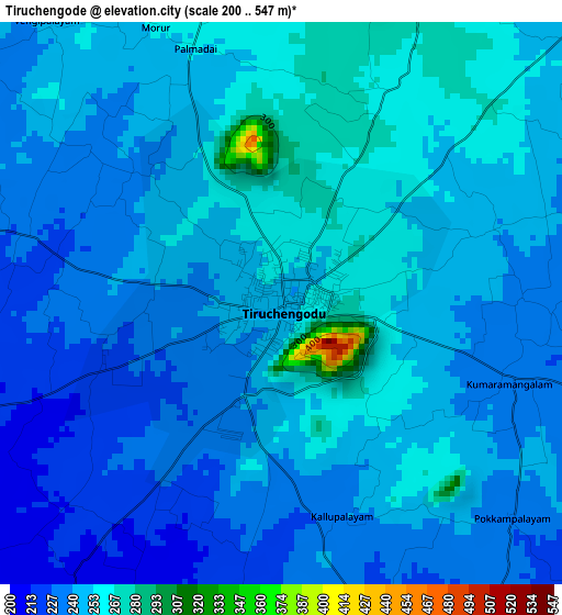
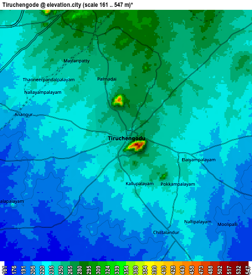
Below is the Elevation map of Tiruchengode, which displays elevation range with different colors. Scale of the first map is from 200 to 547 m (656 to 1795 ft) with average elevation of 244.6 meters (=802 ft) [note 1]
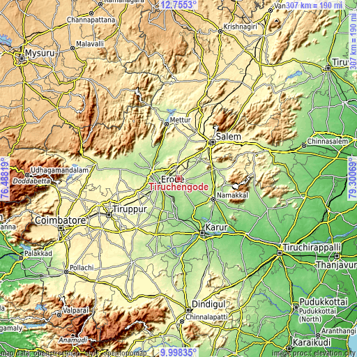
These maps also provides idea of topography and contour of this city, they are displayed at different zoom levels. More info about maps, scale and edge coordinates you can find below images.
| \ | Map #1 | Map #2 | Topo.Map |
| Scale [m] | 200..547 m | 161..547 m | × |
| Scale [ft] | 656..1795 ft | 528..1795 ft | × |
| Average | 244.6 m = 802 ft | 230.7 m = 757 ft | × |
| Width | 9.58 km = 6 mi | 19.16 km = 11.9 mi | 306.5 km = 190.4 mi |
| Height | 9.58 km = 6 mi | 19.16 km = 11.9 mi | 306.6 km = 190.5 mi |
| ↑Max Latitude | 11.423238° | 11.46631° | 12.7553° |
| Latitude at center | 11.38016° | 11.38016° | 11.38016° |
| ↓Min Latitude | 11.337075° | 11.293984° | 9.99835° |
| ← Min Longitude | 77.850495° | 77.806549° | 76.48819° |
| Longitude center | 77.89444° | 77.89444° | 77.89444° |
| →Max Longitude | 77.938385° | 77.982331° | 79.30069° |
Nearby cities:
Cities around Tiruchengode sort by population:
• Erode elevation 170 m
18.7 km,  257°
257°
• Idappadi 209 m
23.7 km,  345°
345°
• Rasipuram 234 m
33 km,  74°
74°
• Bhavāni 172 m
24.3 km,  287°
287°
• Velur 136 m
32.4 km,  158°
158°
• Mallasamudram 220 m
19.5 km,  49°
49°
• Sivagiri 196 m
31.1 km,  201°
201°
• Āttayyāmpatti 235 m
24.3 km, 45°
• Ilampillai 275 m
28 km,  25°
25°
• Māllūr 279 m
32.5 km,  55°
55°
• Ammāpettai 186 m
31.4 km,  328°
328°
• Konganāpuram 232 m
21.2 km,  1°
1°
Multilingual:
 En español:
Tiruchengode elevación 246 m.
 En France:
Tiruchengode élévation 246 m.
 Auf Deutsch:
Tiruchengode höhe über dem Meeresspiegel ist 246 m.

Sources and notes:
- [note 1] Map square and city borders are not equal. Map elevation data is calculated only from area inside that square.
- [src 1] Elevation data from geonames database provided with same terms of usage.
- [src 2] The elevation map of Tiruchengode is generated using elevation data from NASA's 3 arcsec (90m) resolution SRTM data.
- [src 3] Base (background) map © OpenStreetMap contributors tiles are generated by Geofabrik and OpenTopoMap.
Copyright & License:
This Tiruchengode Elevation Map is licensed under CC BY-SA. You may reuse any part from this page, if you give a proper credit by linking to this URL:
 More info on terms of use page.