Tufānganj elevation
Tufānganj (West Bengal, Koch Bihār), India elevation is 41 meters and Tufānganj elevation in feet is 135 ft above sea level [src 1]. Tufānganj is a populated place (feature code) with elevation that is 252 meters (827 ft) smaller than average city elevation in India.
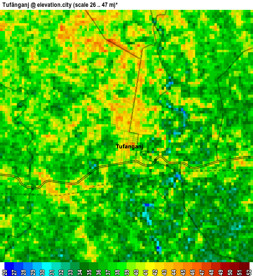
Below is the Elevation map of Tufānganj, which displays elevation range with different colors. Scale of the first map is from 26 to 47 m (85 to 154 ft) with average elevation of 37.6 meters (=123 ft) [note 1]
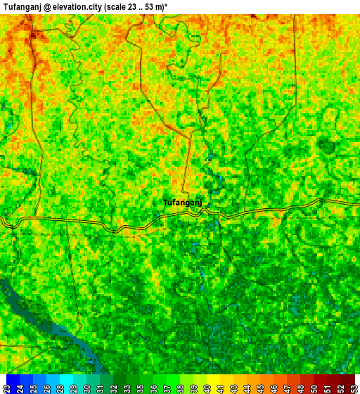
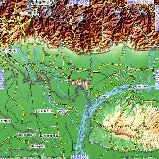
These maps also provides idea of topography and contour of this city, they are displayed at different zoom levels. More info about maps, scale and edge coordinates you can find below images.
| \ | Map #1 | Map #2 | Topo.Map |
| Scale [m] | 26..47 m | 23..53 m | × |
| Scale [ft] | 85..154 ft | 75..174 ft | × |
| Average | 37.6 m = 123 ft | 37.8 m = 124 ft | × |
| Width | 8.76 km = 5.4 mi | 17.52 km = 10.9 mi | 280.3 km = 174.2 mi |
| Height | 8.76 km = 5.4 mi | 17.52 km = 10.9 mi | 280.3 km = 174.2 mi |
| ↑Max Latitude | 26.356264° | 26.395634° | 27.57045° |
| Latitude at center | 26.31688° | 26.31688° | 26.31688° |
| ↓Min Latitude | 26.277483° | 26.238072° | 25.0496° |
| ← Min Longitude | 89.621545° | 89.577599° | 88.25924° |
| Longitude center | 89.66549° | 89.66549° | 89.66549° |
| →Max Longitude | 89.709435° | 89.753381° | 91.07174° |
Nearby cities:
Cities around Tufānganj sort by population:
• Koch Bihār elevation 47 m
22 km,  272°
272°
• Alīpur Duār 49 m
23.3 km,  322°
322°
• Dhuburi 34 m
46.1 km,  136°
136°
• Dīnhāta 42 m
28.7 km,  225°
225°
• Hāsimāra 139 m
57 km,  327°
327°
• Bilāsipāra 38 m
57.5 km,  99°
99°
• Gauripur 33 m
39.3 km,  131°
131°
• Mātābhānga 56 m
44.9 km, 273°
• Fālākāta 66 m
51.2 km,  296°
296°
• Goshaingaon 51 m
32.6 km,  65°
65°
• Sapatgrām 43 m
45.7 km,  87°
87°
• Golakganj 31 m
28.6 km,  146°
146°
Multilingual:
 En español:
Tufānganj elevación 41 m.
 En France:
Tufānganj élévation 41 m.
 Auf Deutsch:
Tufānganj höhe über dem Meeresspiegel ist 41 m.

Sources and notes:
- [note 1] Map square and city borders are not equal. Map elevation data is calculated only from area inside that square.
- [src 1] Elevation data from geonames database provided with same terms of usage.
- [src 2] The elevation map of Tufānganj is generated using elevation data from NASA's 3 arcsec (90m) resolution SRTM data.
- [src 3] Base (background) map © OpenStreetMap contributors tiles are generated by Geofabrik and OpenTopoMap.
Copyright & License:
This Tufānganj Elevation Map is licensed under CC BY-SA. You may reuse any part from this page, if you give a proper credit by linking to this URL:
 More info on terms of use page.