Bet She’an elevation
Bet She’an (Northern District), Israel elevation is -121 meters and Bet She’an elevation in feet is -397 ft above sea level [src 1]. Bet She’an is a populated place (feature code) with elevation that is 332 meters (1089 ft) smaller than average city elevation in Israel.
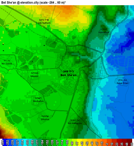
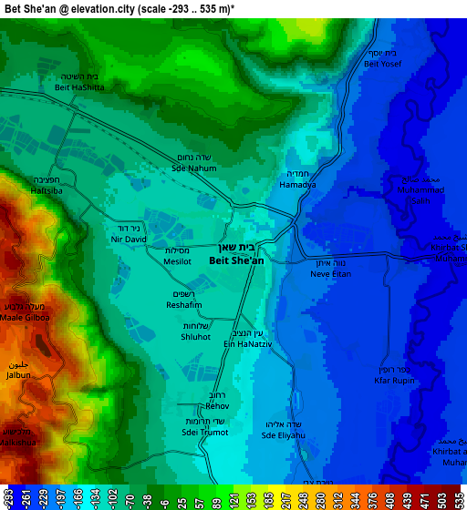
Below is the Elevation map of Bet She’an, which displays elevation range with different colors. Scale of the first map is from -264 to 60 m (-866 to 197 ft) with average elevation of -144 meters (=-472 ft) [note 1]
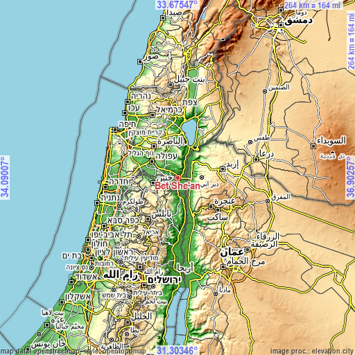
These maps also provides idea of topography and contour of this city, they are displayed at different zoom levels. More info about maps, scale and edge coordinates you can find below images.
| \ | Map #1 | Map #2 | Topo.Map |
| Scale [m] | -264..60 m | -293..535 m | × |
| Scale [ft] | -866..197 ft | -961..1755 ft | × |
| Average | -144 m = -472 ft | -90.7 m = -298 ft | × |
| Width | 8.24 km = 5.1 mi | 16.48 km = 10.2 mi | 263.7 km = 163.9 mi |
| Height | 8.24 km = 5.1 mi | 16.48 km = 10.2 mi | 263.7 km = 163.9 mi |
| ↑Max Latitude | 32.534337° | 32.571378° | 33.67547° |
| Latitude at center | 32.49728° | 32.49728° | 32.49728° |
| ↓Min Latitude | 32.460208° | 32.423121° | 31.30346° |
| ← Min Longitude | 35.452375° | 35.408429° | 34.09007° |
| Longitude center | 35.49632° | 35.49632° | 35.49632° |
| →Max Longitude | 35.540265° | 35.584211° | 36.90257° |
Nearby cities:
Cities around Bet She’an sort by population:
• Nazareth elevation 504 m
29.3 km,  320°
320°
• Afula 62 m
23.1 km,  302°
302°
• Er Reina 343 m
30.3 km,  326°
326°
• Iksāl 160 m
26.1 km, 321°
• Dabbūrīya 180 m
24.7 km, 331°
• Shibli 234 m
24 km,  336°
336°
• Kafr Kammā 228 m
25.4 km,  348°
348°
• Yavne’el -18 m
23.2 km,  1°
1°
• Sūlam 120 m
19.4 km,  308°
308°
• Kafr Miṣr 122 m
17.9 km, 336°
• Kefar Tavor 118 m
22.2 km, 341°
• Nein 234 m
20.3 km, 317°
Multilingual:
 En español:
Beit She'an elevación -121 m.
 En France:
Beït Shéan, Beït-Shéan élévation -121 m.
 Auf Deutsch:
Bet Sche’an höhe über dem Meeresspiegel ist -121 m.

Sources and notes:
- [note 1] Map square and city borders are not equal. Map elevation data is calculated only from area inside that square.
- [src 1] Elevation data from geonames database provided with same terms of usage.
- [src 2] The elevation map of Bet She’an is generated using elevation data from NASA's 3 arcsec (90m) resolution SRTM data.
- [src 3] Base (background) map © OpenStreetMap contributors tiles are generated by Geofabrik and OpenTopoMap.
Copyright & License:
This Bet She’an Elevation Map is licensed under CC BY-SA. You may reuse any part from this page, if you give a proper credit by linking to this URL:
 More info on terms of use page.