El Fureidīs elevation
El Fureidīs (Haifa), Israel elevation is 33 meters and El Fureidīs elevation in feet is 108 ft above sea level [src 1]. El Fureidīs is a populated place (feature code) with elevation that is 178 meters (584 ft) smaller than average city elevation in Israel.
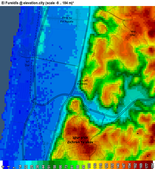
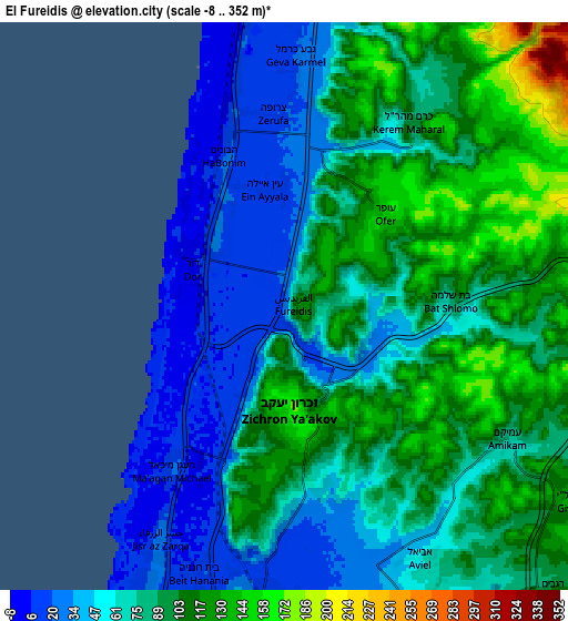
Below is the Elevation map of El Fureidīs, which displays elevation range with different colors. Scale of the first map is from -8 to 184 m (-26 to 604 ft) with average elevation of 59.3 meters (=195 ft) [note 1]
These maps also provides idea of topography and contour of this city, they are displayed at different zoom levels. More info about maps, scale and edge coordinates you can find below images.
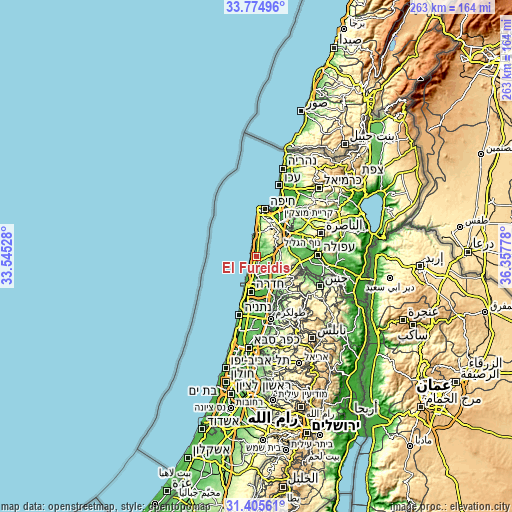
| \ | Map #1 | Map #2 | Topo.Map |
| Scale [m] | -8..184 m | -8..352 m | × |
| Scale [ft] | -26..604 ft | -26..1155 ft | × |
| Average | 59.3 m = 195 ft | 79.2 m = 260 ft | × |
| Width | 8.23 km = 5.1 mi | 16.47 km = 10.2 mi | 263.4 km = 163.7 mi |
| Height | 8.23 km = 5.1 mi | 16.47 km = 10.2 mi | 263.5 km = 163.7 mi |
| ↑Max Latitude | 32.635135° | 32.672135° | 33.77496° |
| Latitude at center | 32.59812° | 32.59812° | 32.59812° |
| ↓Min Latitude | 32.56109° | 32.524044° | 31.40561° |
| ← Min Longitude | 34.907585° | 34.863639° | 33.54528° |
| Longitude center | 34.95153° | 34.95153° | 34.95153° |
| →Max Longitude | 34.995475° | 35.039421° | 36.35778° |
Nearby cities:
Cities around El Fureidīs sort by population:
• Haifa elevation 40 m
24.7 km,  8°
8°
• Hadera 13 m
17.9 km,  194°
194°
• Umm el Faḥm 398 m
21 km,  115°
115°
• Daliyat al Karmel 414 m
13.9 km,  39°
39°
• Nesher 125 m
20.6 km,  24°
24°
• Tirat Karmel 47 m
18.1 km, 6°
• Rekhasim 43 m
21.7 km, 39°
• Ramat Yishay 98 m
23.7 km,  60°
60°
• Atlit 22 m
10.1 km,  355°
355°
• Caesarea 16 m
9.8 km,  206°
206°
• Elyakhin 36 m
21.3 km, 186°
• Ibṭīn 93 m
23.7 km, 39°
Multilingual:
 En español:
El Fureidīs elevación 33 m.
 En France:
El Fureidīs élévation 33 m.
 Auf Deutsch:
El Fureidīs höhe über dem Meeresspiegel ist 33 m.

Sources and notes:
- [note 1] Map square and city borders are not equal. Map elevation data is calculated only from area inside that square.
- [src 1] Elevation data from geonames database provided with same terms of usage.
- [src 2] The elevation map of El Fureidīs is generated using elevation data from NASA's 3 arcsec (90m) resolution SRTM data.
- [src 3] Base (background) map © OpenStreetMap contributors tiles are generated by Geofabrik and OpenTopoMap.
Copyright & License:
This El Fureidīs Elevation Map is licensed under CC BY-SA. You may reuse any part from this page, if you give a proper credit by linking to this URL:
 More info on terms of use page.