Shoham elevation
Shoham (Central District), Israel elevation is 82 meters and Shoham elevation in feet is 269 ft above sea level [src 1]. Shoham is a populated place (feature code) with elevation that is 129 meters (423 ft) smaller than average city elevation in Israel.
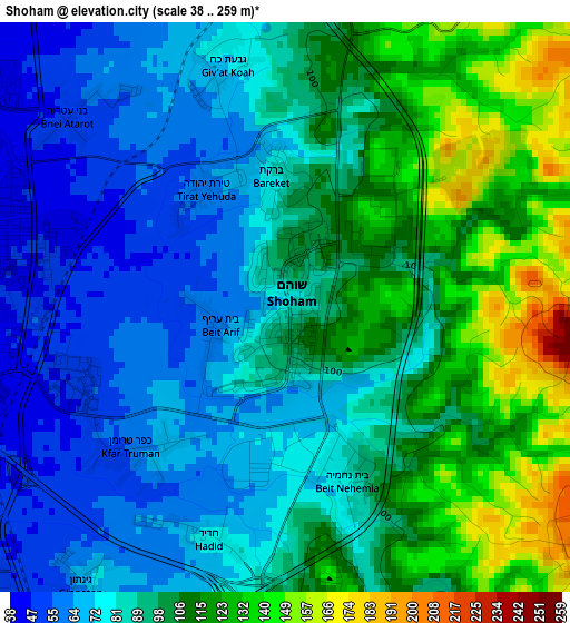
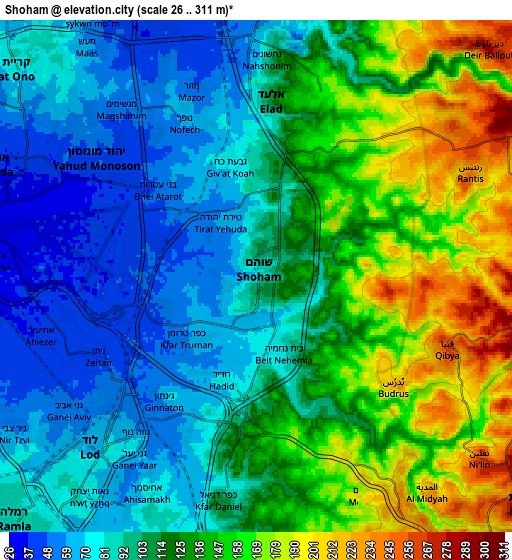
Below is the Elevation map of Shoham, which displays elevation range with different colors. Scale of the first map is from 38 to 259 m (125 to 850 ft) with average elevation of 93 meters (=305 ft) [note 1]
These maps also provides idea of topography and contour of this city, they are displayed at different zoom levels. More info about maps, scale and edge coordinates you can find below images.
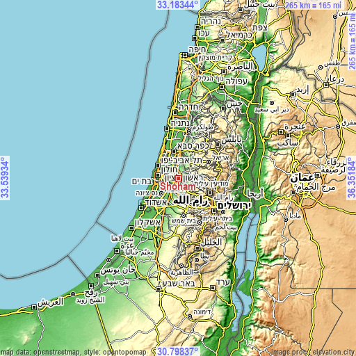
| \ | Map #1 | Map #2 | Topo.Map |
| Scale [m] | 38..259 m | 26..311 m | × |
| Scale [ft] | 125..850 ft | 85..1020 ft | × |
| Average | 93 m = 305 ft | 115.6 m = 379 ft | × |
| Width | 8.29 km = 5.2 mi | 16.58 km = 10.3 mi | 265.2 km = 164.8 mi |
| Height | 8.29 km = 5.2 mi | 16.58 km = 10.3 mi | 265.2 km = 164.8 mi |
| ↑Max Latitude | 32.035921° | 32.073166° | 33.18344° |
| Latitude at center | 31.99866° | 31.99866° | 31.99866° |
| ↓Min Latitude | 31.961384° | 31.924093° | 30.79837° |
| ← Min Longitude | 34.901645° | 34.857699° | 33.53934° |
| Longitude center | 34.94559° | 34.94559° | 34.94559° |
| →Max Longitude | 34.989535° | 35.033481° | 36.35184° |
Nearby cities:
Cities around Shoham sort by population:
• Lod elevation 68 m
7.8 km,  222°
222°
• Ramla 83 m
10.8 km, 224°
• Rosh Ha‘Ayin 62 m
10.8 km,  5°
5°
• Or Yehuda 33 m
8.9 km,  292°
292°
• Yehud-Monosson 36 m
7 km,  297°
297°
• Yehud 44 m
6.4 km,  306°
306°
• Ganei Tikva 79 m
9.6 km, 314°
• Bet Dagan 36 m
10.9 km,  271°
271°
• Kefar H̱abad 43 m
8.9 km,  262°
262°
• Savyon 75 m
8.6 km, 311°
• Hashmonaim 258 m
10.5 km,  136°
136°
• Neẖalim 47 m
7.6 km,  334°
334°
Multilingual:
 En español:
Shoham elevación 82 m.
 En France:
Shoham élévation 82 m.


Sources and notes:
- [note 1] Map square and city borders are not equal. Map elevation data is calculated only from area inside that square.
- [src 1] Elevation data from geonames database provided with same terms of usage.
- [src 2] The elevation map of Shoham is generated using elevation data from NASA's 3 arcsec (90m) resolution SRTM data.
- [src 3] Base (background) map © OpenStreetMap contributors tiles are generated by Geofabrik and OpenTopoMap.
Copyright & License:
This Shoham Elevation Map is licensed under CC BY-SA. You may reuse any part from this page, if you give a proper credit by linking to this URL:
 More info on terms of use page.