Ariel elevation
Ariel (Judea and Samaria Area), Israel elevation is 567 meters and Ariel elevation in feet is 1860 ft above sea level [src 1]. Ariel is a seat of a first-order administrative division (feature code) with elevation that is 356 meters (1168 ft) bigger than average city elevation in Israel.
Below is the Elevation map of Ariel, which displays elevation range with different colors. Scale of the first map is from 348 to 796 m (1142 to 2612 ft) with average elevation of 505.6 meters (=1659 ft) [note 1]
These maps also provides idea of topography and contour of this city, they are displayed at different zoom levels. More info about maps, scale and edge coordinates you can find below images.
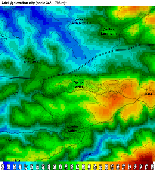
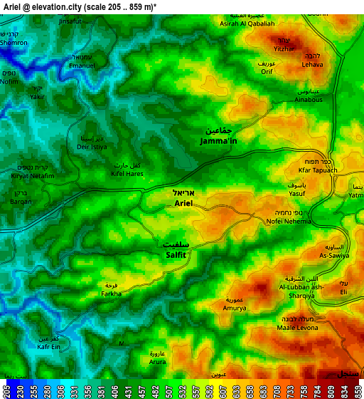
| \ | Map #1 | Map #2 | Topo.Map |
| Scale [m] | 348..796 m | 205..859 m | × |
| Scale [ft] | 1142..2612 ft | 673..2818 ft | × |
| Average | 505.6 m = 1659 ft | 496.3 m = 1628 ft | × |
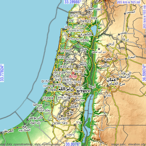
| Width | 8.28 km = 5.1 mi | 16.56 km = 10.3 mi | 264.9 km = 164.6 mi |
| Height | 8.28 km = 5.1 mi | 16.56 km = 10.3 mi | 264.9 km = 164.6 mi |
| ↑Max Latitude | 32.143717° | 32.180918° | 33.28986° |
| Latitude at center | 32.1065° | 32.1065° | 32.1065° |
| ↓Min Latitude | 32.069268° | 32.032021° | 30.9076° |
| ← Min Longitude | 35.140545° | 35.096599° | 33.77824° |
| Longitude center | 35.18449° | 35.18449° | 35.18449° |
| →Max Longitude | 35.228435° | 35.272381° | 36.59074° |
Nearby cities:
Cities around Ariel sort by population:
• Modiin Ilit elevation 319 m
23.5 km,  214°
214°
• Rosh Ha‘Ayin 62 m
21.5 km,  266°
266°
• Eṭ Ṭaiyiba 86 m
24.3 km,  317°
317°
• Kafr Qāsim 136 m
19.6 km, 272°
• Jaljūlya 51 m
22.4 km,  283°
283°
• Talmon 561 m
19.2 km,  193°
193°
• Hashmonaim 258 m
24.9 km,  218°
218°
• Kfar NaOranim 305 m
25 km, 213°
• Revava 455 m
5.4 km,  285°
285°
• Dolev 611 m
20.6 km, 193°
• Nirit 117 m
19.2 km, 283°
• Na'ale 392 m
19.6 km, 214°
Multilingual:
 En español:
Ariel elevación 567 m.
 En France:
Ariel élévation 567 m.


Sources and notes:
- [note 1] Map square and city borders are not equal. Map elevation data is calculated only from area inside that square.
- [src 1] Elevation data from geonames database provided with same terms of usage.
- [src 2] The elevation map of Ariel is generated using elevation data from NASA's 3 arcsec (90m) resolution SRTM data.
- [src 3] Base (background) map © OpenStreetMap contributors tiles are generated by Geofabrik and OpenTopoMap.
Copyright & License:
This Ariel Elevation Map is licensed under CC BY-SA. You may reuse any part from this page, if you give a proper credit by linking to this URL:
 More info on terms of use page.