Modiin Ilit elevation
Modiin Ilit (Jerusalem), Israel elevation is 319 meters and Modiin Ilit elevation in feet is 1047 ft above sea level [src 1]. Modiin Ilit is a populated place (feature code) with elevation that is 108 meters (354 ft) bigger than average city elevation in Israel.
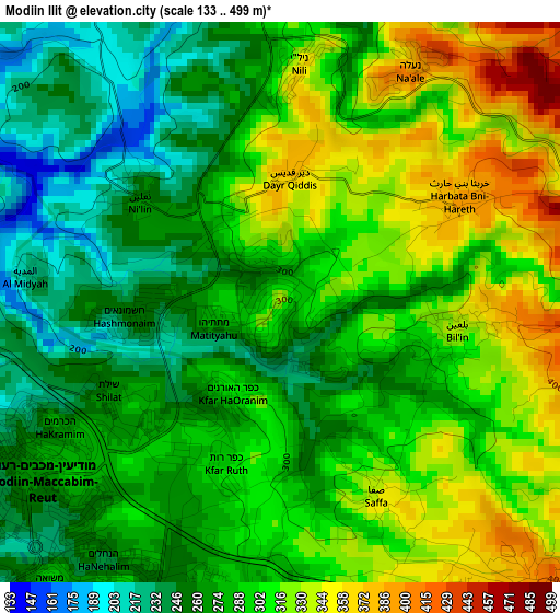
Below is the Elevation map of Modiin Ilit, which displays elevation range with different colors. Scale of the first map is from 133 to 499 m (436 to 1637 ft) with average elevation of 291.3 meters (=956 ft) [note 1]
These maps also provides idea of topography and contour of this city, they are displayed at different zoom levels. More info about maps, scale and edge coordinates you can find below images.
| \ | Map #1 | Map #2 | Topo.Map |
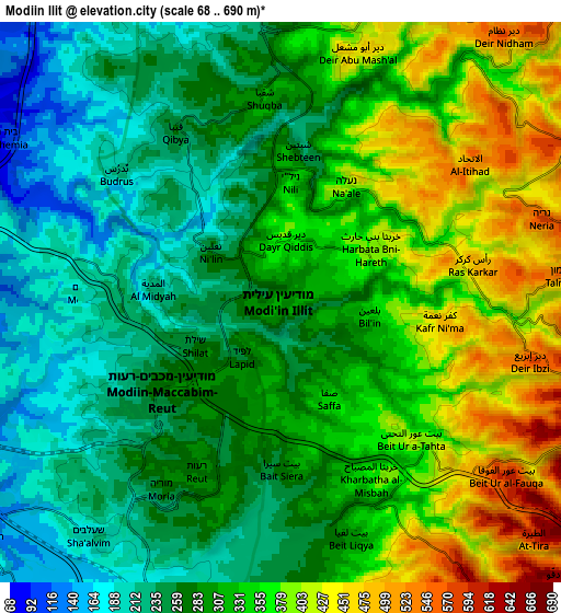
| Scale [m] | 133..499 m | 68..690 m | × |
| Scale [ft] | 436..1637 ft | 223..2264 ft | × |
| Average | 291.3 m = 956 ft | 310 m = 1017 ft | × |
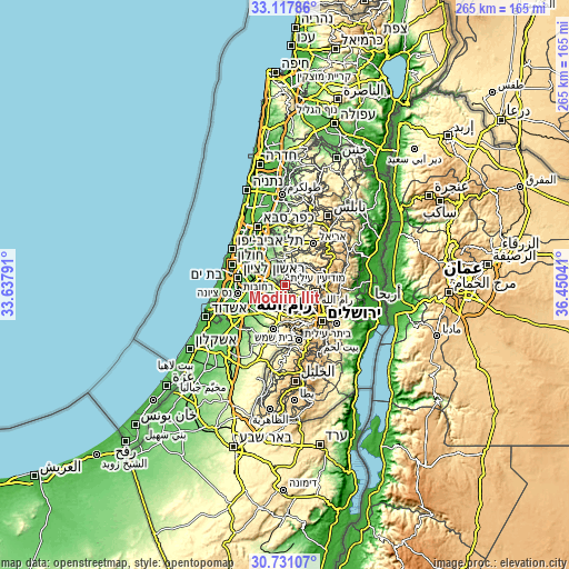
| Width | 8.29 km = 5.2 mi | 16.59 km = 10.3 mi | 265.4 km = 164.9 mi |
| Height | 8.29 km = 5.2 mi | 16.59 km = 10.3 mi | 265.4 km = 164.9 mi |
| ↑Max Latitude | 31.969498° | 32.00677° | 33.11786° |
| Latitude at center | 31.93221° | 31.93221° | 31.93221° |
| ↓Min Latitude | 31.894907° | 31.857589° | 30.73107° |
| ← Min Longitude | 35.000215° | 34.956269° | 33.63791° |
| Longitude center | 35.04416° | 35.04416° | 35.04416° |
| →Max Longitude | 35.088105° | 35.132051° | 36.45041° |
Nearby cities:
Cities around Modiin Ilit sort by population:
• Modi‘in Makkabbim Re‘ut elevation 276 m
5.1 km,  212°
212°
• Shoham 82 m
11.9 km,  308°
308°
• Nof Ayalon 204 m
8.5 km,  216°
216°
• Har Adar 866 m
14.2 km,  144°
144°
• Talmon 561 m
8.6 km,  84°
84°
• Hashmonaim 258 m
2.2 km,  262°
262°
• Kfar NaOranim 305 m
1.5 km, 207°
• Lapid 254 m
2 km, 214°
• Mevo horon 258 m
9.3 km,  184°
184°
• Dolev 611 m
8.5 km,  94°
94°
• Beit Horon 620 m
10.2 km,  127°
127°
• Na'ale 392 m
3.9 km,  31°
31°
Multilingual:
 En español:
Modiin Ilit elevación 319 m.
 En France:
Modiin Ilit élévation 319 m.
 Auf Deutsch:
Modiin Ilit höhe über dem Meeresspiegel ist 319 m.

Sources and notes:
- [note 1] Map square and city borders are not equal. Map elevation data is calculated only from area inside that square.
- [src 1] Elevation data from geonames database provided with same terms of usage.
- [src 2] The elevation map of Modiin Ilit is generated using elevation data from NASA's 3 arcsec (90m) resolution SRTM data.
- [src 3] Base (background) map © OpenStreetMap contributors tiles are generated by Geofabrik and OpenTopoMap.
Copyright & License:
This Modiin Ilit Elevation Map is licensed under CC BY-SA. You may reuse any part from this page, if you give a proper credit by linking to this URL:
 More info on terms of use page.