Cahir elevation
Cahir (Munster, County Tipperary), Ireland elevation is 56 meters and Cahir elevation in feet is 184 ft above sea level [src 1]. Cahir is a populated place (feature code) with elevation that is 5 meters (16 ft) bigger than average city elevation in Ireland.
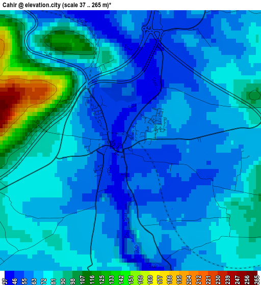
Below is the Elevation map of Cahir, which displays elevation range with different colors. Scale of the first map is from 37 to 265 m (121 to 869 ft) with average elevation of 74.3 meters (=244 ft) [note 1]
These maps also provides idea of topography and contour of this city, they are displayed at different zoom levels. More info about maps, scale and edge coordinates you can find below images.
| \ | Map #1 | Map #2 | Topo.Map |
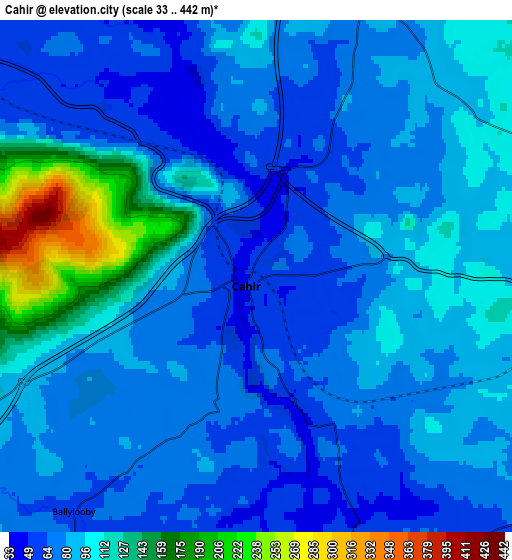
| Scale [m] | 37..265 m | 33..442 m | × |
| Scale [ft] | 121..869 ft | 108..1450 ft | × |
| Average | 74.3 m = 244 ft | 89.7 m = 294 ft | × |
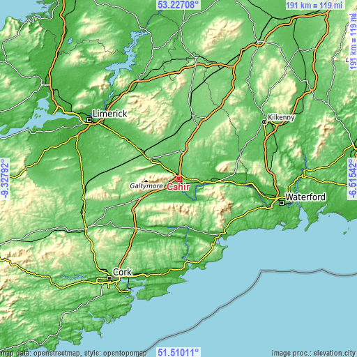
| Width | 5.97 km = 3.7 mi | 11.93 km = 7.4 mi | 190.9 km = 118.6 mi |
| Height | 5.97 km = 3.7 mi | 11.93 km = 7.4 mi | 190.9 km = 118.6 mi |
| ↑Max Latitude | 52.403759° | 52.430561° | 53.22708° |
| Latitude at center | 52.37694° | 52.37694° | 52.37694° |
| ↓Min Latitude | 52.350105° | 52.323253° | 51.51011° |
| ← Min Longitude | -7.965615° | -8.009561° | -9.32792° |
| Longitude center | -7.92167° | -7.92167° | -7.92167° |
| →Max Longitude | -7.877725° | -7.833779° | -6.51542° |
Nearby cities:
Cities around Cahir sort by population:
• Cluain Meala elevation 24 m
15 km,  99°
99°
• Thurles 102 m
34.9 km,  13°
13°
• Dungarvan 12 m
37.9 km,  147°
147°
• Carrick-on-Suir 7 m
34.7 km, 95°
• Tipperary 91 m
19.2 km,  304°
304°
• Fermoy 54 m
36.1 km,  221°
221°
• Mitchelstown 101 m
26.6 km,  242°
242°
• Cashel 111 m
15.6 km, 9°
• Callan 67 m
40.5 km,  62°
62°
• Fethard 64 m
18.6 km, 57°
• Rathcormac 56 m
41.4 km, 216°
• Piltown 31 m
39.6 km,  93°
93°
Multilingual:
 En español:
Cahir elevación 56 m.
 En France:
Cahir élévation 56 m.


Sources and notes:
- [note 1] Map square and city borders are not equal. Map elevation data is calculated only from area inside that square.
- [src 1] Elevation data from geonames database provided with same terms of usage.
- [src 2] The elevation map of Cahir is generated using elevation data from NASA's 3 arcsec (90m) resolution SRTM data.
- [src 3] Base (background) map © OpenStreetMap contributors tiles are generated by Geofabrik and OpenTopoMap.
Copyright & License:
This Cahir Elevation Map is licensed under CC BY-SA. You may reuse any part from this page, if you give a proper credit by linking to this URL:
 More info on terms of use page.