Kildare elevation
Kildare (Leinster), Ireland elevation is 100 meters and Kildare elevation in feet is 328 ft above sea level [src 1]. Kildare is a populated place (feature code) with elevation that is 49 meters (161 ft) bigger than average city elevation in Ireland.
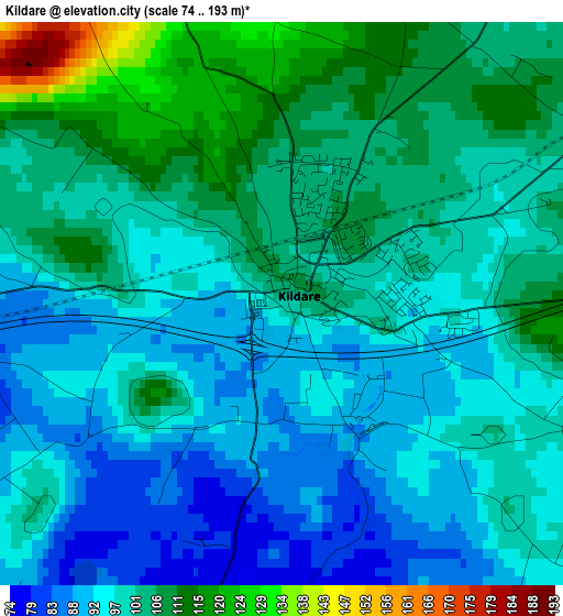
Below is the Elevation map of Kildare, which displays elevation range with different colors. Scale of the first map is from 74 to 193 m (243 to 633 ft) with average elevation of 99.8 meters (=327 ft) [note 1]
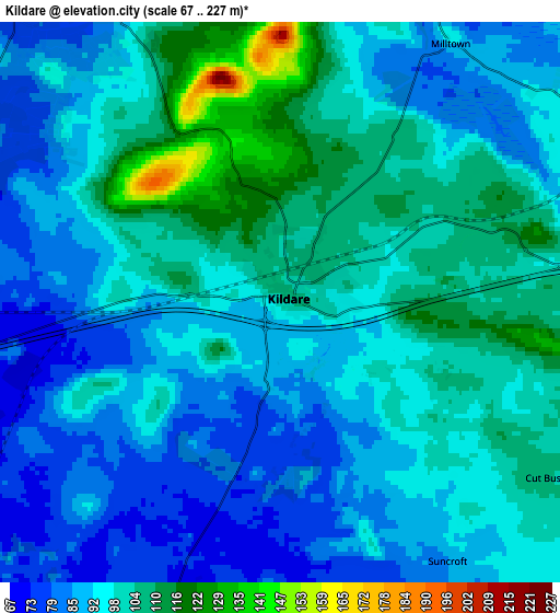
These maps also provides idea of topography and contour of this city, they are displayed at different zoom levels. More info about maps, scale and edge coordinates you can find below images.
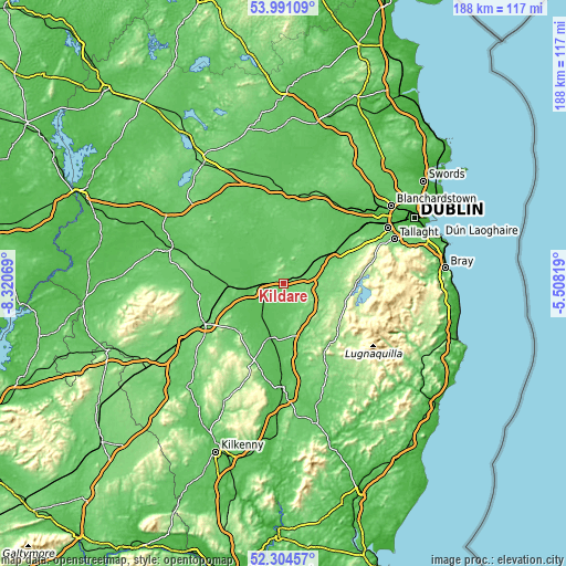
| \ | Map #1 | Map #2 | Topo.Map |
| Scale [m] | 74..193 m | 67..227 m | × |
| Scale [ft] | 243..633 ft | 220..745 ft | × |
| Average | 99.8 m = 327 ft | 95.6 m = 314 ft | × |
| Width | 5.86 km = 3.6 mi | 11.72 km = 7.3 mi | 187.5 km = 116.5 mi |
| Height | 5.86 km = 3.6 mi | 11.72 km = 7.3 mi | 187.5 km = 116.5 mi |
| ↑Max Latitude | 53.182453° | 53.20878° | 53.99109° |
| Latitude at center | 53.15611° | 53.15611° | 53.15611° |
| ↓Min Latitude | 53.129751° | 53.103375° | 52.30457° |
| ← Min Longitude | -6.958385° | -7.002331° | -8.32069° |
| Longitude center | -6.91444° | -6.91444° | -6.91444° |
| →Max Longitude | -6.870495° | -6.826549° | -5.50819° |
Nearby cities:
Cities around Kildare sort by population:
• Naas elevation 93 m
17.8 km,  68°
68°
• Droichead Nua 92 m
8.4 km, 69°
• Athy 62 m
18.8 km,  193°
193°
• Portarlington 67 m
18.5 km,  272°
272°
• Cherryville 99 m
3.5 km, 271°
• Sallins 77 m
19.5 km,  58°
58°
• Monasterevin 63 m
10.3 km,  260°
260°
• Kilcullen 113 m
11.7 km,  104°
104°
• Rathangan 74 m
9 km,  323°
323°
• Prosperous 90 m
18.4 km,  35°
35°
• Old Kilcullen 145 m
11.4 km,  119°
119°
• Athgarvan 98 m
8.9 km,  92°
92°
Multilingual:
 En español:
Kildare elevación 100 m.
 En France:
Kildare élévation 100 m.


Sources and notes:
- [note 1] Map square and city borders are not equal. Map elevation data is calculated only from area inside that square.
- [src 1] Elevation data from geonames database provided with same terms of usage.
- [src 2] The elevation map of Kildare is generated using elevation data from NASA's 3 arcsec (90m) resolution SRTM data.
- [src 3] Base (background) map © OpenStreetMap contributors tiles are generated by Geofabrik and OpenTopoMap.
Copyright & License:
This Kildare Elevation Map is licensed under CC BY-SA. You may reuse any part from this page, if you give a proper credit by linking to this URL:
 More info on terms of use page.