Loughrea elevation
Loughrea (Connaught, County Galway), Ireland elevation is 84 meters and Loughrea elevation in feet is 276 ft above sea level [src 1]. Loughrea is a populated place (feature code) with elevation that is 33 meters (108 ft) bigger than average city elevation in Ireland.
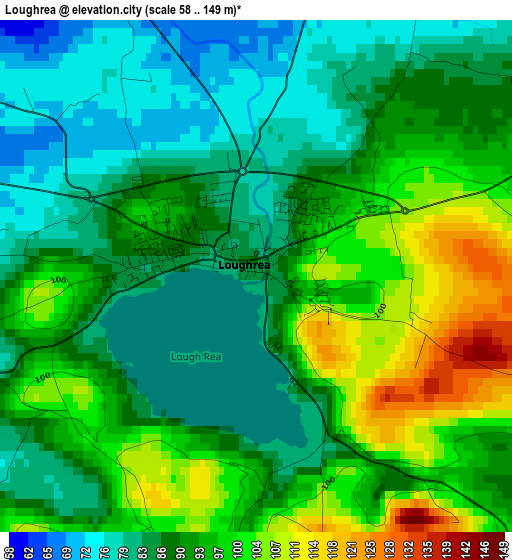
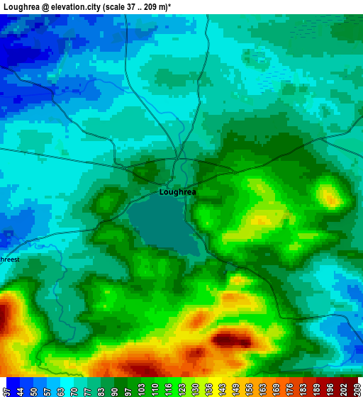
Below is the Elevation map of Loughrea, which displays elevation range with different colors. Scale of the first map is from 58 to 149 m (190 to 489 ft) with average elevation of 90.6 meters (=297 ft) [note 1]
These maps also provides idea of topography and contour of this city, they are displayed at different zoom levels. More info about maps, scale and edge coordinates you can find below images.
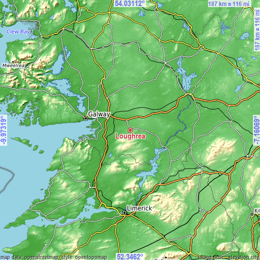
| \ | Map #1 | Map #2 | Topo.Map |
| Scale [m] | 58..149 m | 37..209 m | × |
| Scale [ft] | 190..489 ft | 121..686 ft | × |
| Average | 90.6 m = 297 ft | 88.6 m = 291 ft | × |
| Width | 5.85 km = 3.6 mi | 11.71 km = 7.3 mi | 187.3 km = 116.4 mi |
| Height | 5.85 km = 3.6 mi | 11.71 km = 7.3 mi | 187.3 km = 116.4 mi |
| ↑Max Latitude | 53.223258° | 53.24956° | 54.03112° |
| Latitude at center | 53.19694° | 53.19694° | 53.19694° |
| ↓Min Latitude | 53.170606° | 53.144255° | 52.3462° |
| ← Min Longitude | -8.610885° | -8.654831° | -9.97319° |
| Longitude center | -8.56694° | -8.56694° | -8.56694° |
| →Max Longitude | -8.522995° | -8.479049° | -7.16069° |
Nearby cities:
Cities around Loughrea sort by population:
• Gaillimh elevation 6 m
33.1 km,  284°
284°
• Nenagh Bridge 52 m
42.9 km,  144°
144°
• Ballinasloe 39 m
27.3 km,  57°
57°
• Tuam 38 m
40.2 km,  332°
332°
• Oranmore 5 m
24.8 km,  288°
288°
• Athenry 35 m
16.1 km,  313°
313°
• Gort 23 m
22.1 km,  228°
228°
• Bearna 11 m
39.3 km, 278°
• Banagher 47 m
38.7 km,  91°
91°
• Moycullen 33 m
43.7 km, 291°
• Portumna 43 m
26.1 km,  117°
117°
• Claregalway 11 m
29.7 km,  302°
302°
Multilingual:
 En español:
Loughrea elevación 84 m.
 En France:
Loughrea élévation 84 m.


Sources and notes:
- [note 1] Map square and city borders are not equal. Map elevation data is calculated only from area inside that square.
- [src 1] Elevation data from geonames database provided with same terms of usage.
- [src 2] The elevation map of Loughrea is generated using elevation data from NASA's 3 arcsec (90m) resolution SRTM data.
- [src 3] Base (background) map © OpenStreetMap contributors tiles are generated by Geofabrik and OpenTopoMap.
Copyright & License:
This Loughrea Elevation Map is licensed under CC BY-SA. You may reuse any part from this page, if you give a proper credit by linking to this URL:
 More info on terms of use page.