Ambon elevation
Ambon (Maluku), Indonesia elevation is 12 meters and Ambon elevation in feet is 39 ft above sea level [src 1]. Ambon is a seat of a first-order administrative division (feature code) with elevation that is 179 meters (587 ft) smaller than average city elevation in Indonesia.
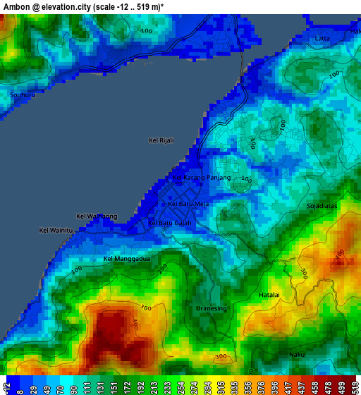
Below is the Elevation map of Ambon, which displays elevation range with different colors. Scale of the first map is from -12 to 519 m (-39 to 1703 ft) with average elevation of 152.9 meters (=502 ft) [note 1]
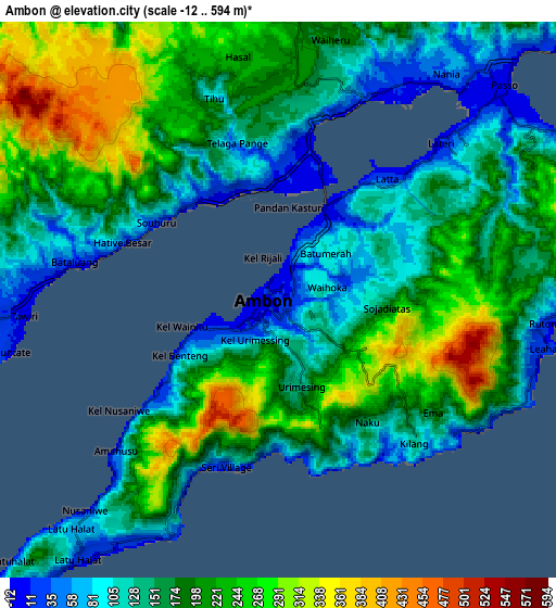
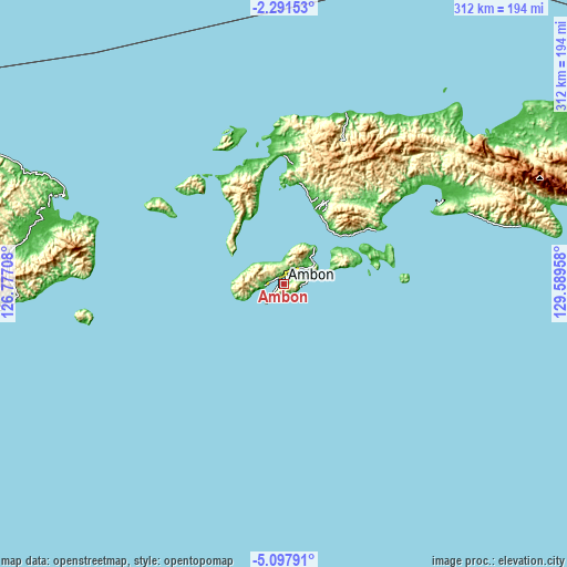
These maps also provides idea of topography and contour of this city, they are displayed at different zoom levels. More info about maps, scale and edge coordinates you can find below images.
| \ | Map #1 | Map #2 | Topo.Map |
| Scale [m] | -12..519 m | -12..594 m | × |
| Scale [ft] | -39..1703 ft | -39..1949 ft | × |
| Average | 152.9 m = 502 ft | 179.1 m = 588 ft | × |
| Width | 9.75 km = 6.1 mi | 19.5 km = 12.1 mi | 312 km = 193.9 mi |
| Height | 9.75 km = 6.1 mi | 19.5 km = 12.1 mi | 312.1 km = 193.9 mi |
| ↑Max Latitude | -3.651975° | -3.608118° | -2.29153° |
| Latitude at center | -3.69583° | -3.69583° | -3.69583° |
| ↓Min Latitude | -3.739683° | -3.783533° | -5.09791° |
| ← Min Longitude | 128.139385° | 128.095439° | 126.77708° |
| Longitude center | 128.18333° | 128.18333° | 128.18333° |
| →Max Longitude | 128.227275° | 128.271221° | 129.58958° |
Nearby cities:
Cities around Ambon sort by population:
• Amahai elevation 6 m
90.8 km,  64°
64°
• Taniwel 7 m
99.3 km,  19°
19°
• Waipia 36 m
97.8 km,  54°
54°
• Masohi 21 m
97.7 km, 63°
• Piru 25 m
70.5 km,  1°
1°
• Saparua 3 m
53.8 km,  75°
75°
• Kairatu 10 m
43.4 km,  28°
28°
• Pelau 24 m
37.1 km, 58°
• Tulehu 10 m
20 km, 53°
• Hila 22 m
16.1 km,  318°
318°
• Passo 7 m
10.6 km, 46°
• Amahusu 21 m
5.2 km,  230°
230°
Multilingual:
 En español:
Ambon elevación 12 m.
 En France:
Ambon élévation 12 m.


Sources and notes:
- [note 1] Map square and city borders are not equal. Map elevation data is calculated only from area inside that square.
- [src 1] Elevation data from geonames database provided with same terms of usage.
- [src 2] The elevation map of Ambon is generated using elevation data from NASA's 3 arcsec (90m) resolution SRTM data.
- [src 3] Base (background) map © OpenStreetMap contributors tiles are generated by Geofabrik and OpenTopoMap.
Copyright & License:
This Ambon Elevation Map is licensed under CC BY-SA. You may reuse any part from this page, if you give a proper credit by linking to this URL:
 More info on terms of use page.