Batang elevation
Batang (Central Java), Indonesia elevation is 14 meters and Batang elevation in feet is 46 ft above sea level [src 1]. Batang is a populated place (feature code) with elevation that is 177 meters (581 ft) smaller than average city elevation in Indonesia.
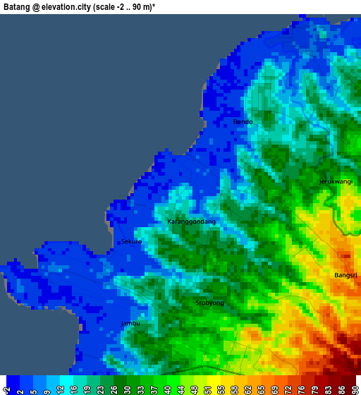
Below is the Elevation map of Batang, which displays elevation range with different colors. Scale of the first map is from -2 to 90 m (-7 to 295 ft) with average elevation of 24.5 meters (=80 ft) [note 1]
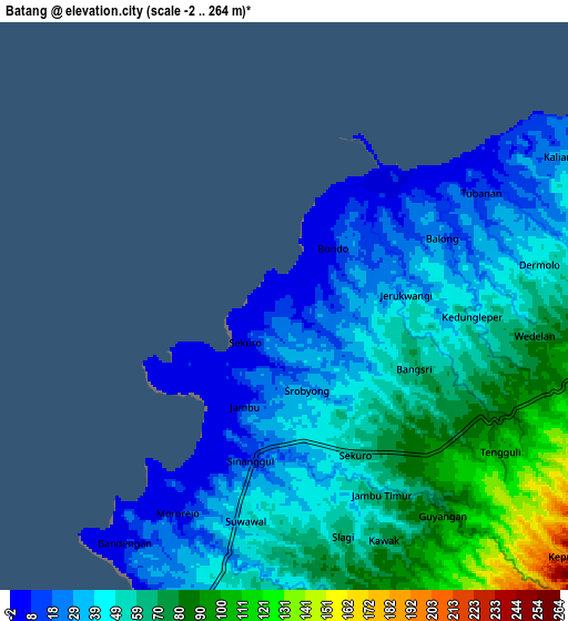
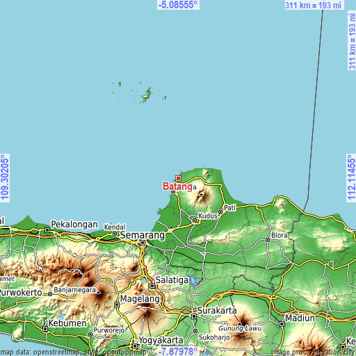
These maps also provides idea of topography and contour of this city, they are displayed at different zoom levels. More info about maps, scale and edge coordinates you can find below images.
| \ | Map #1 | Map #2 | Topo.Map |
| Scale [m] | -2..90 m | -2..264 m | × |
| Scale [ft] | -7..295 ft | -7..866 ft | × |
| Average | 24.5 m = 80 ft | 51.1 m = 168 ft | × |
| Width | 9.71 km = 6 mi | 19.42 km = 12.1 mi | 310.7 km = 193.1 mi |
| Height | 9.71 km = 6 mi | 19.42 km = 12.1 mi | 310.7 km = 193.1 mi |
| ↑Max Latitude | -6.440934° | -6.397264° | -5.08555° |
| Latitude at center | -6.4846° | -6.4846° | -6.4846° |
| ↓Min Latitude | -6.528262° | -6.571921° | -7.87978° |
| ← Min Longitude | 110.664355° | 110.620409° | 109.30205° |
| Longitude center | 110.7083° | 110.7083° | 110.7083° |
| →Max Longitude | 110.752245° | 110.796191° | 112.11455° |
Nearby cities:
Cities around Batang sort by population:
• Kudus elevation 27 m
38.5 km,  157°
157°
• Pecangaan 18 m
23.7 km,  179°
179°
• Baekrajan 68 m
35.3 km,  152°
152°
• Gebog 127 m
31.6 km, 151°
• Jekulo 15 m
43.1 km, 146°
• Mlonggo 18 m
5.5 km,  189°
189°
• Tayu 9 m
38.4 km,  99°
99°
• Welahan 4 m
35.1 km, 178°
• Tlogowungu 66 m
41.9 km,  126°
126°
• Dukuhseti 9 m
36.2 km,  87°
87°
• Gunungwungkal 122 m
32.3 km,  106°
106°
• Jepara 5 m
12.7 km,  198°
198°
Multilingual:
 En español:
Batang elevación 14 m.
 En France:
Batang élévation 14 m.


Sources and notes:
- [note 1] Map square and city borders are not equal. Map elevation data is calculated only from area inside that square.
- [src 1] Elevation data from geonames database provided with same terms of usage.
- [src 2] The elevation map of Batang is generated using elevation data from NASA's 3 arcsec (90m) resolution SRTM data.
- [src 3] Base (background) map © OpenStreetMap contributors tiles are generated by Geofabrik and OpenTopoMap.
Copyright & License:
This Batang Elevation Map is licensed under CC BY-SA. You may reuse any part from this page, if you give a proper credit by linking to this URL:
 More info on terms of use page.