Cikampek elevation
Cikampek (West Java), Indonesia elevation is 61 meters and Cikampek elevation in feet is 200 ft above sea level [src 1]. Cikampek is a populated place (feature code) with elevation that is 130 meters (427 ft) smaller than average city elevation in Indonesia.
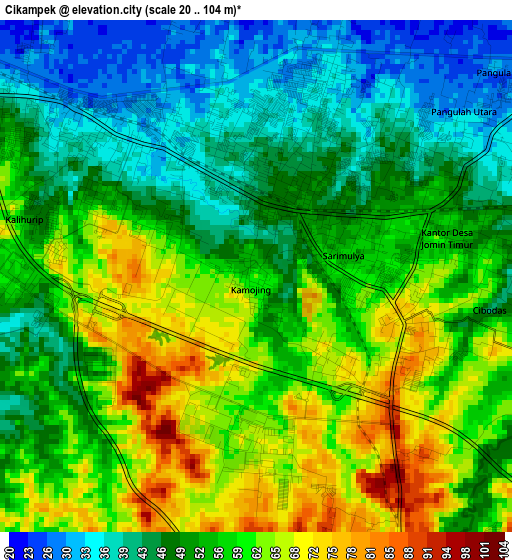
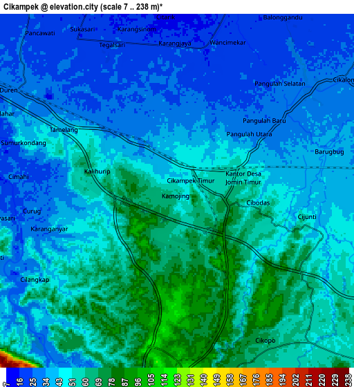
Below is the Elevation map of Cikampek, which displays elevation range with different colors. Scale of the first map is from 20 to 104 m (66 to 341 ft) with average elevation of 53.6 meters (=176 ft) [note 1]
These maps also provides idea of topography and contour of this city, they are displayed at different zoom levels. More info about maps, scale and edge coordinates you can find below images.
| \ | Map #1 | Map #2 | Topo.Map |
| Scale [m] | 20..104 m | 7..238 m | × |
| Scale [ft] | 66..341 ft | 23..781 ft | × |
| Average | 53.6 m = 176 ft | 46.2 m = 152 ft | × |
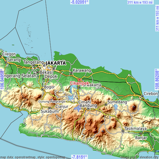
| Width | 9.71 km = 6 mi | 19.42 km = 12.1 mi | 310.7 km = 193.1 mi |
| Height | 9.71 km = 6 mi | 19.42 km = 12.1 mi | 310.8 km = 193.1 mi |
| ↑Max Latitude | -6.376048° | -6.332373° | -5.02051° |
| Latitude at center | -6.41972° | -6.41972° | -6.41972° |
| ↓Min Latitude | -6.463388° | -6.507052° | -7.8151° |
| ← Min Longitude | 107.411885° | 107.367939° | 106.04958° |
| Longitude center | 107.45583° | 107.45583° | 107.45583° |
| →Max Longitude | 107.499775° | 107.543721° | 108.86208° |
Nearby cities:
Cities around Cikampek sort by population:
• Cimahi elevation 764 m
51.2 km,  169°
169°
• Purwakarta 86 m
15.3 km,  185°
185°
• Cileungsir 78 m
54.9 km,  272°
272°
• Rengasdengklok 10 m
33.8 km,  328°
328°
• Lembang 1252 m
47.1 km,  157°
157°
• Padalarang 703 m
46.5 km,  177°
177°
• Pamanukan 10 m
42 km,  68°
68°
• Cikarang 17 m
37.8 km,  297°
297°
• Ciranjang-hilir 266 m
49.6 km,  206°
206°
• Ngamprah 269 m
47.1 km, 205°
• Subang 96 m
37.2 km,  116°
116°
• Karawang 16 m
21.1 km,  307°
307°
Multilingual:
 En español:
Cikampek elevación 61 m.
 En France:
Cikampek élévation 61 m.


Sources and notes:
- [note 1] Map square and city borders are not equal. Map elevation data is calculated only from area inside that square.
- [src 1] Elevation data from geonames database provided with same terms of usage.
- [src 2] The elevation map of Cikampek is generated using elevation data from NASA's 3 arcsec (90m) resolution SRTM data.
- [src 3] Base (background) map © OpenStreetMap contributors tiles are generated by Geofabrik and OpenTopoMap.
Copyright & License:
This Cikampek Elevation Map is licensed under CC BY-SA. You may reuse any part from this page, if you give a proper credit by linking to this URL:
 More info on terms of use page.